Nova Scotia Archives
Historical Maps of Nova Scotia
Results 1 to 14 of 14 from your search: Amherst
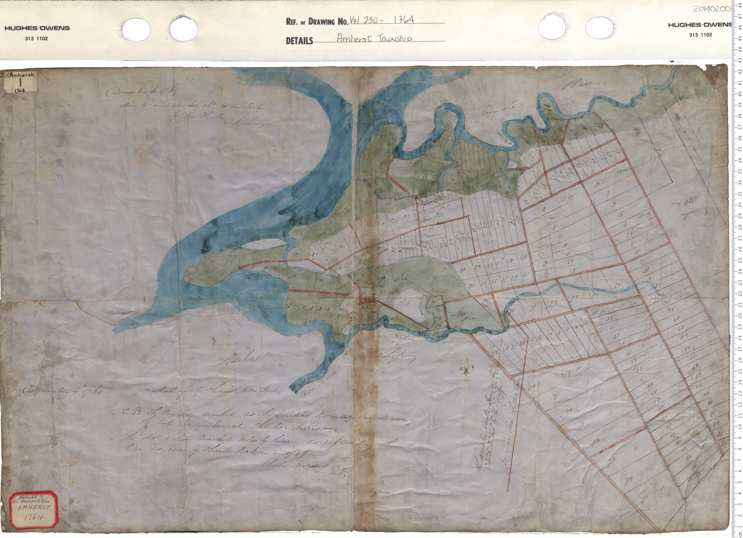
Amherst Township
Date: 1764
Reference: Nova Scotia Archives Map Collection: V7 230 Amherst Township, Nova Scotia
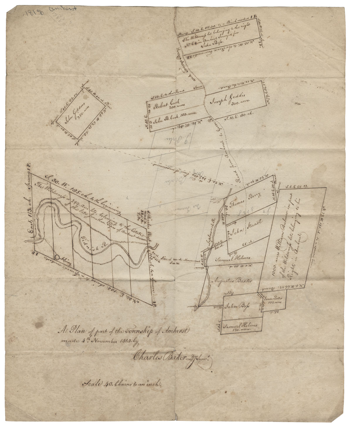
A plan of part of the Township of Amherst Maps: Amherst: 1818
Date: 4 November 1818
Reference: Nova Scotia Archives Map Collection: F/239 - 1818

Cumberland County Lots of land in or near Amherst town line
Date: 1844
Reference: Nova Scotia Archives Map Collection: F/220 - 1844
Cumberland County Lots of land in or near Amherst Town line
Date: 1847
Reference: Nova Scotia Archives Map Collection: F/220 - 1847
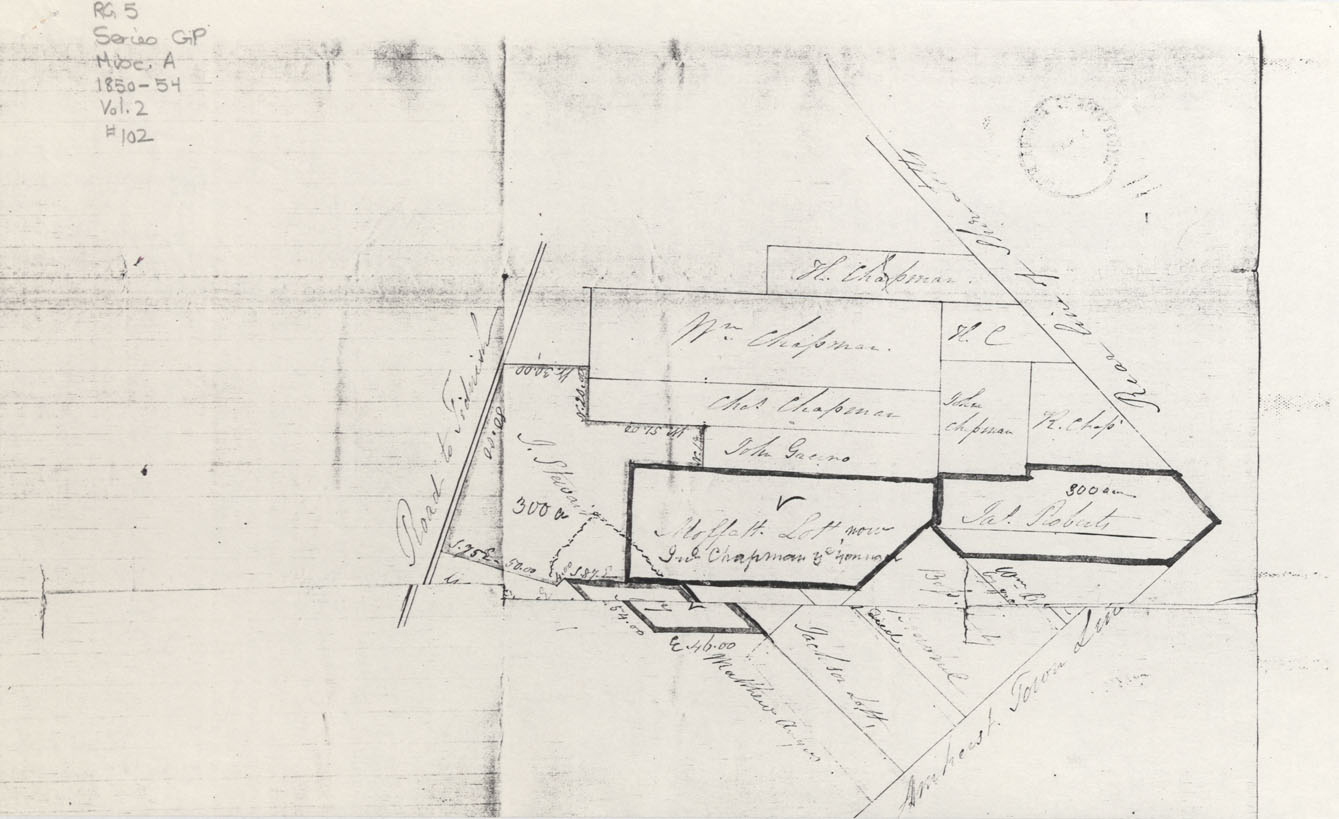
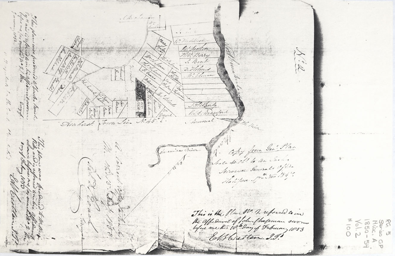
Cumberland County Lots of Land in or near Amherst Town Line
Date: 1853
Reference: Nova Scotia Archives Map Collection: F/220 - 1853
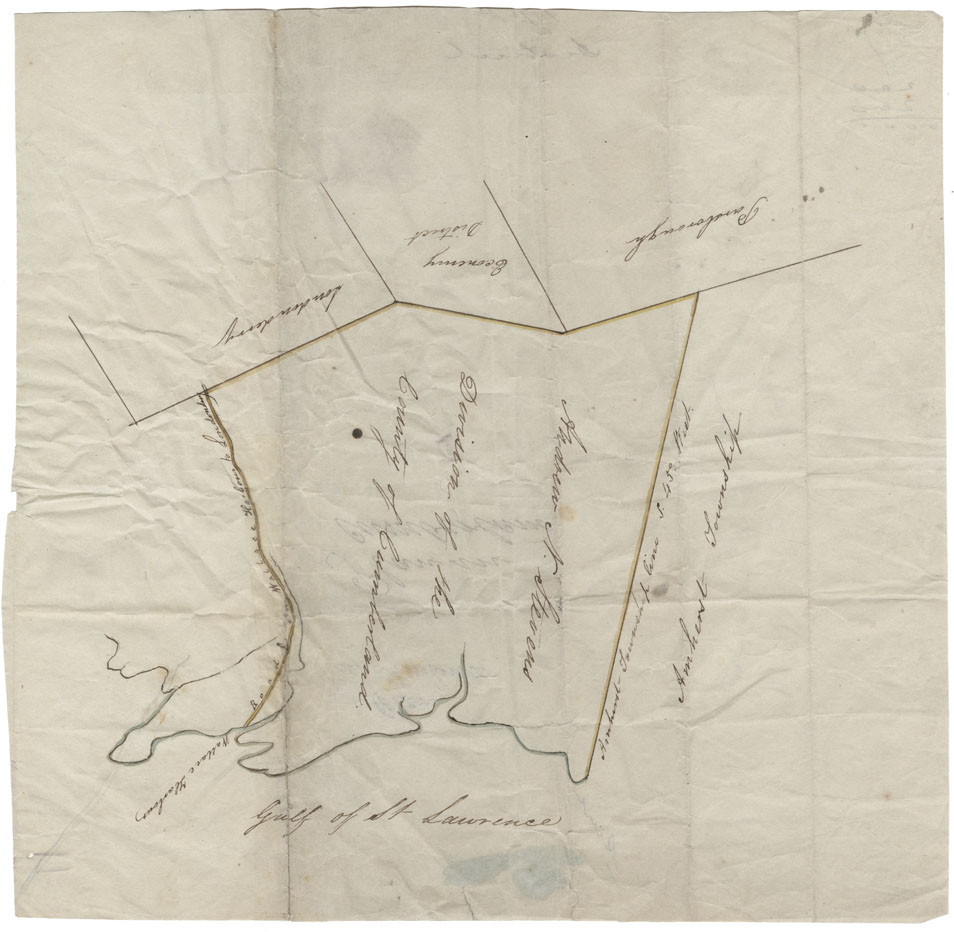
Cumberland County Wallace Harbour, Road from Wallace harbour to Londonderry, Londonderry, Economy District, Parsbourgh, Amherst Township and Gulf of St.Lawrence
Date:
Reference: Nova Scotia Archives Map Collection: F/230
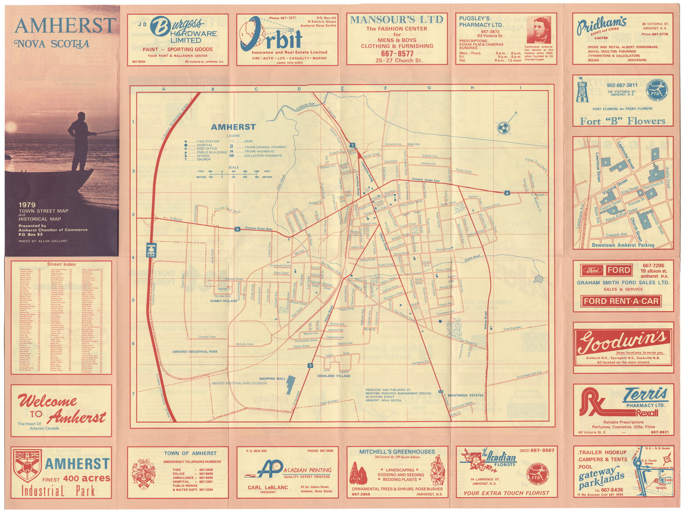
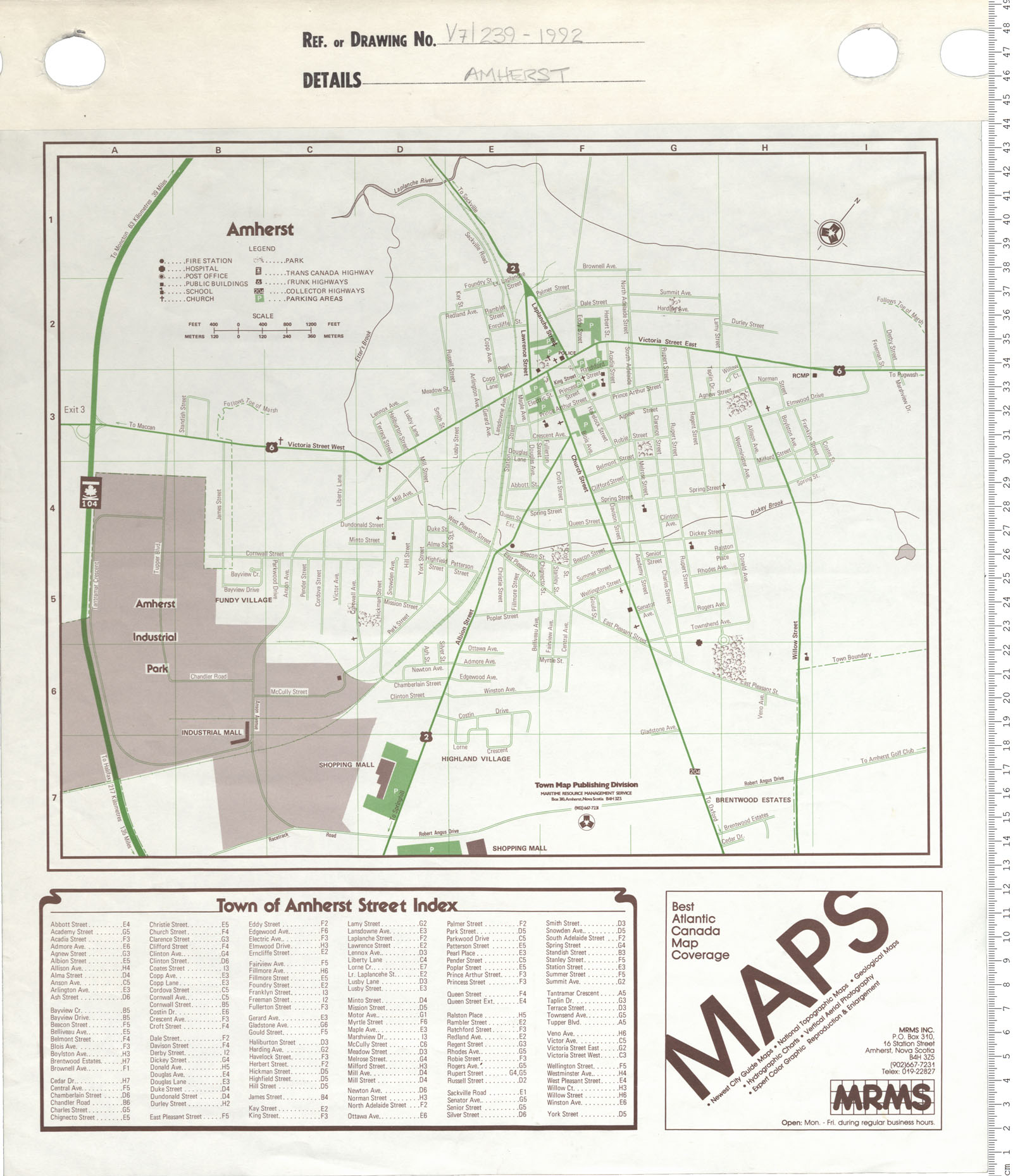
Amherst, NS 1979 Town Street and Historical map
Date: 1979
Reference: Nova Scotia Archives Map Collection: F/239 - 1979

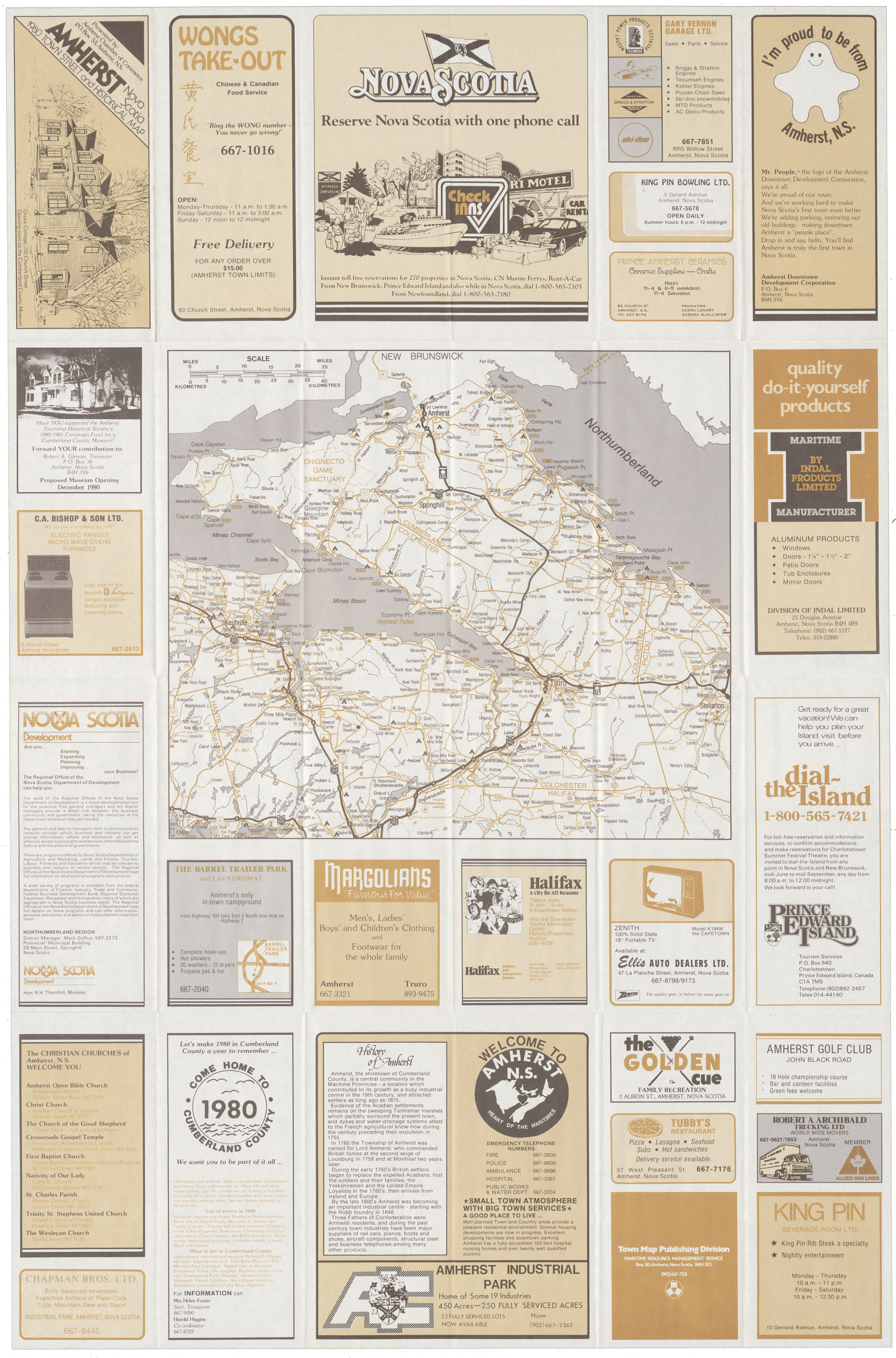
Amherst, NS 1980 Town and Street map
Date: 1980
Reference: Nova Scotia Archives Map Collection: F/239
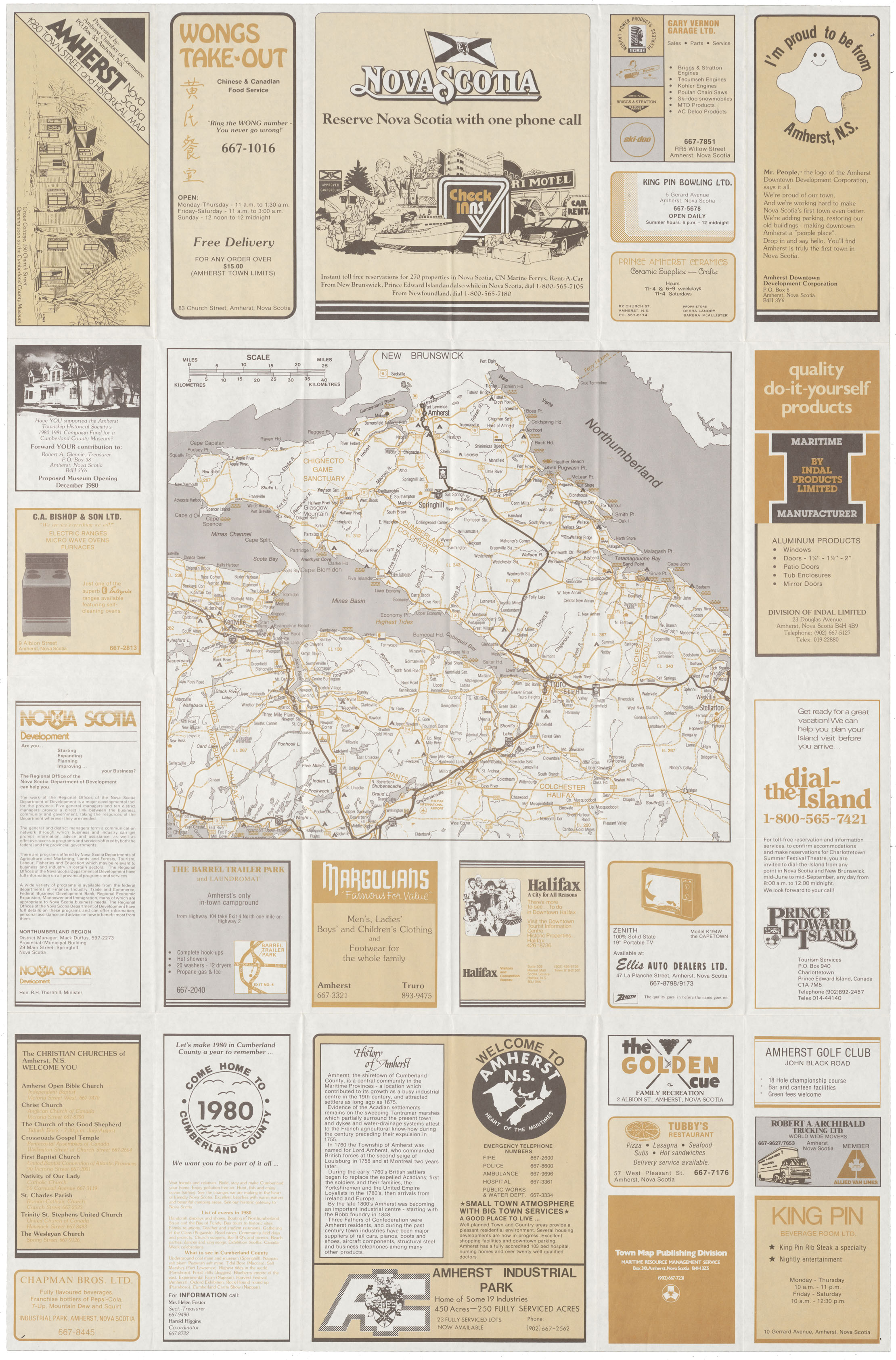
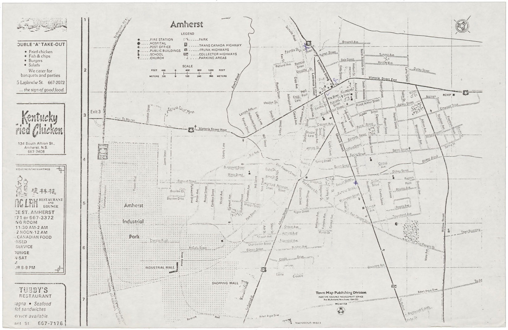
Amherst, NS Town & Street & Historical map
Date: 1980
Reference: Nova Scotia Archives Map Collection: F/239 - 1980
Amherst Amherst Town Street & Historical Map
Date: 1980
Reference: Nova Scotia Archives Map Collection: F/239 - 1980
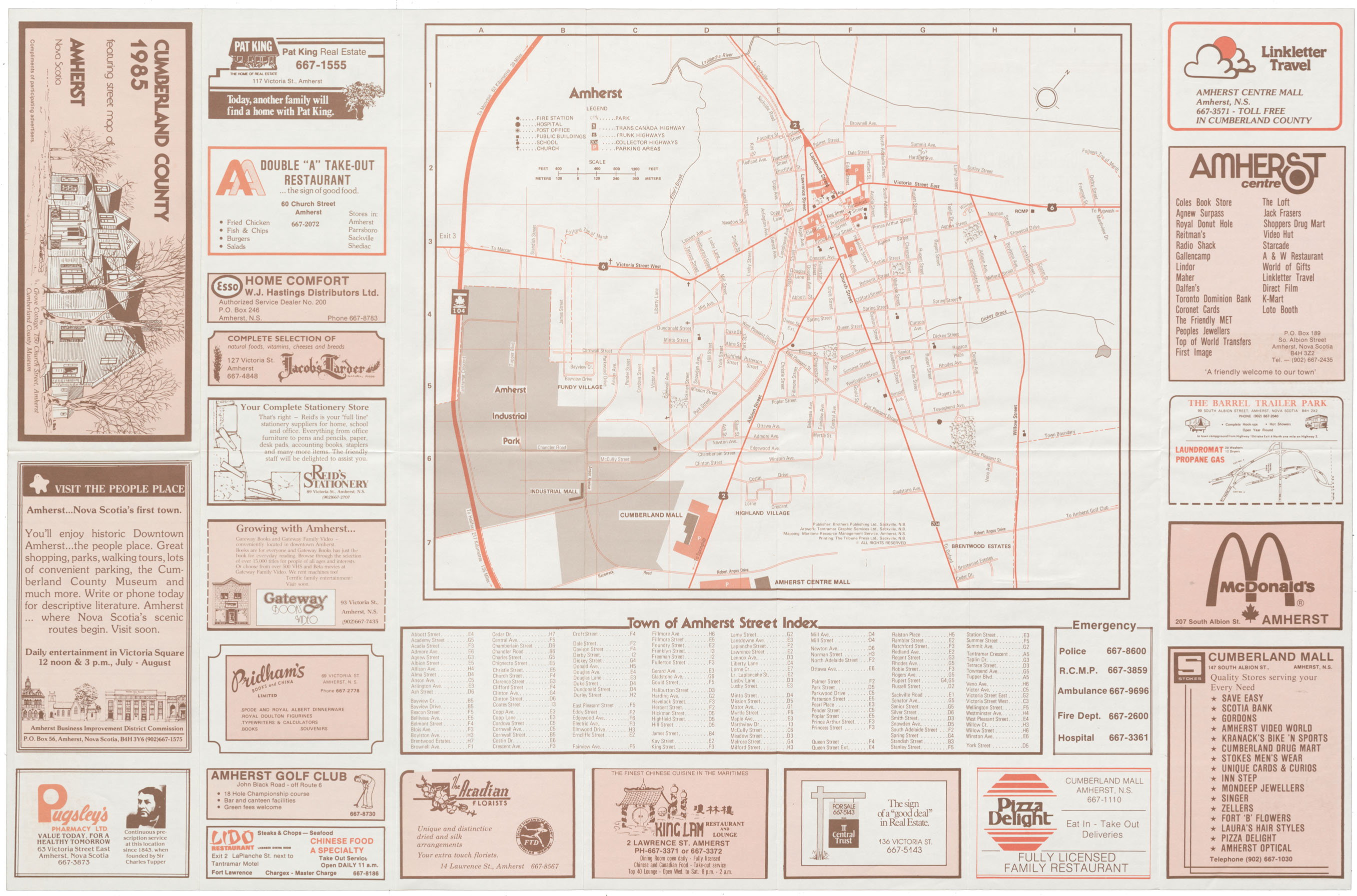
Cumberland County 1985 featuring a Street map of Amherst
Date: 1985
Reference: Nova Scotia Archives Map Collection: F/239 - 1985
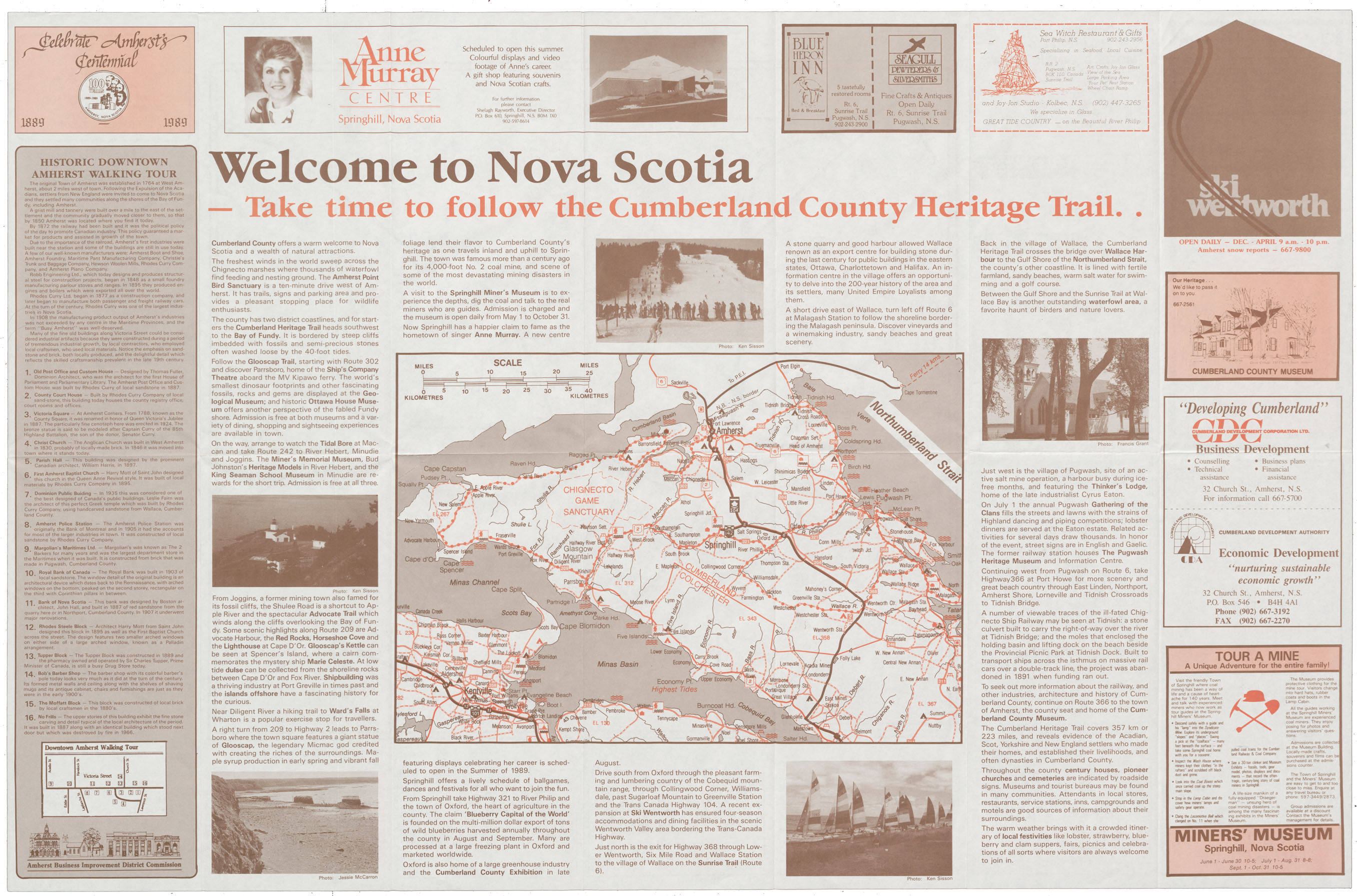
Cumberland County, NS featuring Street map of Amherst
Date: 1985
Reference: Nova Scotia Archives Map Collection: F/239 - 1989