Nova Scotia Archives
Historical Maps of Nova Scotia
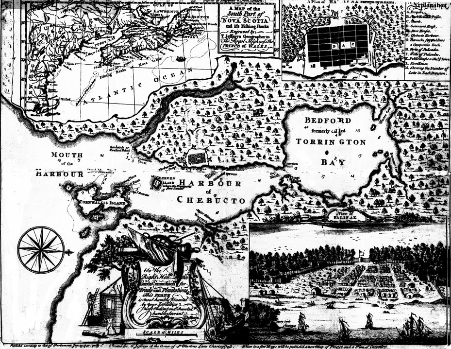
Harbour of Chebucto, with inserts: "A Map of the South Part of Nova Scotia and it's [sic] Fishing Banks...; "A Plan of Halifax Survey'd by M. Harris"; and "A View of Halifax Drawn from ye Topmasthead", 1750
This map first appeared in The Gentleman's Magazine for January 1750, a little over six months after the founding of Halifax on 21 June 1749 by the Honourable Edward Cornwallis. The publication noted that the plan of Halifax (inset at top right), and the central map of Chebucto Harbour, plus the topmast view of the town (inset at bottom right), had been "Drawn on the spot by Moses Harris", while the map of Nova Scotia at the top left was the work of "Mons.[i.e. Monsieur] D'Anville, Geogra
Date: 1750
Cartographer: Moses Harris and D'Anville; published according to an Act of Parliament, 25 January 1750; printed for T[homas] Jefferys, St Martin's Lane, Charing Cross [London, England]
Reference: Nova Scotia Archives Map Collection: S.B. 4

