Nova Scotia Archives
Woolford's Surveys: The Roads from Halifax to Windsor and Truro, 1817-18
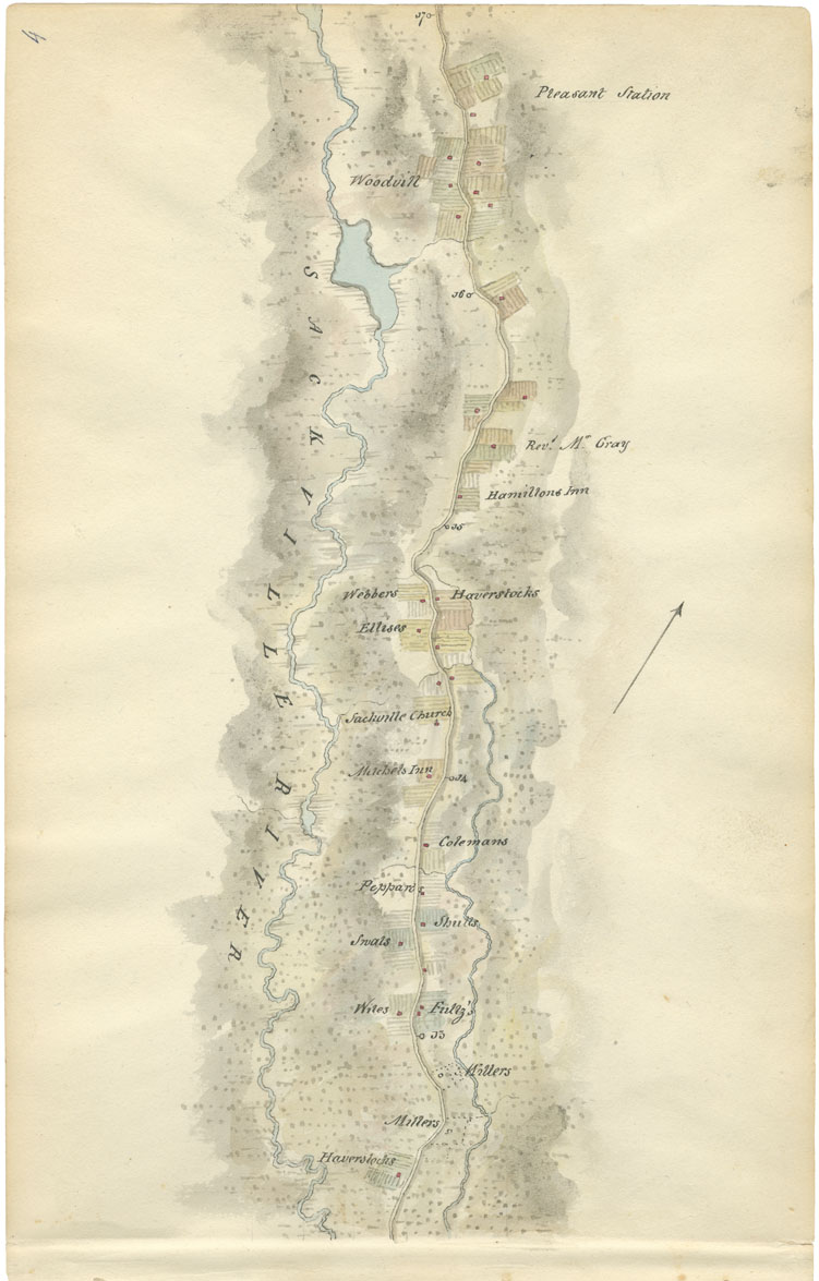
Sheet 4: Mile 13 to Mile 17: Sackville
Woolford identified many houses and farms as he mapped Sackville. The properties included those of Haverstock, Miller, Wile, Fultz, Swal, Shult, Peppard, Coleman, Ellis, Webber, another Haverstock, and Woodvill. The Rev. Benjamin Gerrish Gray also owned a farm beyond Hamilton's property. Other landmarks were Mitchell's Inn, the Hamilton Inn, and St. John's Anglican Church. The map ends at Pleasant Station.
Lord Dalhousie recorded in his journal that the thirty miles between Halifax and Ardoise Hill were thickly settled with little inns and cottages. He noted as well that the landscape had been affected by wild fires and hurricanes, commenting that a great quantity of wood was standing burnt, while other tracts had either been blown down or were uprooted and decayed. The soil was, in his estimation, rocky and poor.
Date: 1817-18
Draughtsman: John Elliott Woolford
Reference: Nova Scotia Archives Map Collection: 15.1

