Nova Scotia Archives
Woolford's Surveys: The Roads from Halifax to Windsor and Truro, 1817-18
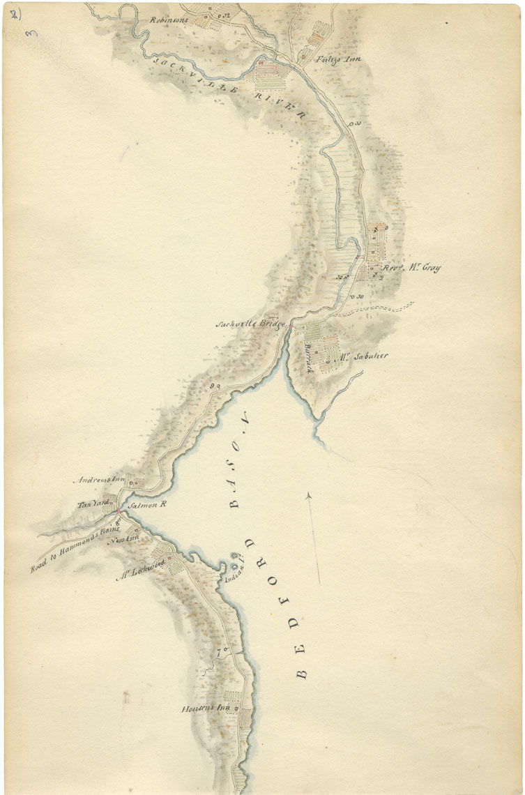
Sheet 3: Mile 7 to Mile 12: Bedford Basin, Bedford and Sackville

Woolford identifies the road to Hammonds Plains; a tan yard; the Sackville River and bridge; the army barracks in Bedford; three inns — Housen's, New, Andrews and Fultz's; and properties belonging to the Rev. Benjamin Gerrish Gray, William Sabatier and a Mr. Robinson. Sabatier's house survives today as the Scott Manor House. Although Ten Mile House, later the residence of the cartographer A.F. Church, dates from the 1790s, it is not identified on this map.
Look for Fultz's Inn, near the top of the plate. It was located at the fork in the road and it was a busy intersection -- travellers took the left branch for Windsor and the right for Truro.
Date: 1817-18
Draughtsman: John Elliott Woolford
Reference: Nova Scotia Archives Map Collection: 15.1