Nova Scotia Archives
Woolford's Surveys: The Roads from Halifax to Windsor and Truro, 1817-18
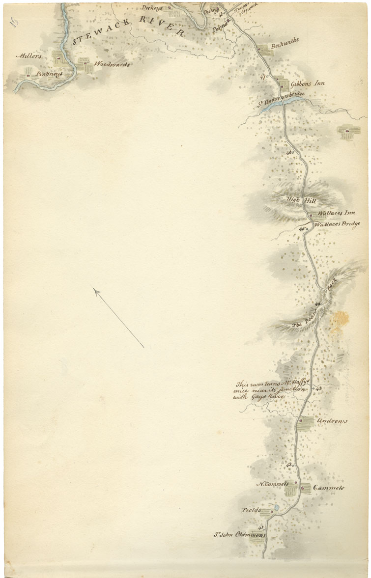
Sheet 15: Mile 41 to Mile 48: Gays River and Stewiacke
The map identifies many properties along the Stewiacke River and the road to Truro -- those of Sir John Oldmixon, Field, N. Cammel, Cammel, Andrew, Wallace's Inn, Gibbon's Inn, Beckwith, Dickey, Tupper, Woodward, Miller and Pinkney. Landmarks or geographical features include "This river turns McHaffys mill near its junction with Gays River" (mile 43), "The Boars Back," Wallace Bridge, High Hill, St. Andrew's Bridge, Pound, and Stewiacke River.
Sir John Oldmixon was an assumed title; he was really an actor who amassed debts in England, emigrated to the United States with his wife, and later settled in Nova Scotia, without his wife. Sir John was a friend of Governor John Wentworth (served 1792-1808), and travelled frequently to and from Halifax to attend social functions at Government House, via snowshoes in winter and horseback in summer. In 1817 his property was sold and 'Sir John' returned to the United States.
On 15 July 1818, Lord Dalhousie arrived at Gibbon's Inn, a "very poor house, but very obliging people." The following year, he again stayed at Gibbon's after visiting Middle Stewiacke on 8 June, and noted that the "Souiac [sic] is I think a beautiful valley & equal in all respects to any part of the Province I have seen."
Date: 1817-18
Draughtsman: John Elliott Woolford
Reference: Nova Scotia Archives Map Collection: 15.1

