Nova Scotia Archives
Search
Results 721 to 768 of 2049 from your search: map
Note: if what you see below isn't quite what you're looking for, or if you're looking for results from different areas of our website, try our Additional Search Tools or Google

Survey of Ferry-House Lot belonging to J.P. Mott Esq.
maps : 201402076
maps : 201402232
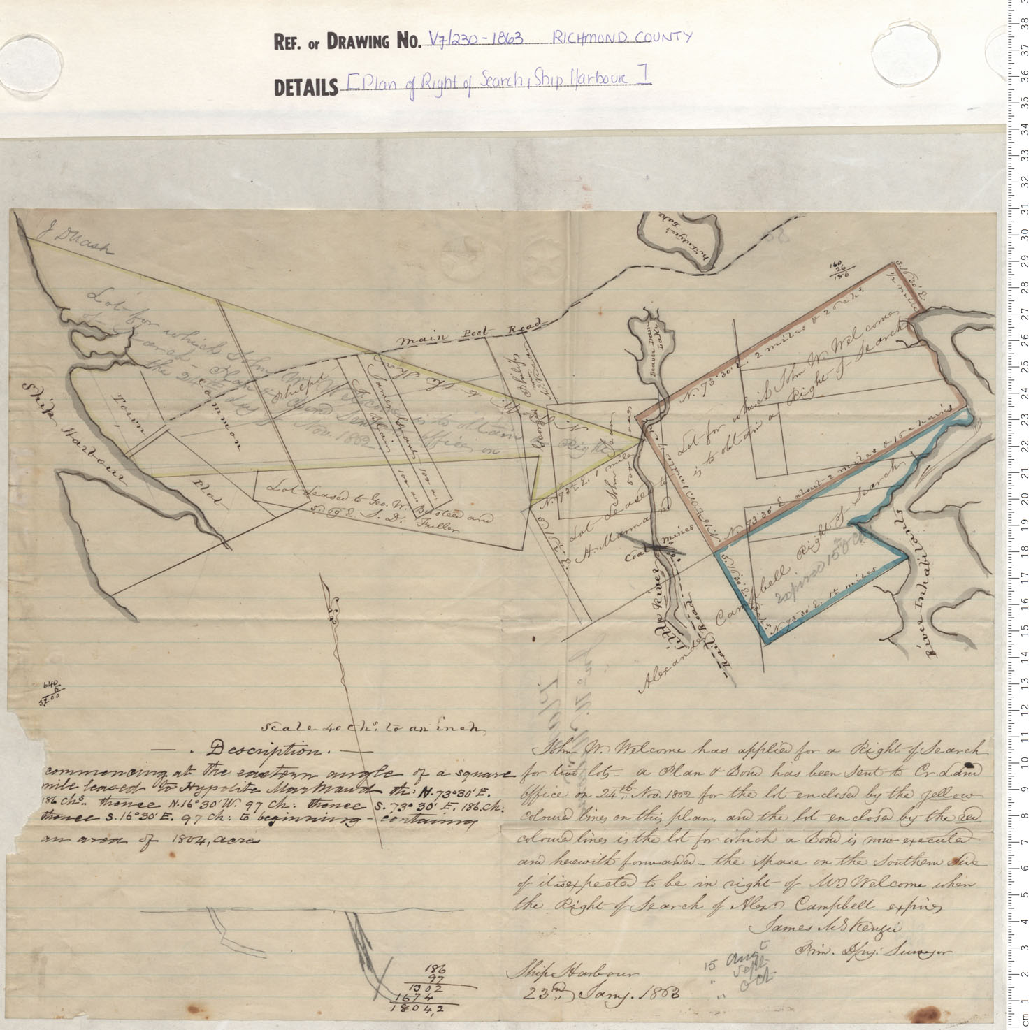
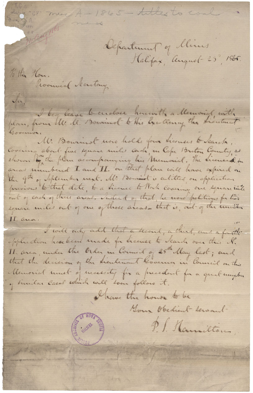
Plan of Right of Search, Ship Harbour
maps : 201402235

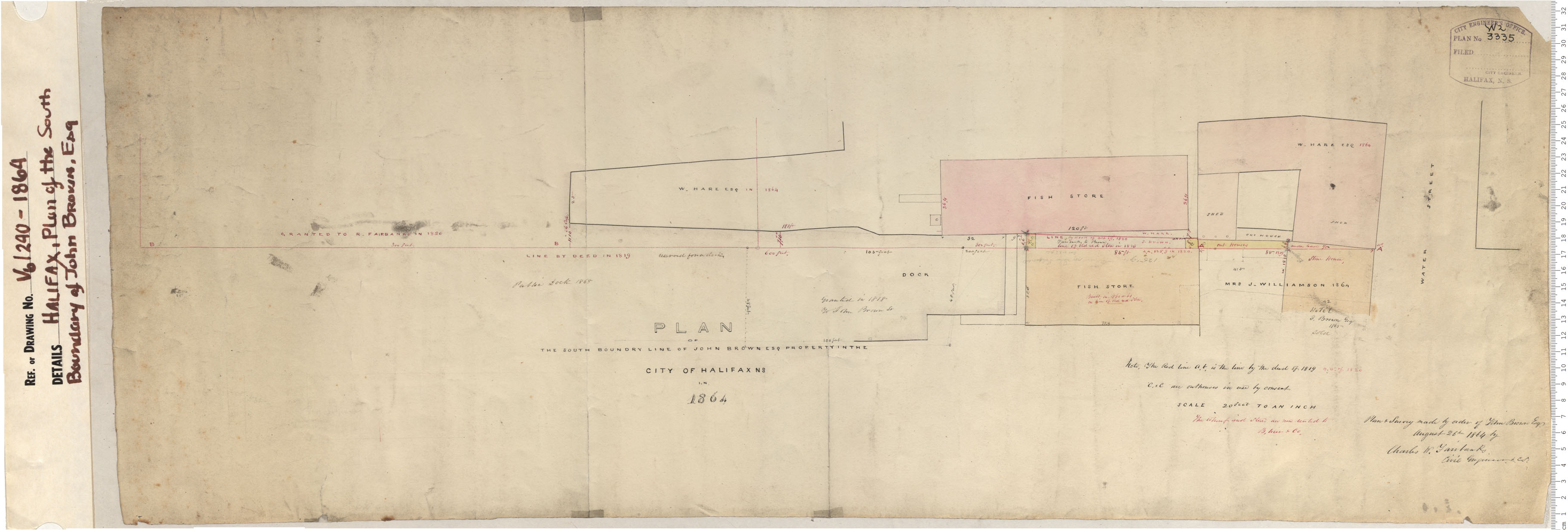
Plan of South Boundray of John Brown Esq.
maps : 201320591
maps : 201402020
maps : 201402345
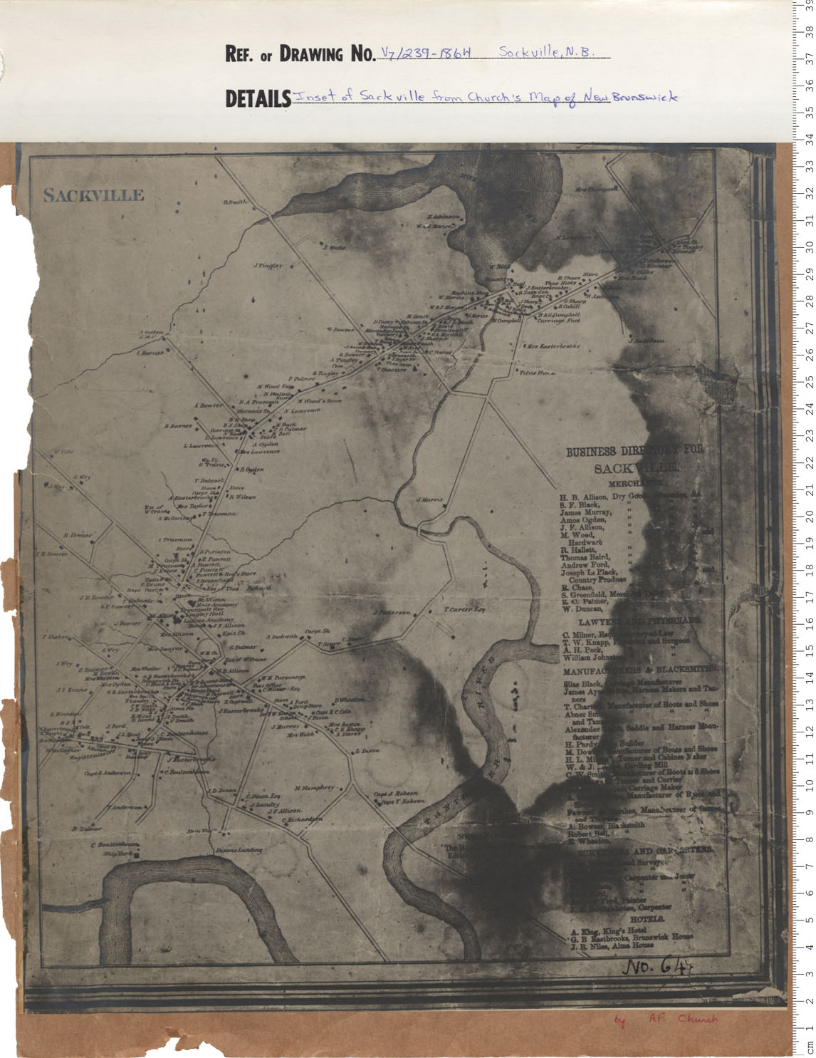
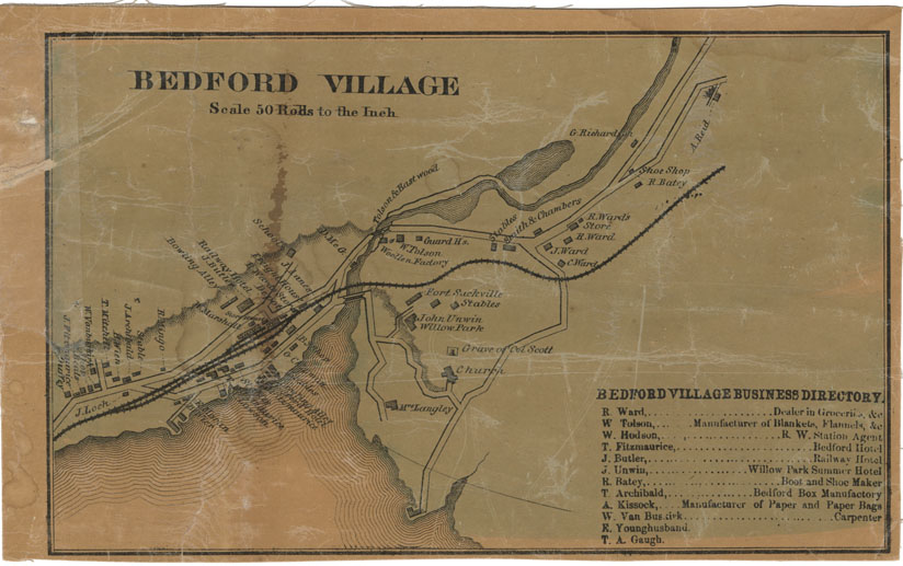
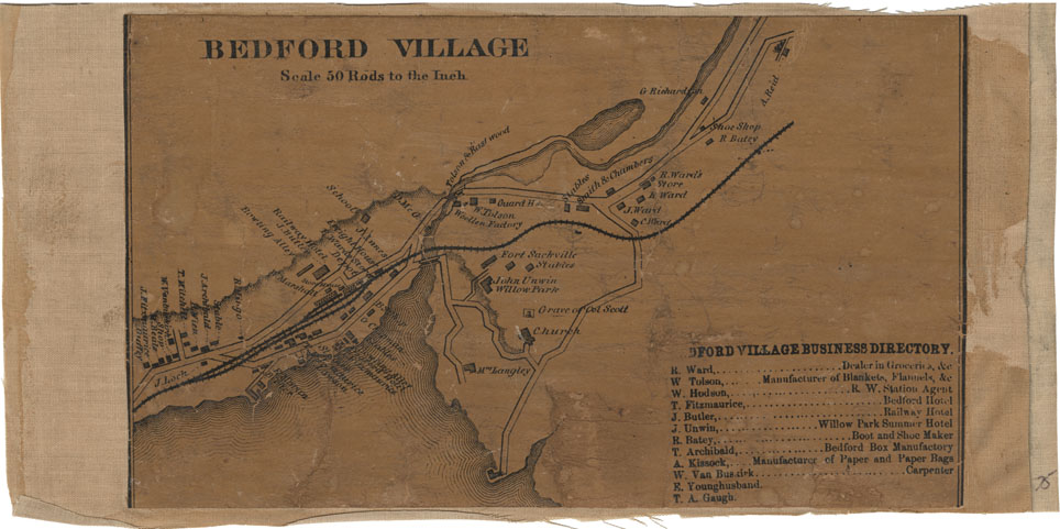
Inset of Sackville from Churchs map of New Brunswick
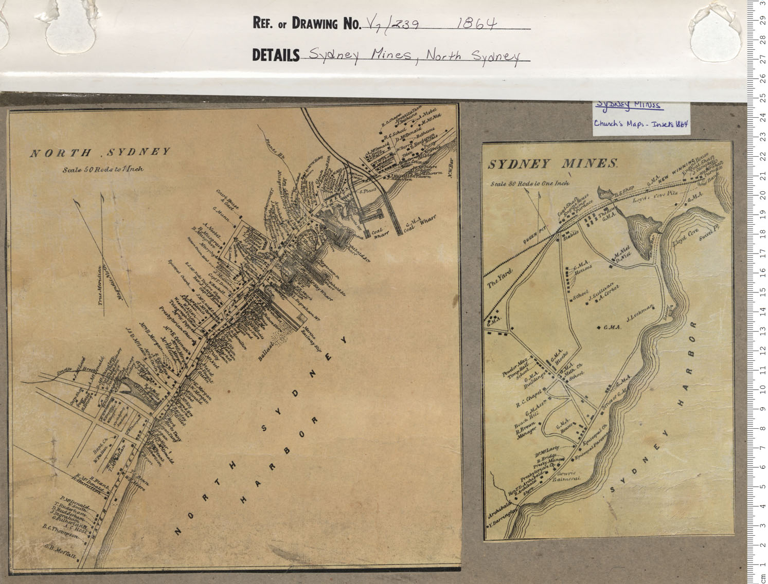
maps : 201402239
maps : 201402280
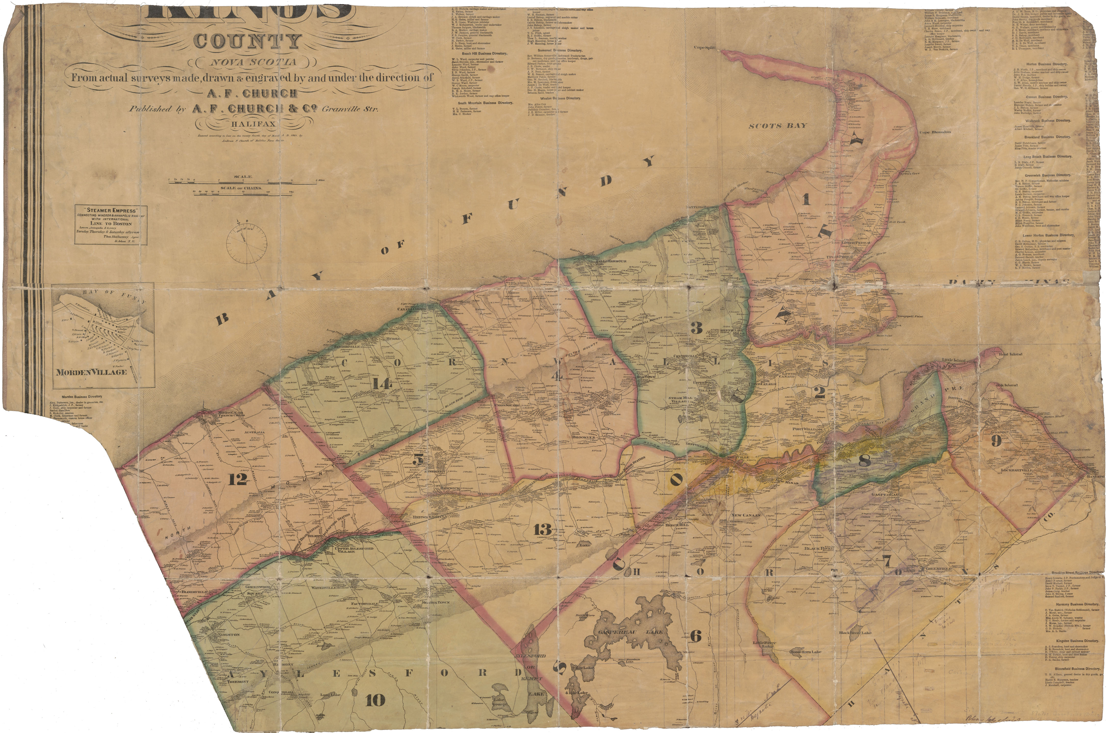
Part of A.F.Churchs Topographical Township Map of Kings County
maps : 202012052
maps : 202012220
maps : 202012221

maps : 202012233
maps : 202012245
maps : 202012248
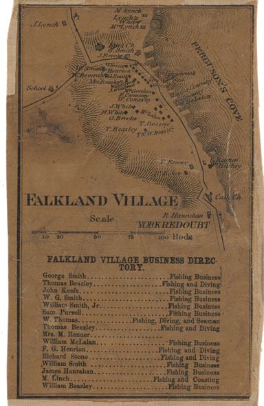
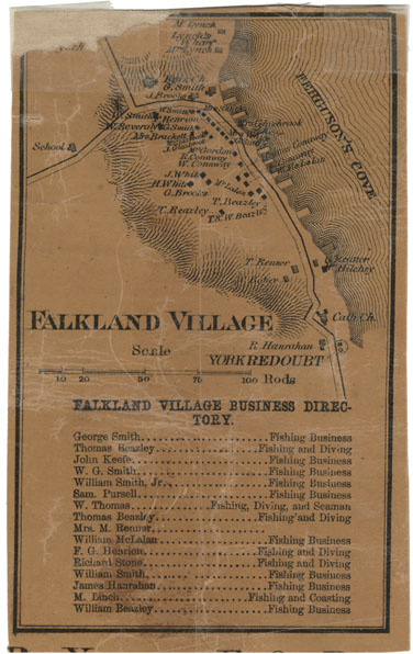
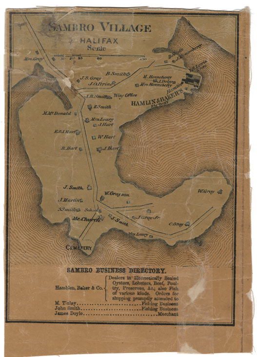
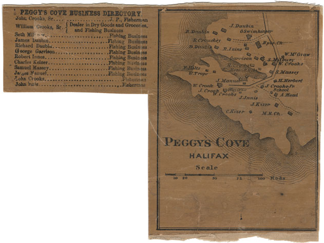
Falkland Village, Halifax County
maps : 202012356
maps : 202012357
maps : 202012360
maps : 202012361
maps : 202012372
maps : 202012521
maps : 202012522
maps : 202012562
maps : 202012718
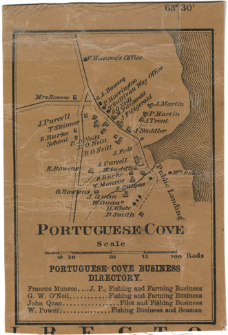
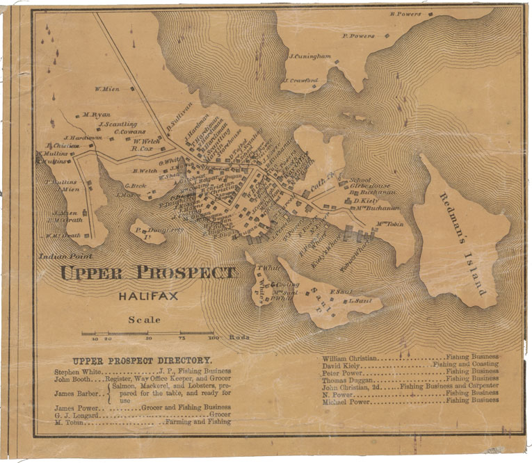
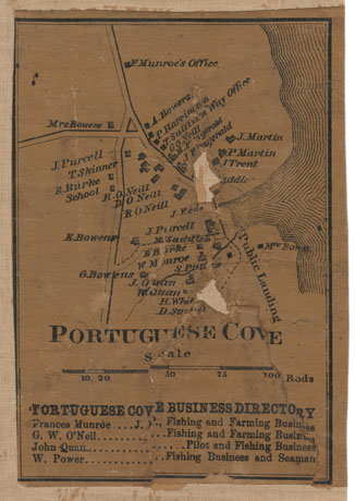
Portuguese Cove Halifax County
maps : 202012753
maps : 202012768
maps : 202012923
maps : 201402174
maps : 201402175
maps : 201402176

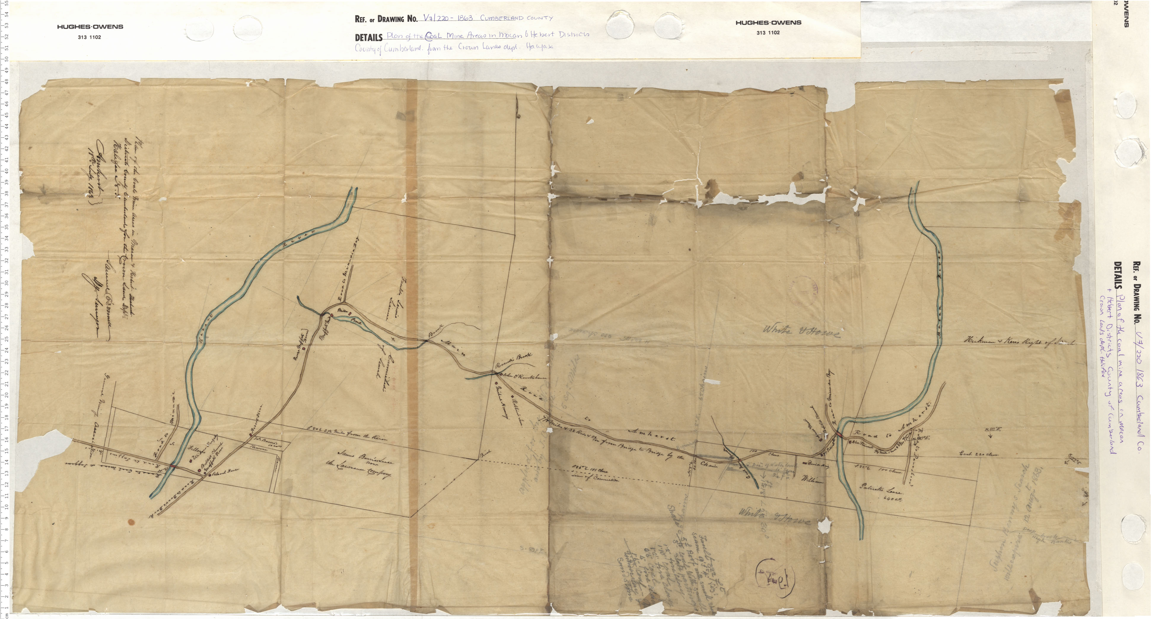
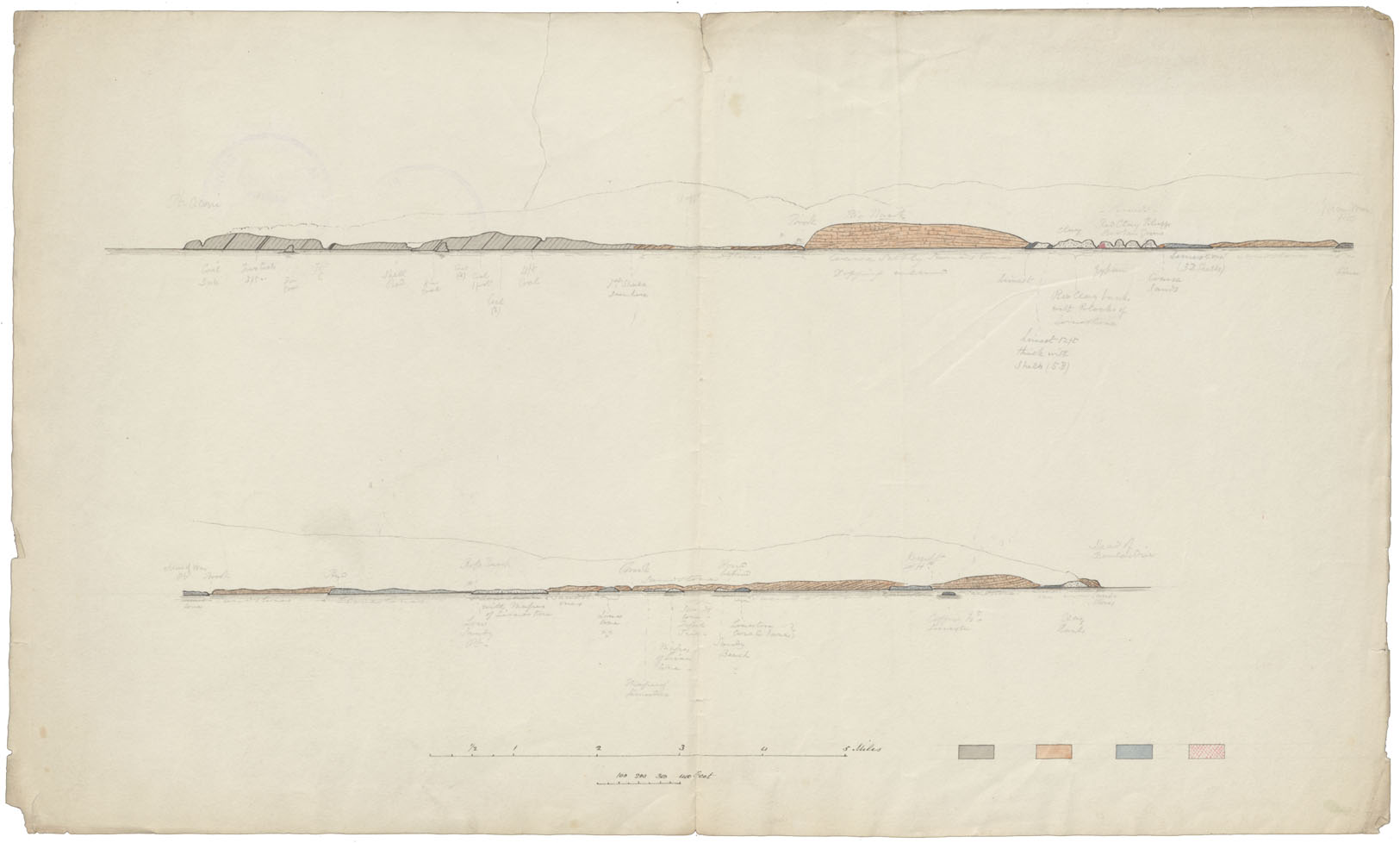
Cumberland County Coal Mining-Empire Coal Company
maps : 201602232

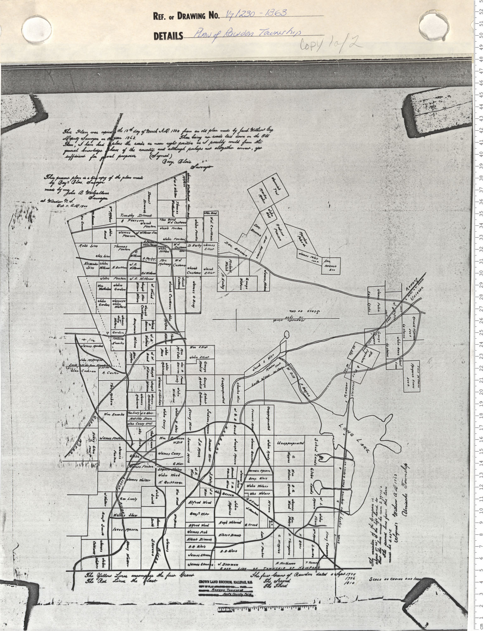
Plan of Survey of line between Rawdon & Douglas Townships
maps : 202012040
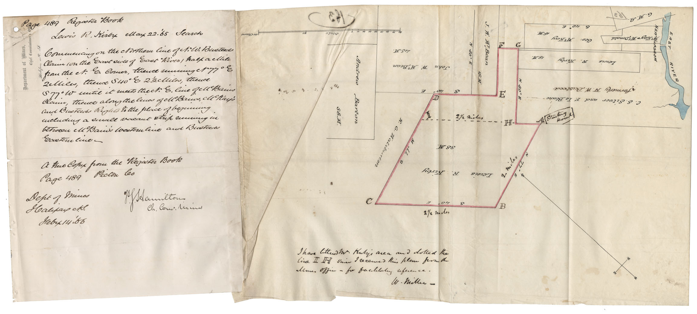
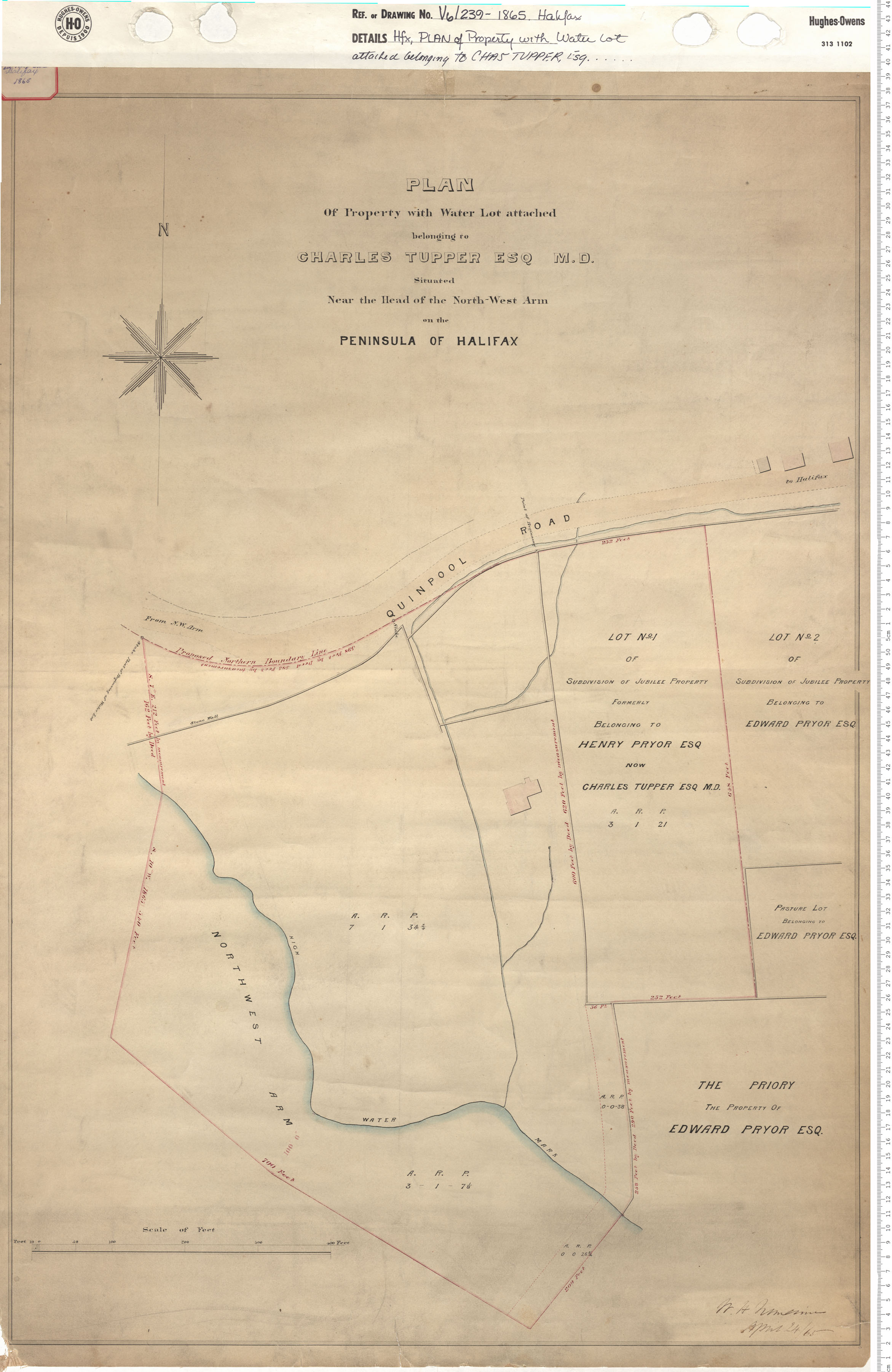
Property of Lewis R Kirby on the east side of East River
maps : 202012352
maps : 202012563
maps : 202012719
maps : 202012752
maps : 202012845
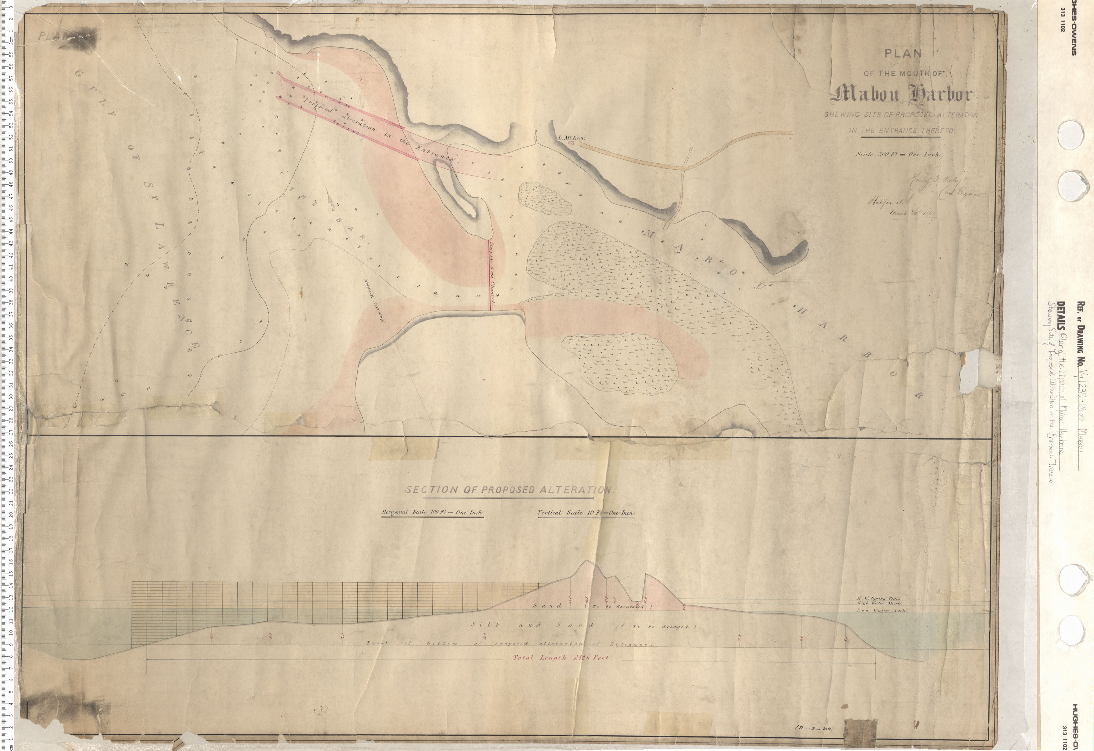
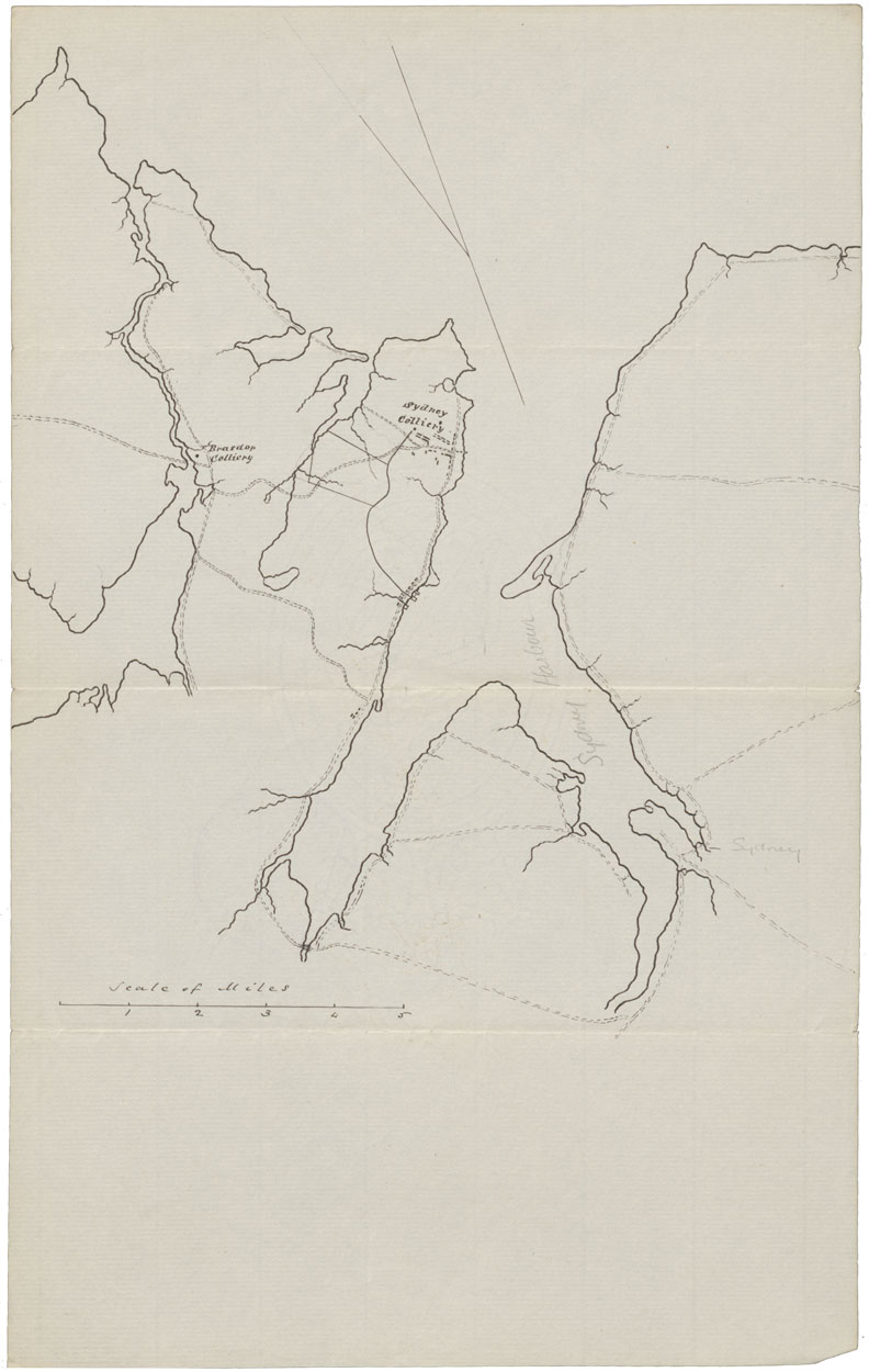
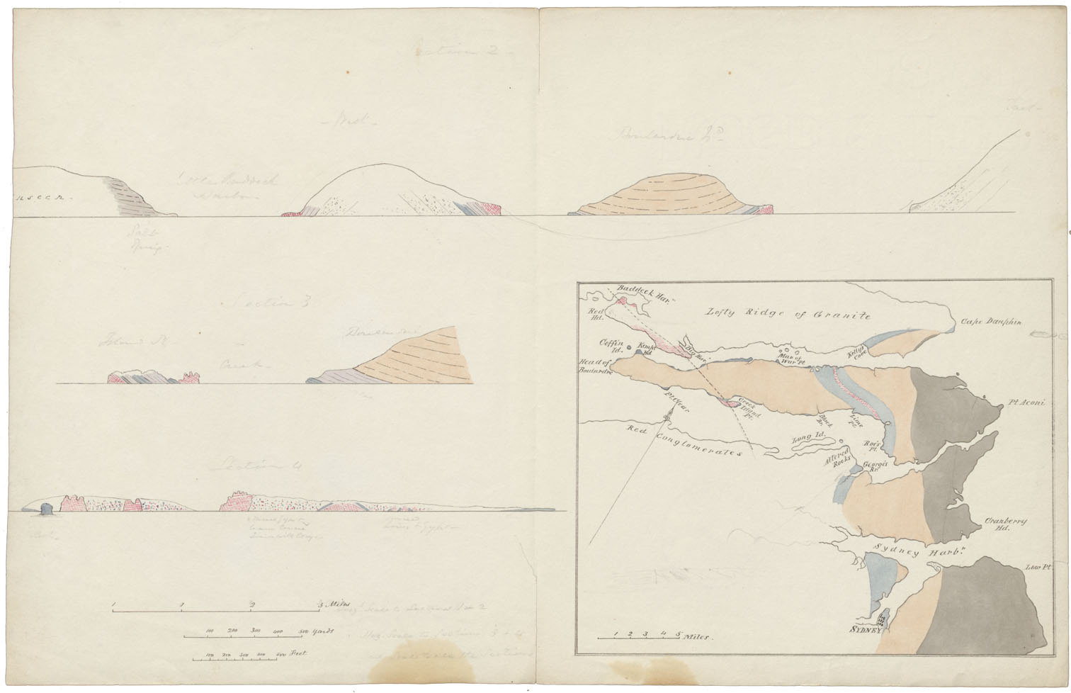
Contour Map Sydney Area Stone Formations
maps : 202012847
maps : 202012849
maps : 202012869
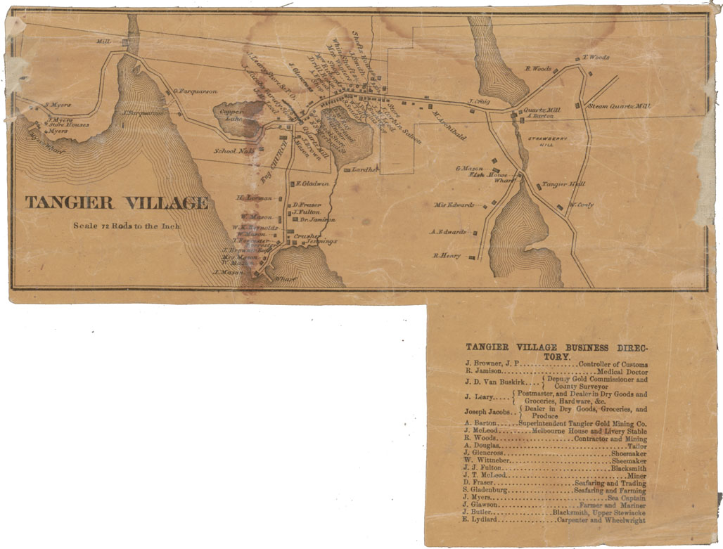
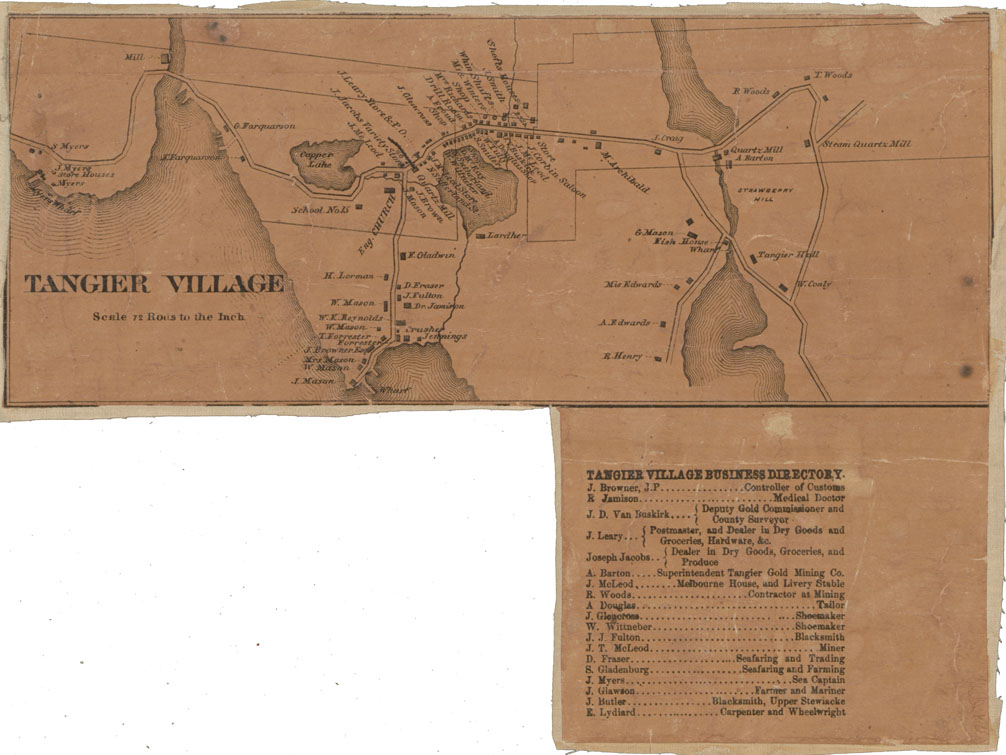
Tangier Village Halifax County
maps : 202012870
Additional Search Tools
Need more results? The Search box in the top right corner looks for digitized content only and does not full-text search our website.
- To search our Nova Scotia Births, Marriages, and Deaths click the Nova Scotia Genealogy button below.
- To search descriptions in the archival holdings catalogue, click the Archival Holdings button below.
- To search items in the library holdings catalogue, click the Library Holdings button below.
- To Google search all our websites click the Google button below
Images Nova Scotia Genealogy Archival Holdings Library Holdings Google Site Search