Nova Scotia Archives
Historical Maps of Nova Scotia
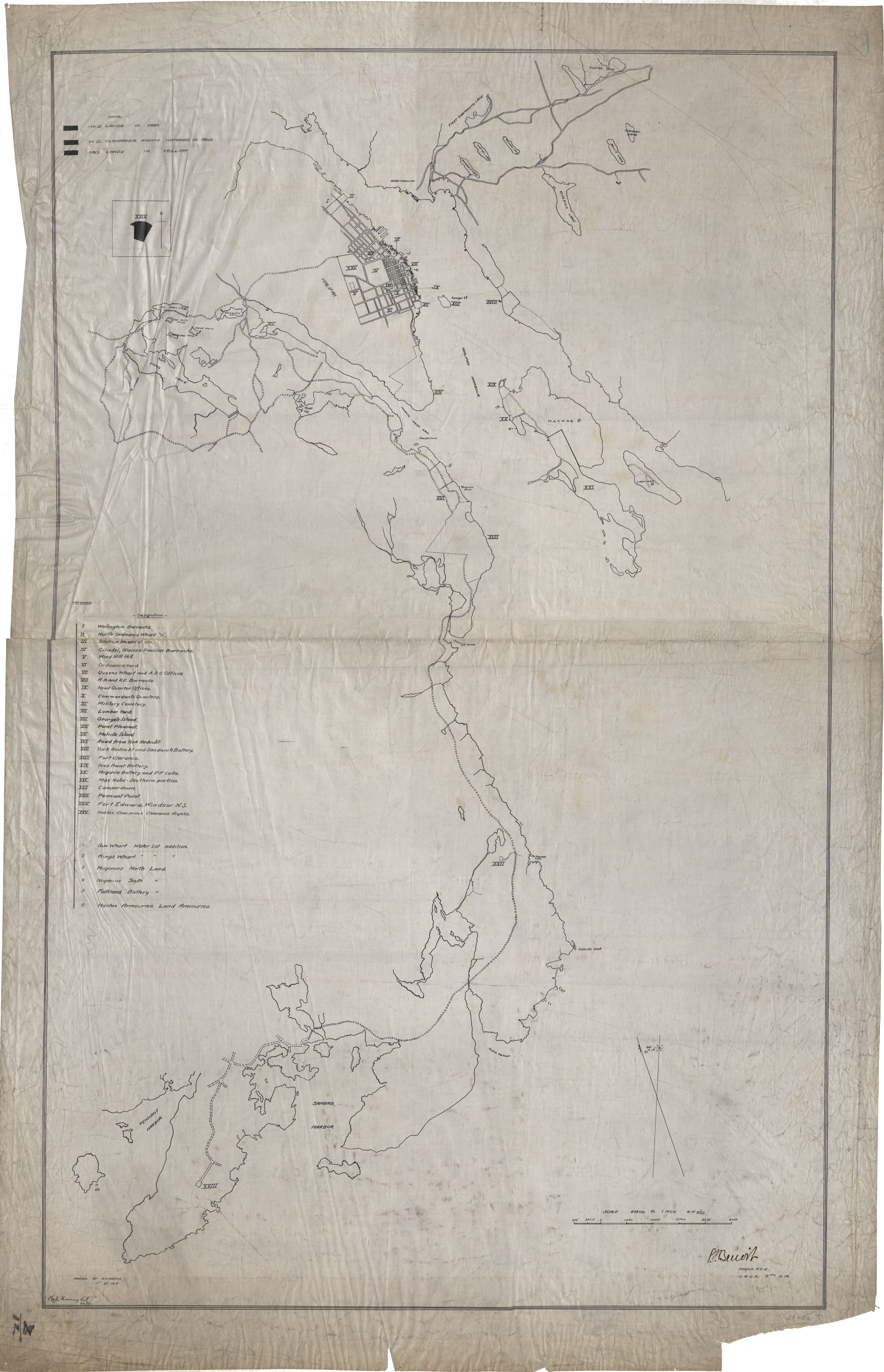
Results 106 to 119 of 119 from your search: Royal Engineers
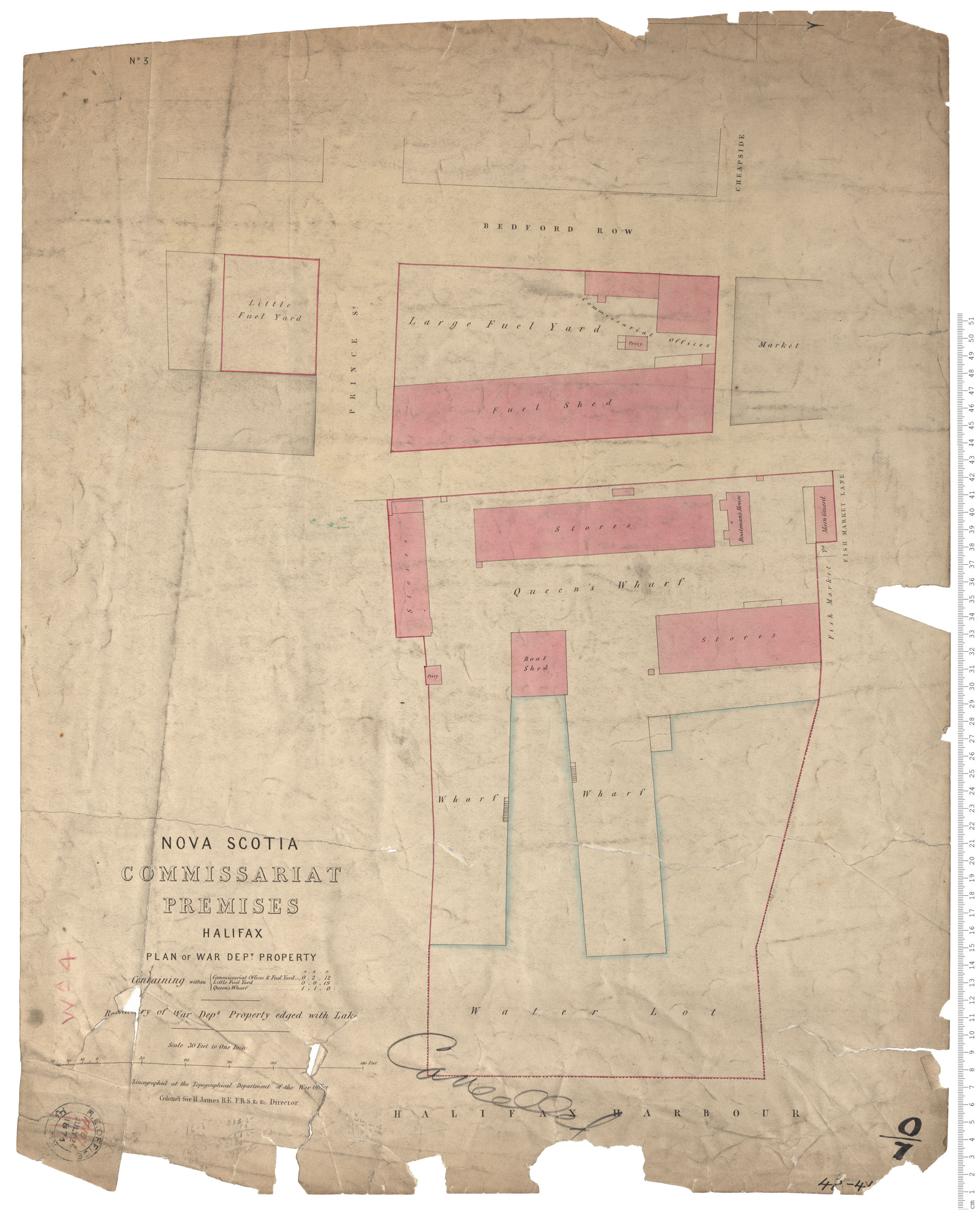
Commissariat Premises
Date: 28 July 1874
Reference: Nova Scotia Archives Royal Engineers Maps and Plans A.107
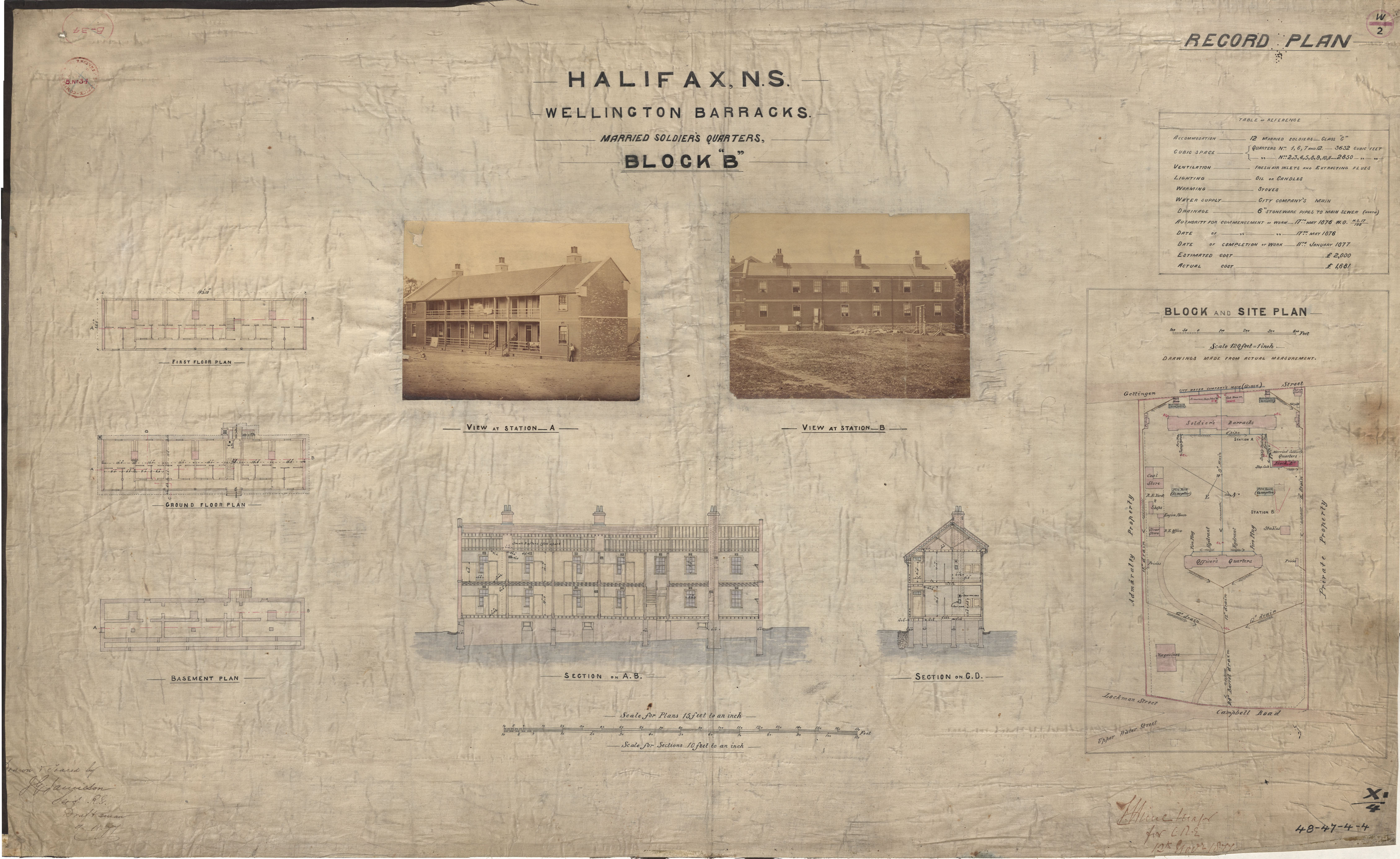
Wellington Barracks- Married Soldiers Quarters
Date: 9 November 1877
Reference: Nova Scotia Archives Royal Engineers Maps and Plans 48 - 47 - 4 - 4
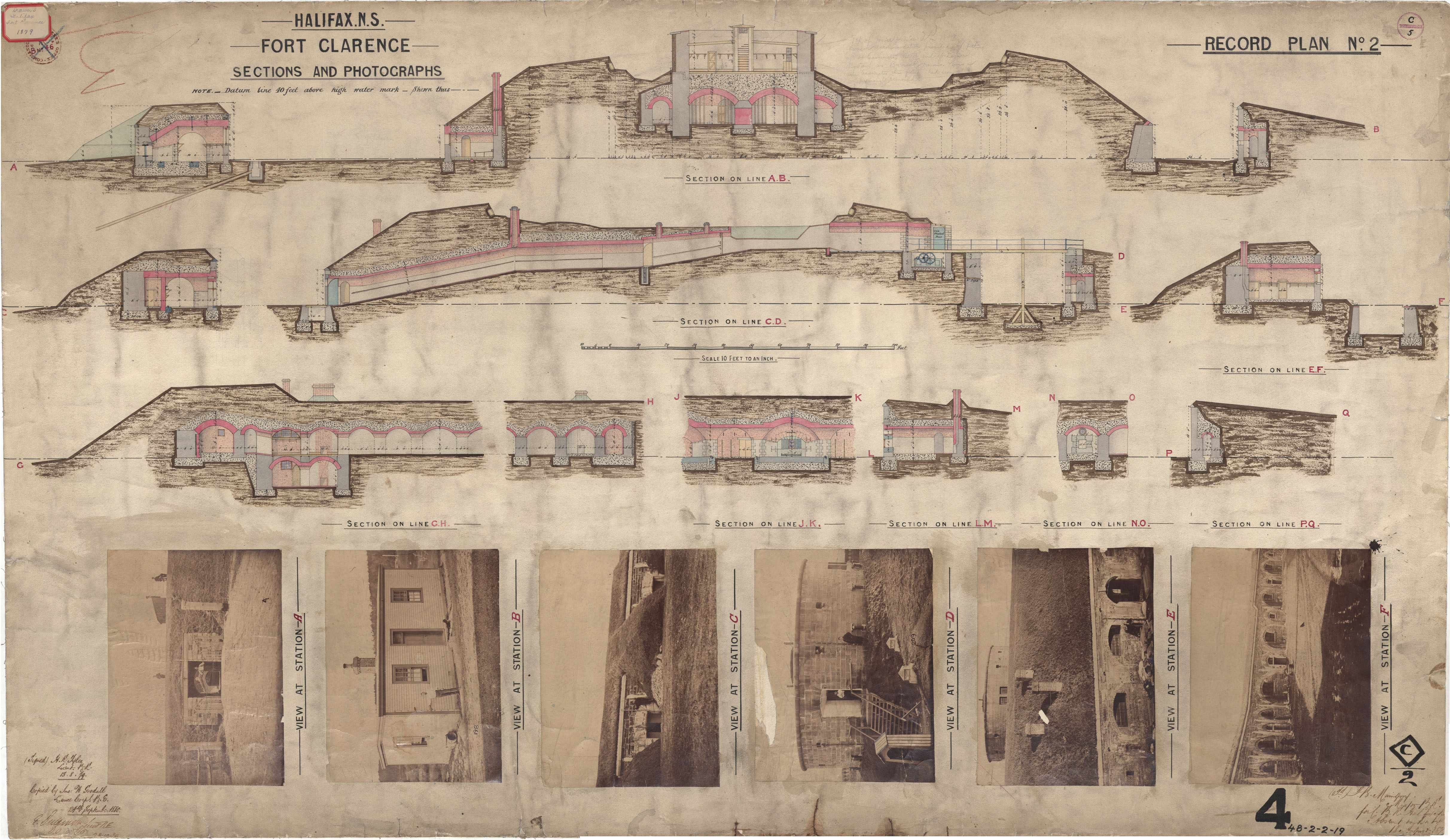
Fort Clarence - Sections and photographs
Date: 13 August 1879
Reference: Nova Scotia Archives Royal Engineers Maps and Plans 48 - 2 - 2 - 19
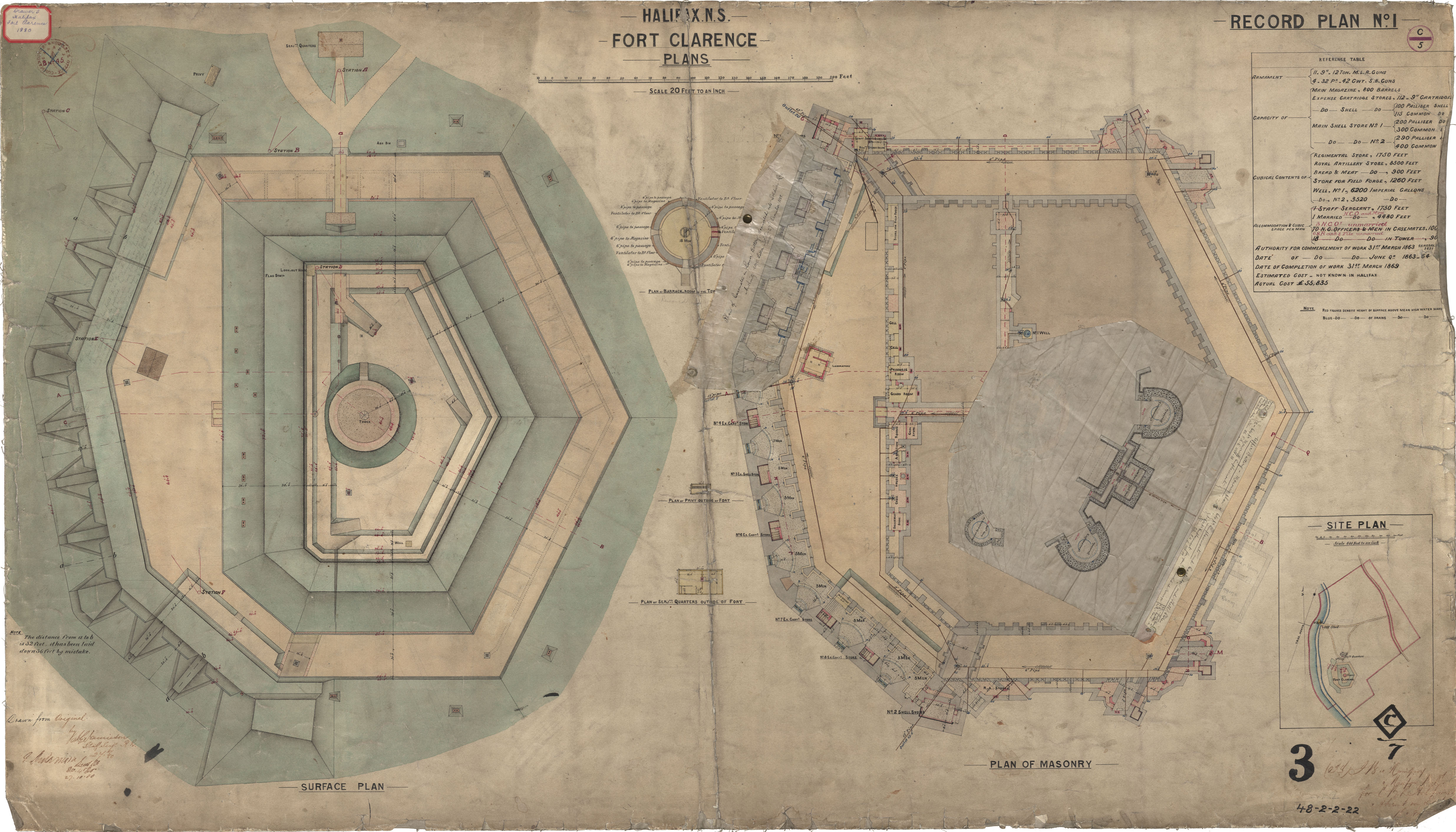
Fort Clarence - Surface & Masonry Plans
Date: 24 August 1880
Reference: Nova Scotia Archives Royal Engineers Maps and Plans 48 - 2 - 2 - 22
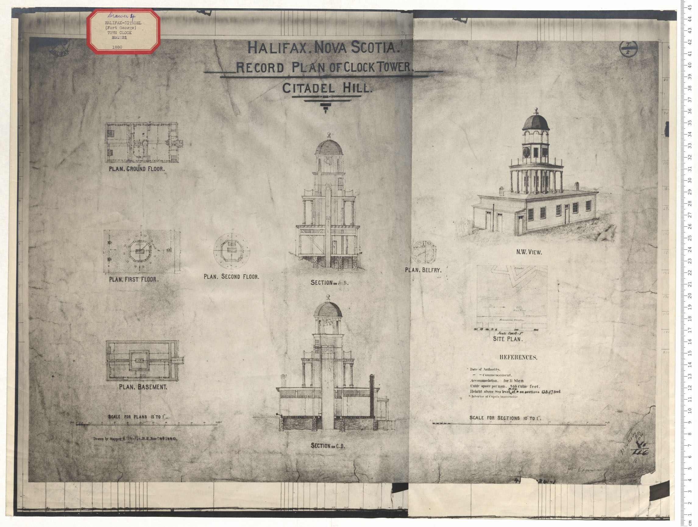
Citadel Hill - Clock Tower
Date: 8 November 1880
Reference: Nova Scotia Archives Royal Engineers Maps and Plans B.09
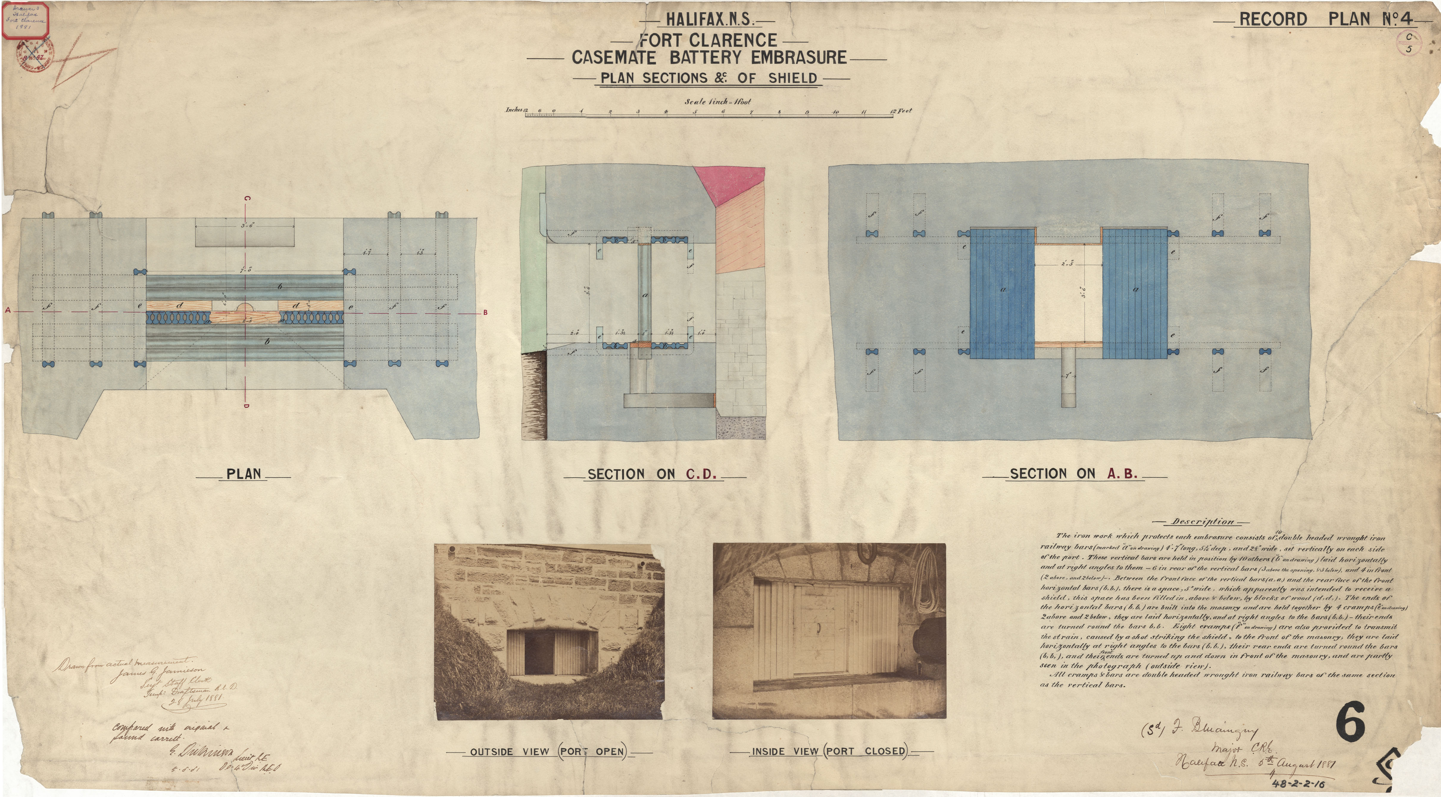
Fort Clarence - Casement Battery Embrasure
Date: 28 July 1881
Reference: Nova Scotia Archives Royal Engineers Maps and Plans 48 - 2 - 2 - 16
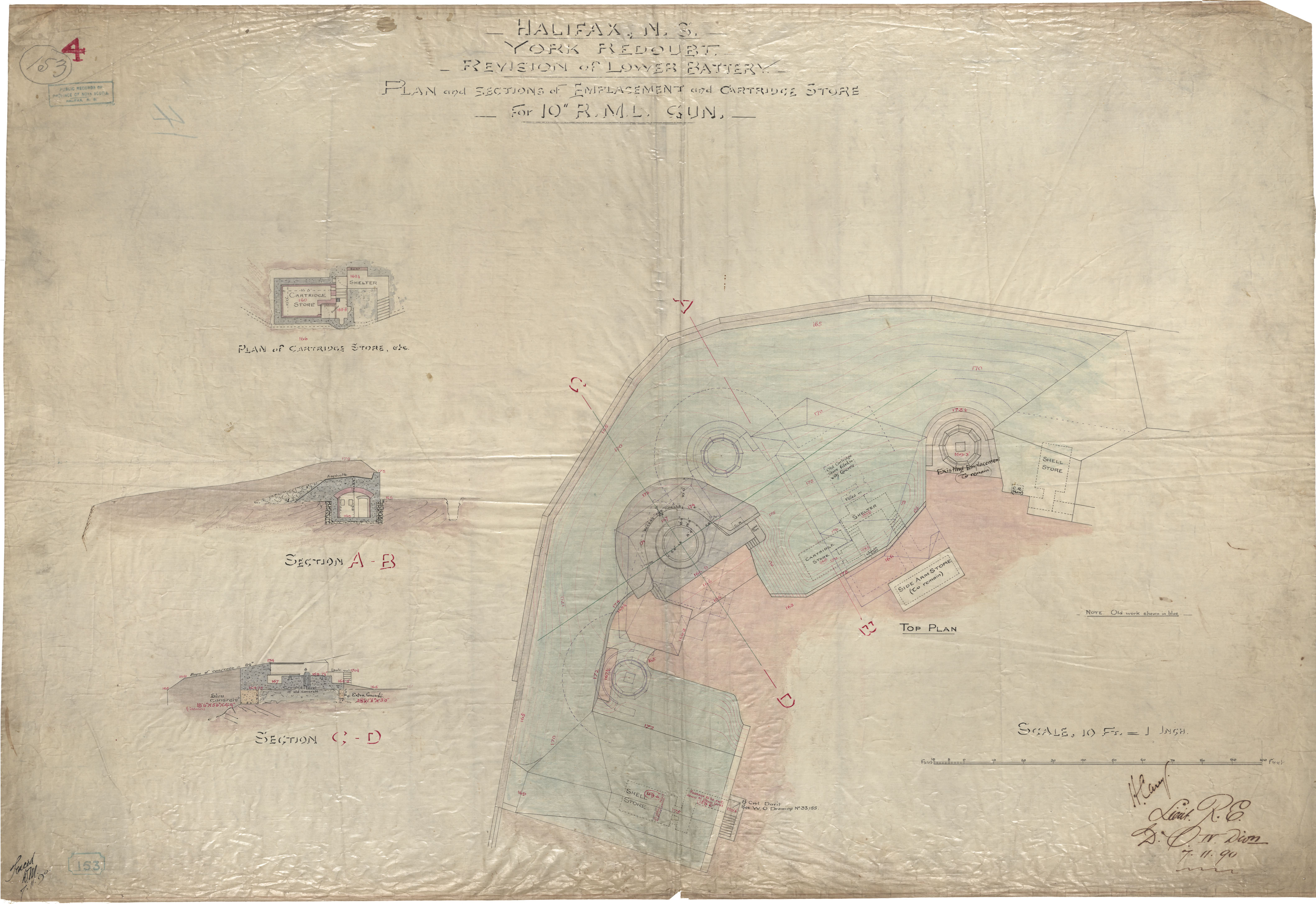
Halifax, ns, York Redoubt, Revision of Lower Battery, Plan and Sctions of Emplacements and Cartridge Store , for 10" RML Gun
Date: 7 November 1890
Reference: Nova Scotia Archives Royal Engineers Maps and Plans
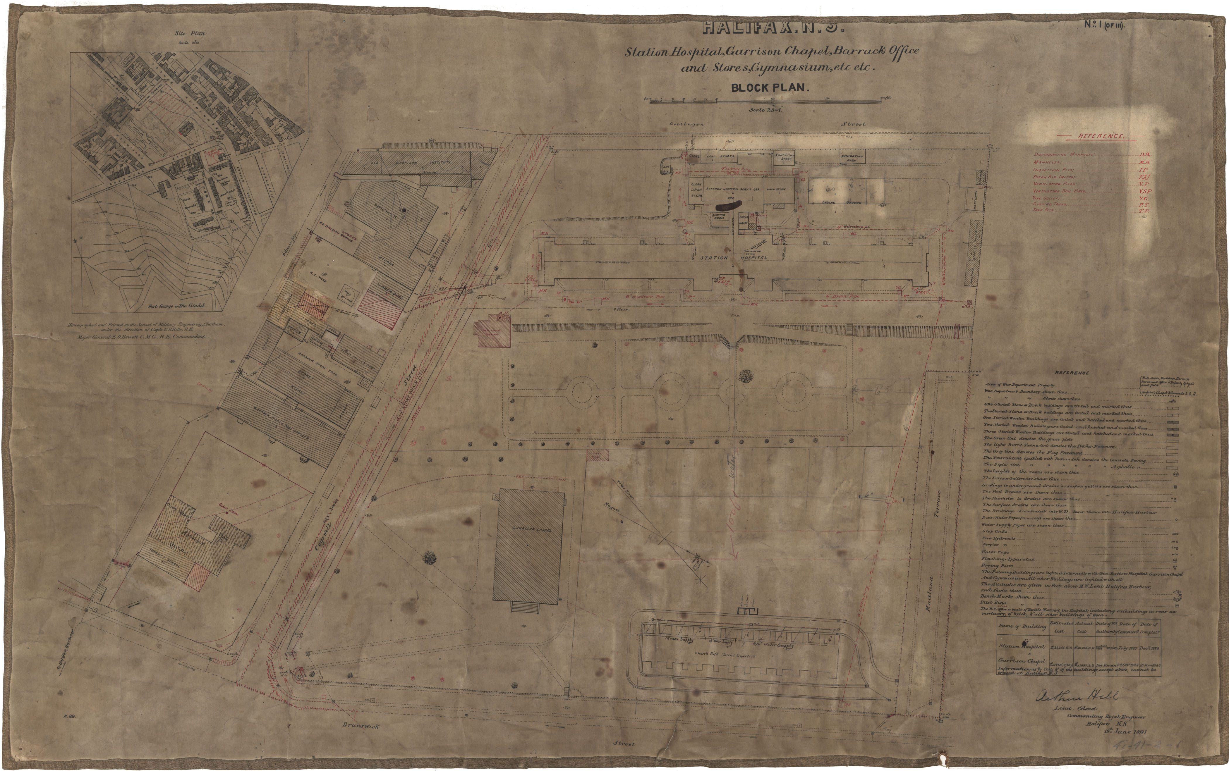
Station Hospital, Garrison Chapel, Barracks, etc.
Date: 19 June 1891
Reference: Nova Scotia Archives Royal Engineers Maps and Plans 41 - 41 - 2 - 1
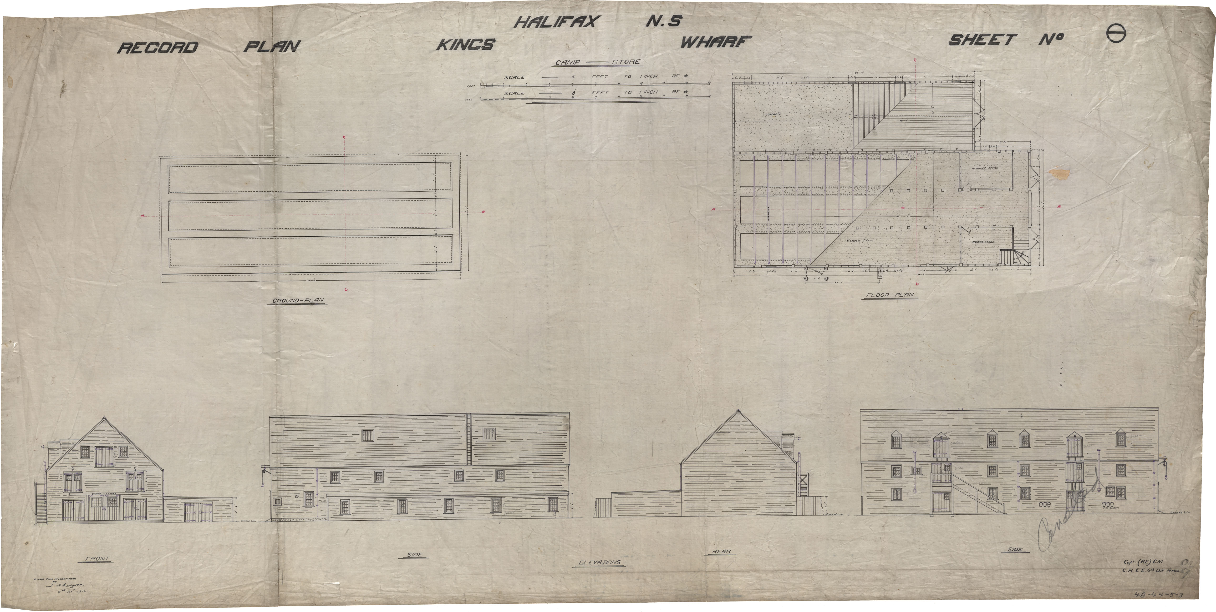
Kings Wharf
Date: 1912
Reference: Nova Scotia Archives Royal Engineers Maps and Plans 48 - 44 - 5 - 3
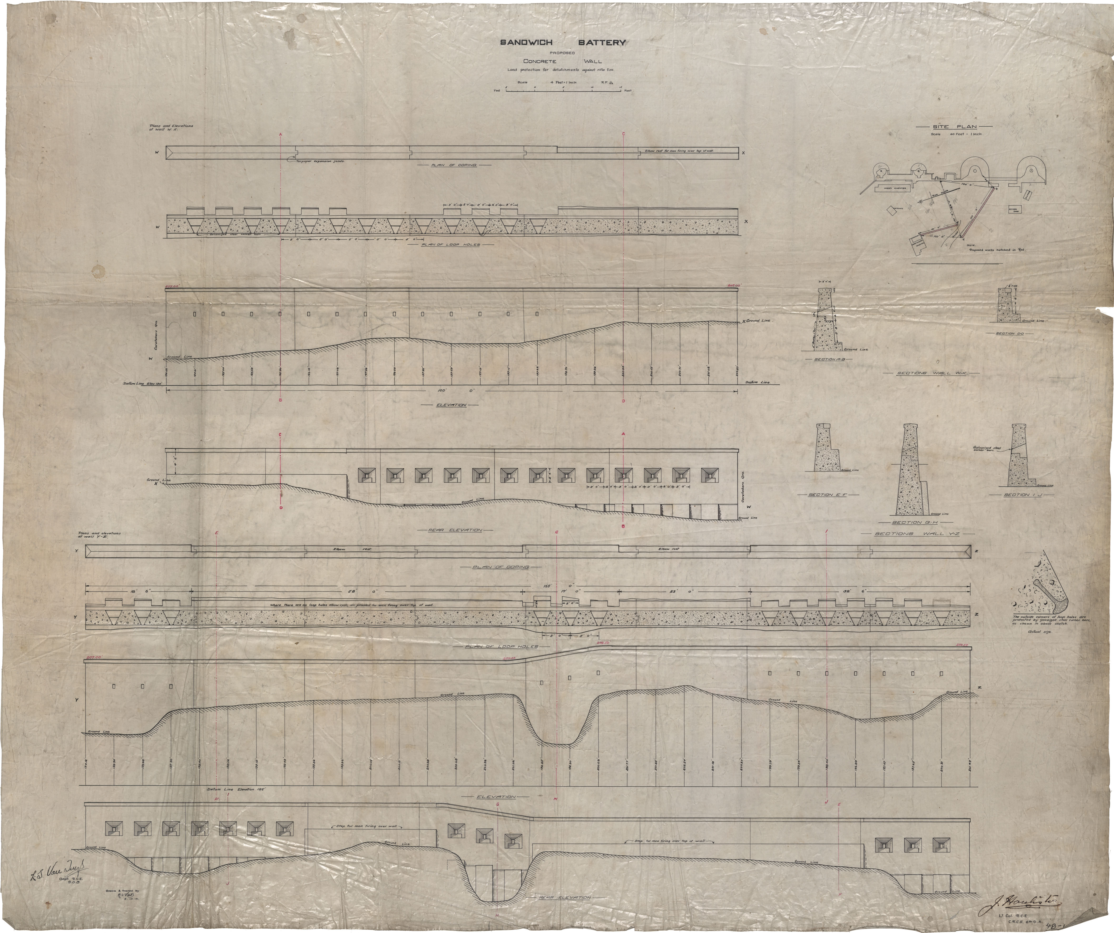
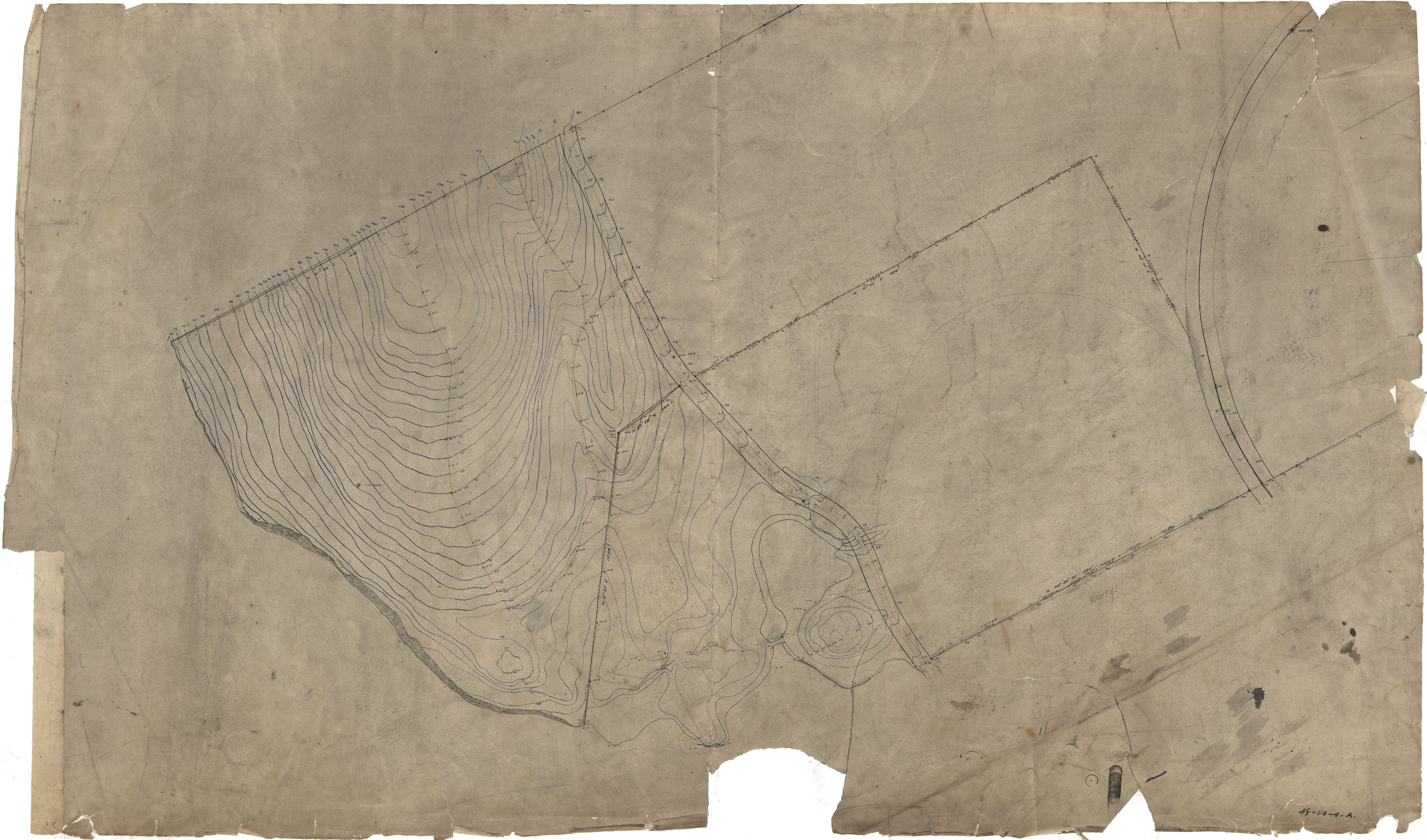
Sandwich Battery
Date: 1914
Reference: Nova Scotia Archives Royal Engineers Maps and Plans 48 - 19 - 1 - 1
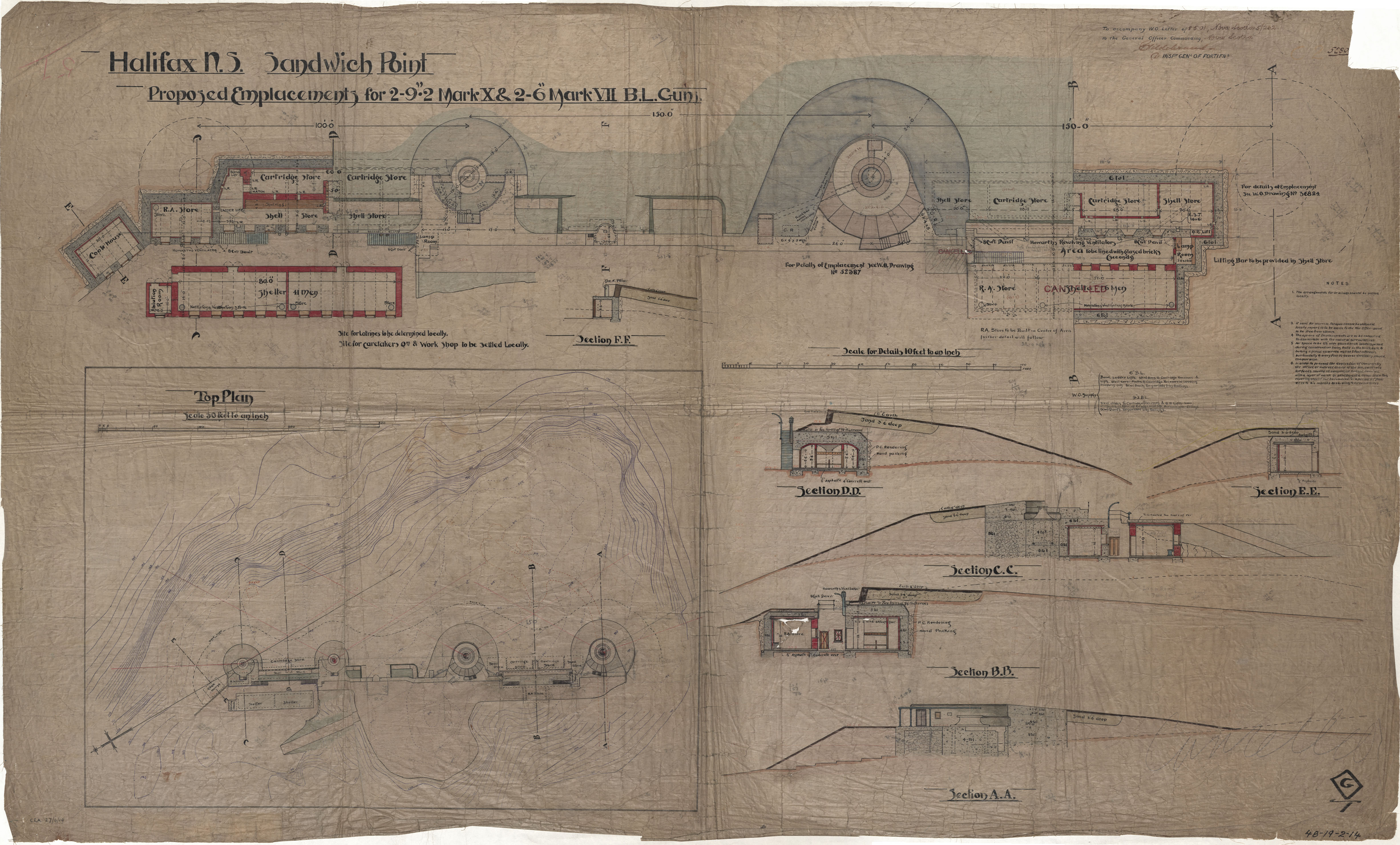
Sandwich Point
Date: 27 April 1919
Reference: Nova Scotia Archives Royal Engineers Maps and Plans 48 - 19 - 2 - 14