Nova Scotia Archives
Historical Maps of Nova Scotia
Results 1 to 15 of 96 from your search: Dartmouth

Old Town Plot of Dartmouth
Date: 1786
Reference: Nova Scotia Archives Map Collection: V7 239 Dartmouth, Nova Scotia
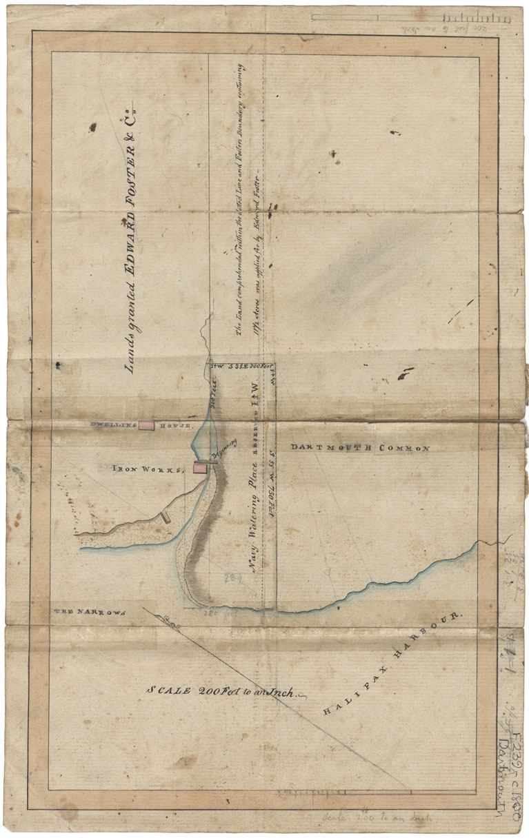
PANS Vert Mss File: Maps: Dartmouth Watering Place c. 1800 (2 maps)
Date: 1800
Reference: Nova Scotia Archives Map Collection: F/239 - 1800
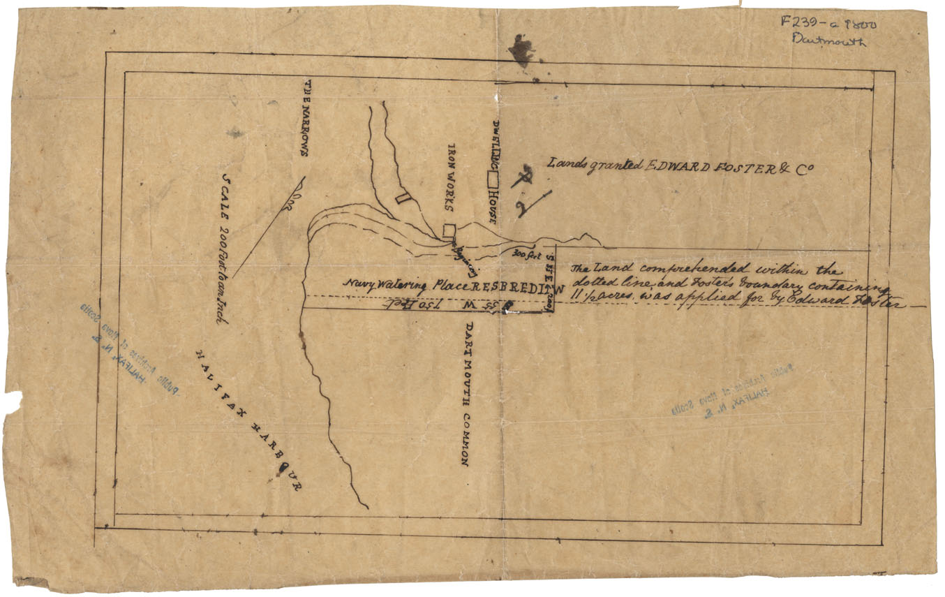
Dartmouth: Navy Watering Place c.1800
Date: 1800
Reference: Nova Scotia Archives Map Collection: F/239 - 1800
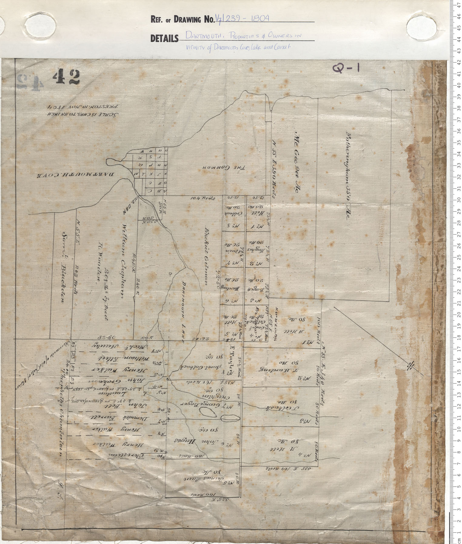
Dartmouth Property and Owners in Vicinty of Dartmouth Cove Lake and Canal
Date: 1804
Reference: Nova Scotia Archives Map Collection: V7 239 Dartmouth, Nova Scotia
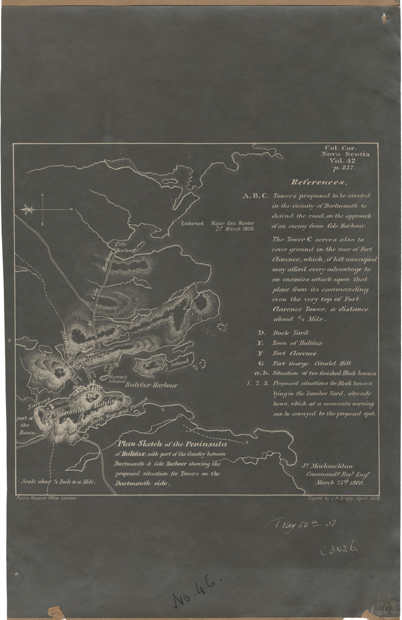
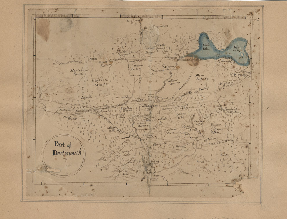
Plan Sketch of the Peninsula of Halifax with part of the Country between Dartmouth and Cole Harbour
Date: 25 March 1808
Reference: Nova Scotia Archives Map Collection: F/239 - 1808
Halifax County Dartmouth Lake & Dartmouth Cove, w.m.1808
Date: 1808
Reference: Nova Scotia Archives Map Collection: F/240 - 1808
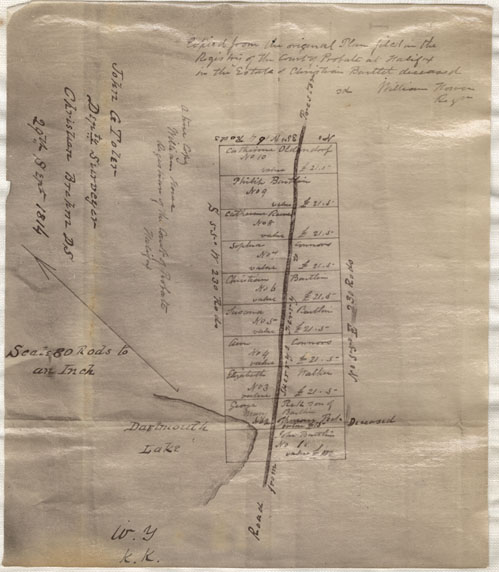
Dartmouth, Property on Road from Dartmouth to Preston
Date: 29 September 1814
Reference: Nova Scotia Archives Map Collection: F/239 - 1814
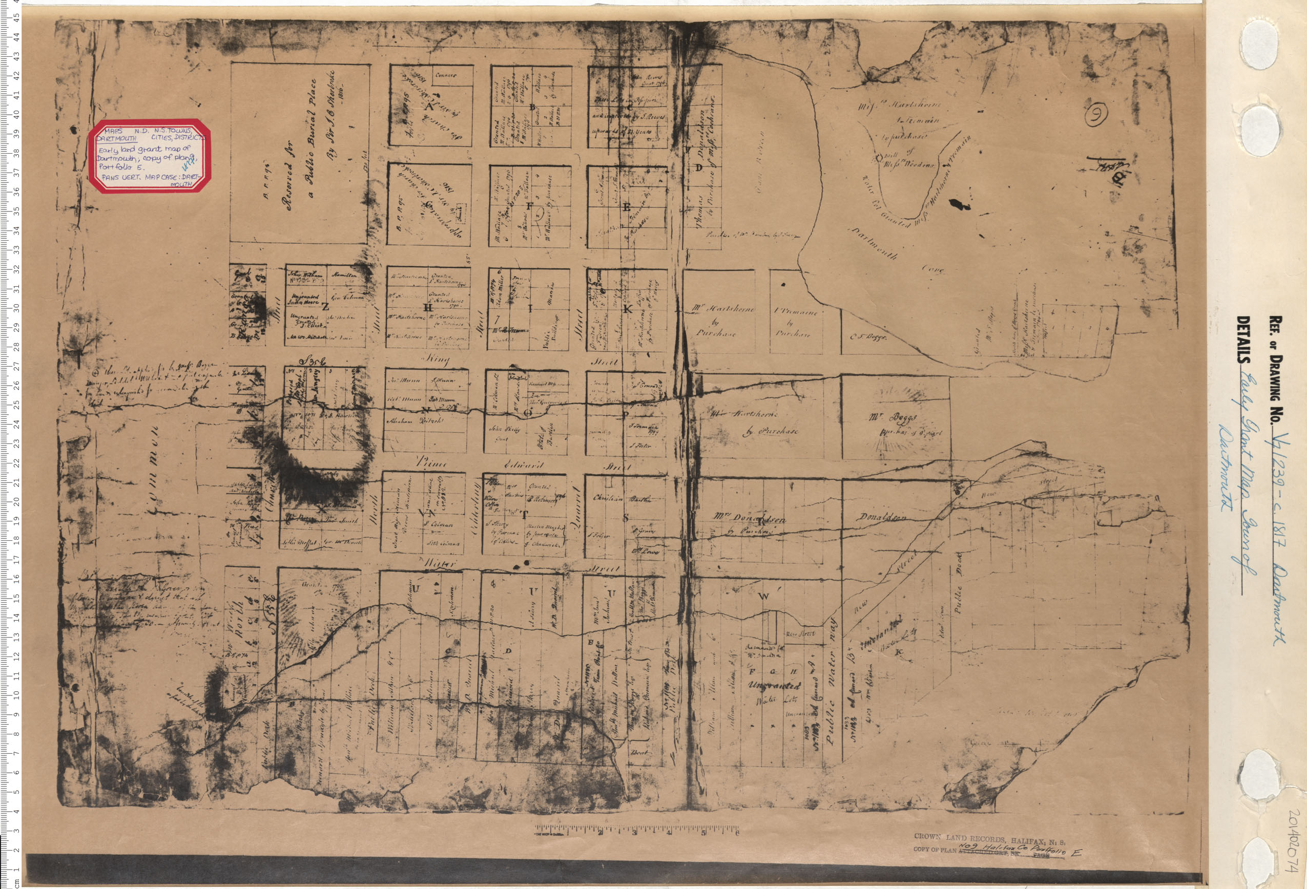
Early Grant Map. Town of Dartmouth
Date: 1817
Reference: Nova Scotia Archives Map Collection: V7 239 Dartmouth, Nova Scotia
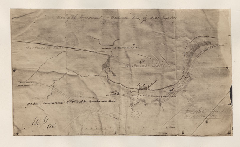
Plan of the Improvement of Dartmouth Road by Bells Sand Pit
Date: 20 October 1830
Reference: Nova Scotia Archives Map Collection: F/239 - 1830
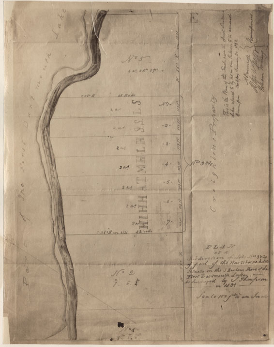
Plan of a Subdivision of Lots Nos 3&4 of part of the Hartshorne Estate situate on the S.Eastern Shore of the Lot Dartmouth Lake as surveyed by J.Thompson in 1831
Date: 1831
Reference: Nova Scotia Archives Map Collection: F/239 - 1831
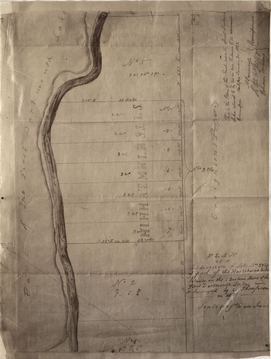
Plan of a Subdivision of Lots Nos3&4 of part of the Hartshorne Estate situate on the S.Eastern Shore of the First Dartmouth Lake
Date: 1831
Reference: Nova Scotia Archives Map Collection: F/239 - 1831
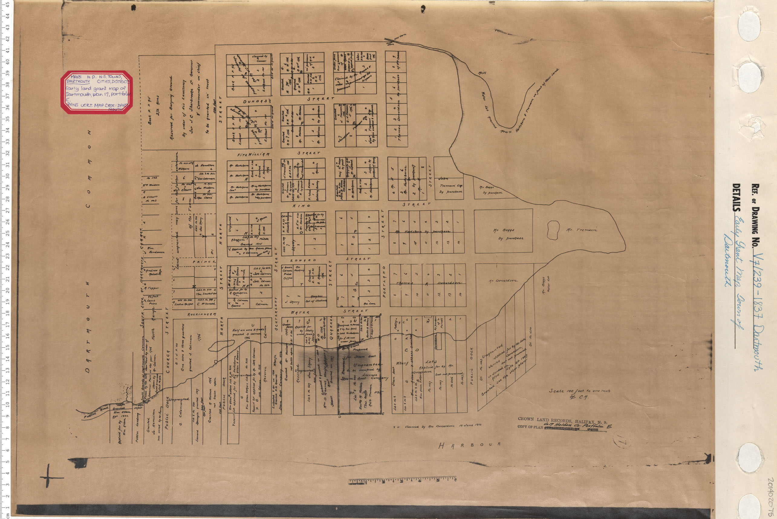
Early Grant Map. Town of Dartmouth
Date: 1837
Reference: Nova Scotia Archives Map Collection: V7 239 Dartmouth, Nova Scotia
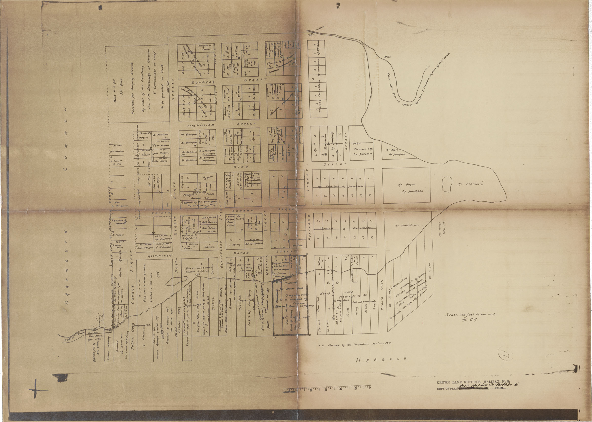
Plan, Town of Dartmouth Central Core-Land Grants
Date: 1838
Reference: Nova Scotia Archives Map Collection: F/239 - 1838
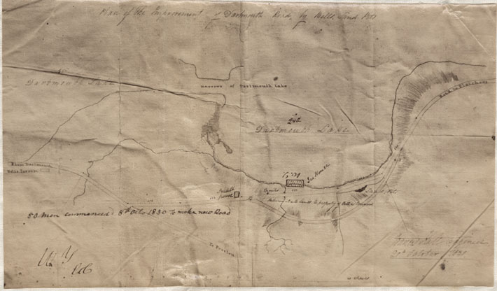
Plan of the Improvement of Dartmouth Road by Bells Sand Pit
Date: 20 October 1838
Reference: Nova Scotia Archives Map Collection: F/239 - 1838