
Nova Scotia Archives
Historical Maps of Nova Scotia
"Map of part of the Indian Lands in Nova Scotia, 1842" – Sydney County
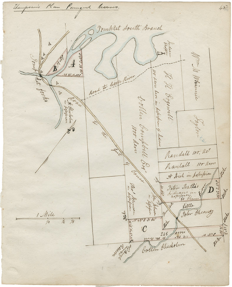
Indian Commissioner Joseph Howe's first "Report on Indian Affairs" [see Journals of the House of Assembly, 25 January 1843, Appendix 1, p. 3] states that Howe had received plans of Mi'kmaq Reserves in Nova Scotia from the Surveyor General and copied them into his note book [RG 1 v. 432]. The original map comprises nine individual plans on one sheet, each signed by John Spry Morris, Surveyor General, 20 May 1842. Howe's copies are embedded in narrative descriptions of his thoughts and enco
Date: 1842
Reference: Nova Scotia Archives Map Collection: F/202 - Nova Scotia 1843; RG 1 v. 432 p. 45; microfilm no. 14011