Nova Scotia Archives
Historical Maps of Nova Scotia
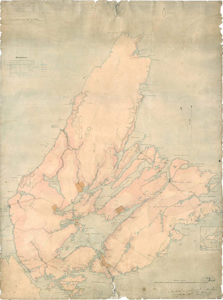
Map of Cape Breton, 1831

Includes First Nations settlements. Drawn by John L. Johnston. Signed "Rupert D. George, August 1831;" and "W.H. Keating, May 1848."
Date: 1831
Cartographer: John L. Johnston
Reference: Nova Scotia Archives Map Collection: F/201 - Cape Breton 1831