Nova Scotia Archives
Historical Maps of Nova Scotia
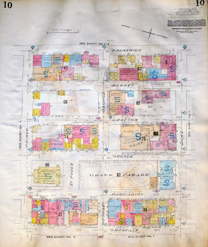
Plate 10, Insurance Plan of the City of Halifax Nova Scotia

November 1914, reprinted July 1949, revised to November 1951. By the mid-twentieth century, the Argyle streetscape between George and Duke streets had radically changed from the late nineteenth century.
The Underwriters’ Survey Bureau Limited identifies Moirs Candy Factory, Shipping, Bakery and Offices at 110-128-130 Argyle Street, November 1951.
Might’s Halifax-Dartmouth City Directories 1951 lists Moirs Limited as located at 128 Argyle. The "Street Directory"
Date: November 1914
Reference: Nova Scotia Archives Map Collection: O/S G1129 H3 G63 1949 Vol. 1