Nova Scotia Archives
Historical Maps of Nova Scotia
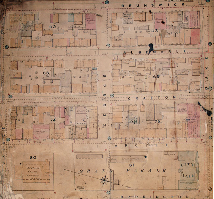
Plate 10, Map of Halifax City
Charles E. Goad, Map of Halifax City, April 1889, identifies the Argyle Street buildings between George and Duke streets as numbers 94 to 130.
McAlpine’s City Directory 1889-90 includes an advertisement for Moir, Son & County as well as the alphabetical listing of Moir Son & County, Bakers and Confectioners, 128 to 132 Argyle (p. 232).
The "Street Directory" lists businesses and residents between George and Duke Streets. Residents include a boarder, tai
Date: April 1889
Reference: Nova Scotia Archives Map Collection: O/S G1129 H3 G63 1889

