Nova Scotia Archives
Mi'kmaw Teaching and Learning Resources
Description of land reserved for the Indians in different counties throughout the province including Sydney County, Cumberland County, Hants County, Halifax County, Queens County, Lunenburg County, Annapolis County, and Kings County.
note: transcription publicly contributed - please contact us with comments, errors or omisions
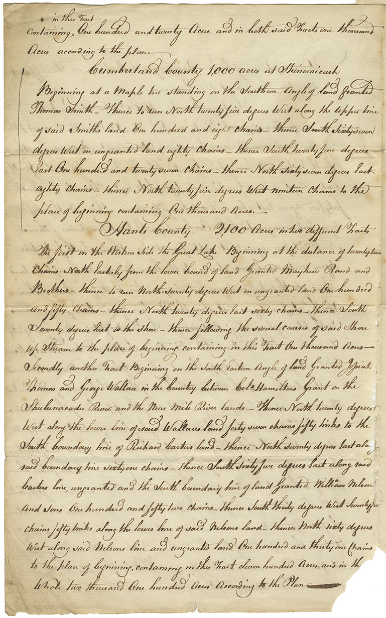
Containing [in this Tract - written above so insert here]
One hundred and twenty Acres. and both said Tracts one thousand Acres according to the plan~
Cumberland County 1,000 acres at Shinemicash Beginning at a Maple tree standing on the Southern Angle of land granted Thomas Smith _ Thence to run North twenty five degrees West along the Upper line of said Smiths land One hundred and eight chains_Thence South Sixty seven degrees West on ungranted land eighty chains _Thence South twenty five degrees East One hundred and twenty seven chains _ Thence North sixty seven degrees East eighty chains _ thence North twenty five degrees West nineteen Chains to the place of beginning containing One thousand Acres_
Hants County. 2,100 Acres in two different tracts The first on the Western side the Great Lake Beginning at the distance of twenty two Chains North Easterly from the lower bound of land Granted [Mayhew?] Rand and Brothers thence to run North seventy degrees West on ungranted land One hundred and fifty Chains_ thence North twenty degrees East sixty chains_ thence South Seventy degrees East to the shore_thence following the several courses of said Shore up Stream to the place of beginning containing in this Tract One thousand Acres_ Secondly another Tract Beginning on the South Eastern Angle of land Granted [Josiah? ] Thomas and George Wallace in the County between [Col.?] Hamiltons Grant on the Shubenacadie River and the Nine Mile River lands _ Thence North twenty degrees West along the lower line of said Wallaces land forty seven chains fifty links to the South boundary line of Richard Carters land_ thence North seventy degrees East along said boundary line sixty one chains_ thence South sixty five degrees East along said Carters line, ungranted and the South boundary line of land Granted William Nelson and Sons One hundred and fifty two chains_ thence South thirty degrees West twenty[five?] chains fifty links along the lower line of said Nelsons land_ thence North sixty degrees West along said Nelsons line and ungranted land One hundred and thirty one chains to the place of beginning, containing in this tract eleven hundred Acres and in The Whole two thousand One hundred Acres According to the Plan
Retrieval no.: Commissioner of Public Records — Mi'kmaq and Government Relations series Nova Scotia Archives RG 1 volume 430 number 54
Questions to Consider
- When do you think the document was written?
- Who do you think wrote the document?
- Why do you think the document was written
- Who do you think received the document?
- Who do you think this document was written for?
- What information do you think this document provides? What do you think it tells us about the past?
- How do you think the document reflects the attitudes and values of the time period in which it was written?
- What impact do you think the document had at the time it was written?
- Do you think those were different impacts for different people?

