Nova Scotia Archives
Mi'kmaq Holdings Resource Guide
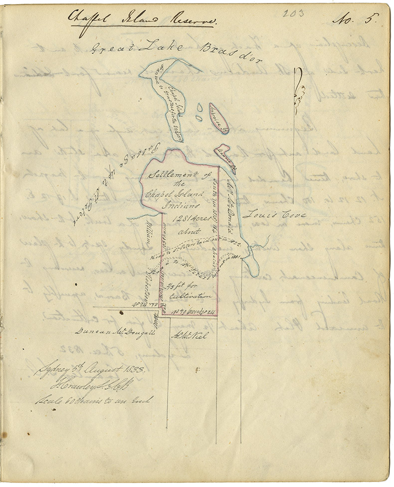
Report by Thomas Crawley, Surveyor General of Cape Breton, describing the settlement of the Chapel Island Mi'kmaq about six miles from St. Peter's. Includes map showing 1281 acres of reserve.
note: transcription publicly contributed - please contact us with comments, errors or omisions
203
No. 5
Chapel Island Reserve
Great Lake Bras d'or
Chapel Island
Granted to Trustees for the Indians
Ambroise Id.
Maurie Id.
Passage up to St. Peters
Settlement of the Chapel Island Indians 1281 Acres about 2/3 fit for cultivation
Wm. McDonald
Louis Cove
Road to St. Peters laid out in 1822.
Road to St. Peters laid out in 1831.
William Robertson
North (in 1818) 103 chains
South (in 1818) 164 chains
West (in 1818) 64 ch.
[Ar?] Mc.Niel
Duncan McDougall
Sydney 5th August 1833
T. Crawley S.G.C.B.
Scale 60 chains to an Inch
Date: 1833
Retrieval no.: Commissioner of Public Records — Mi'kmaq and Government Relations series Nova Scotia Archives RG 1 volume 432 pp. 202-203

