Nova Scotia Archives
Mi'kmaq Holdings Resource Guide
Letter from John Spry Morris, Commissioner of Crown Lands and Surveyor General, giving a description of the Mi'kmaq reserve situate on the shore of St. Margarets Bay on both sides of Ingram River within the county of Halifax. Includes true copy of the description of land granted to Charles Ingram and others 17 Aug 1756.
note: transcription publicly contributed - please contact us with comments, errors or omisions
70
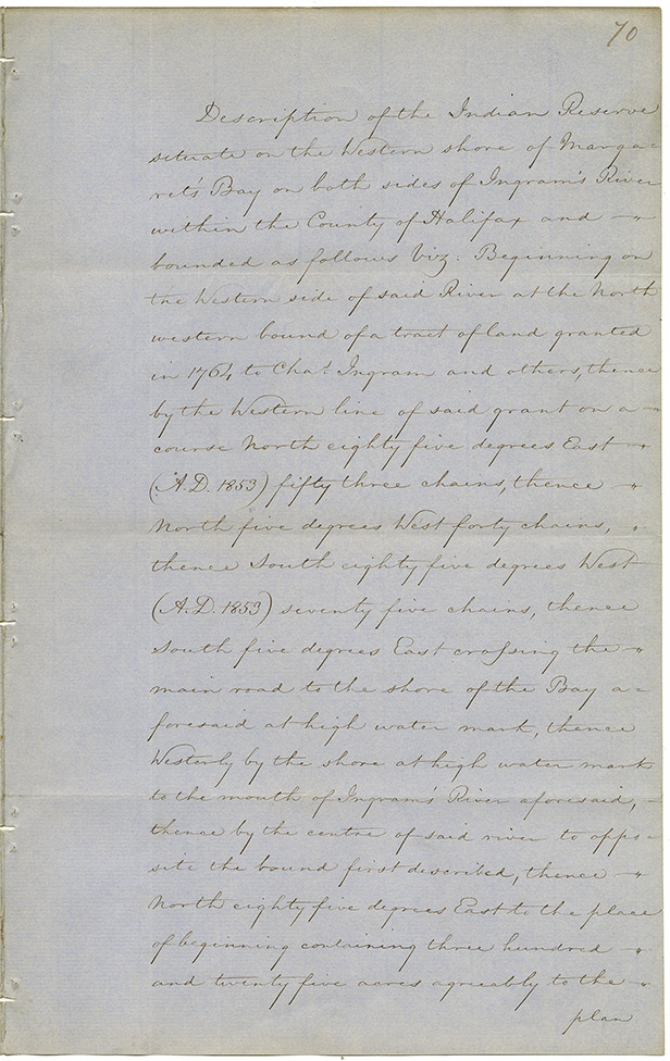
Description of the Indian Reserve
situate on the Western shore of
Margaret's Bay on both sides of Ingram's River
within the County of Halifax and
bounded as follows [viz:] Beginning on
the Western side of said River at the North
western bound of a tract of land granted
in 1764 to Chas. Ingram and others, thence
by the Western line of said grant on a
course North eighty five degrees East
(A.D. 1853) fifty three chains, thence
North five degrees West forty chains
thence South eighty five degrees West
(A.D. 1853) seventy five chains, thence
South five degrees East crossing the
main road to the other shore of the Bay
aforesaid at high water mark, thence
Westerly by the shore at high water mark
to the mouth of Ingram's River aforesaid,
thence by the centre of said River to opposite
the bound first described, thence
North eighty five degrees East to the place
of beginning containing three hundred
and twenty five acres agreeably to the
plan

Date: 1853
Retrieval no.: Commissioner of Public Records — Mi'kmaq and Government Relations series Nova Scotia Archives RG 1 volume 431 number 70