Nova Scotia Archives
The Port Royal Habitation
"Port Royal"
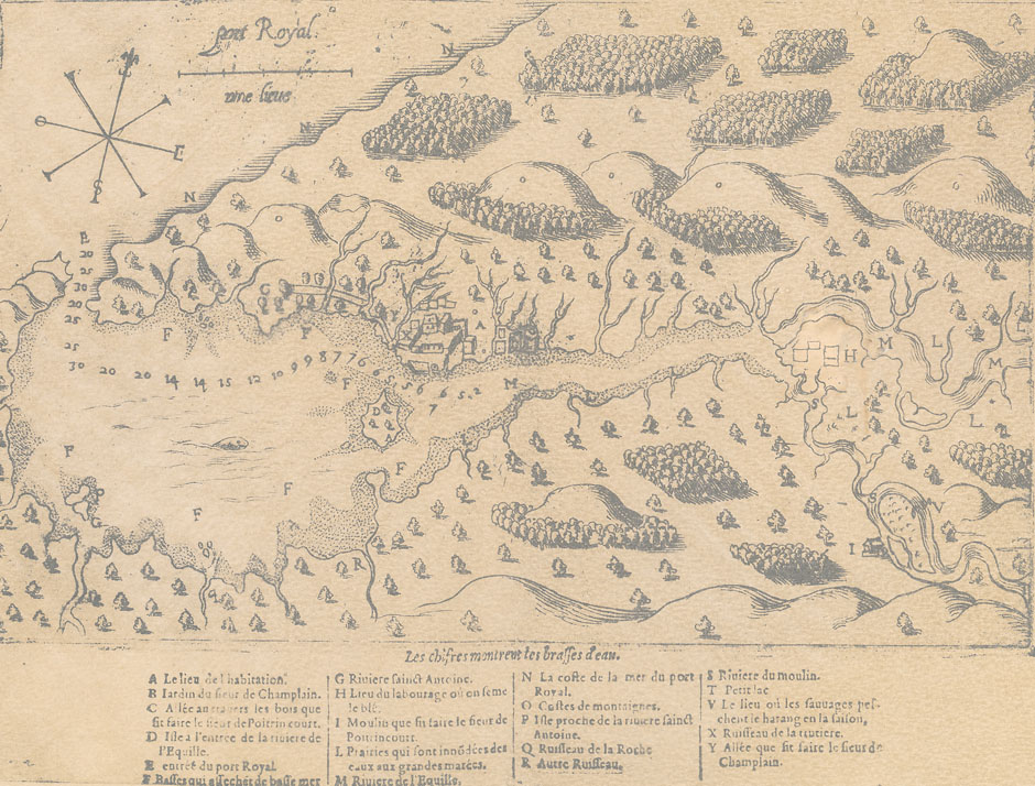
| Legend to Champlain's Map of Port Royal | |||
| A site of the Settlement | G St. Anthony River [now Bear River] | N the seacoast of Port Royal | S River of the Mill [now Allen's River] |
| B the Sieur de Champlain's Garden | H cultivated field where grain was sown [Annapolis Royal now stands here] | O slopes of mountains [North Mountain] | T a small lake |
| C path through the woods which the Sieur de Poutrincourt has made | I mill which the Sieur de Poutrincourt has built | P island near St Anthony River [now Bear Island] | V the place where the Indians catch herring in the season |
| D island at the mouth of the River Equille [now Goat Island] | L fields which are covered by water at spring tides | Q Rocky Brook [now Deep Brook] | X Brook of the Troutery [now Dixon's Brook] |
| E entrance to Port Royal | M Equille River [now Annapolis River] | R another brook [Moose River] | Y the path which the Sieur de Champlain had made |
| F shoals which become dry at low tide |
|||
Photostatic copy of map which was originally published in Les voyages du Sieur de Champlain (1613)
Reference: Nova Scotia Archives Map Collection: F/239-1609 - Annapolis Royal

