Nova Scotia Archives
The Eassons and the Hoyts
Two Hundred Years of Family and Community Life in Nova Scotia
Because 'The Eassons and the Hoyts' consists almost entirely of digitized textual records, the small virtual exhibit presented here features over thirty engravings, aquatints, photographs and maps, in order to provide a visual sense of the homes and communities in which these families lived. Several miscellaneous documents gleaned from other archival material held at Nova Scotia Archives and elsewhere are also included, to provide additional background information.
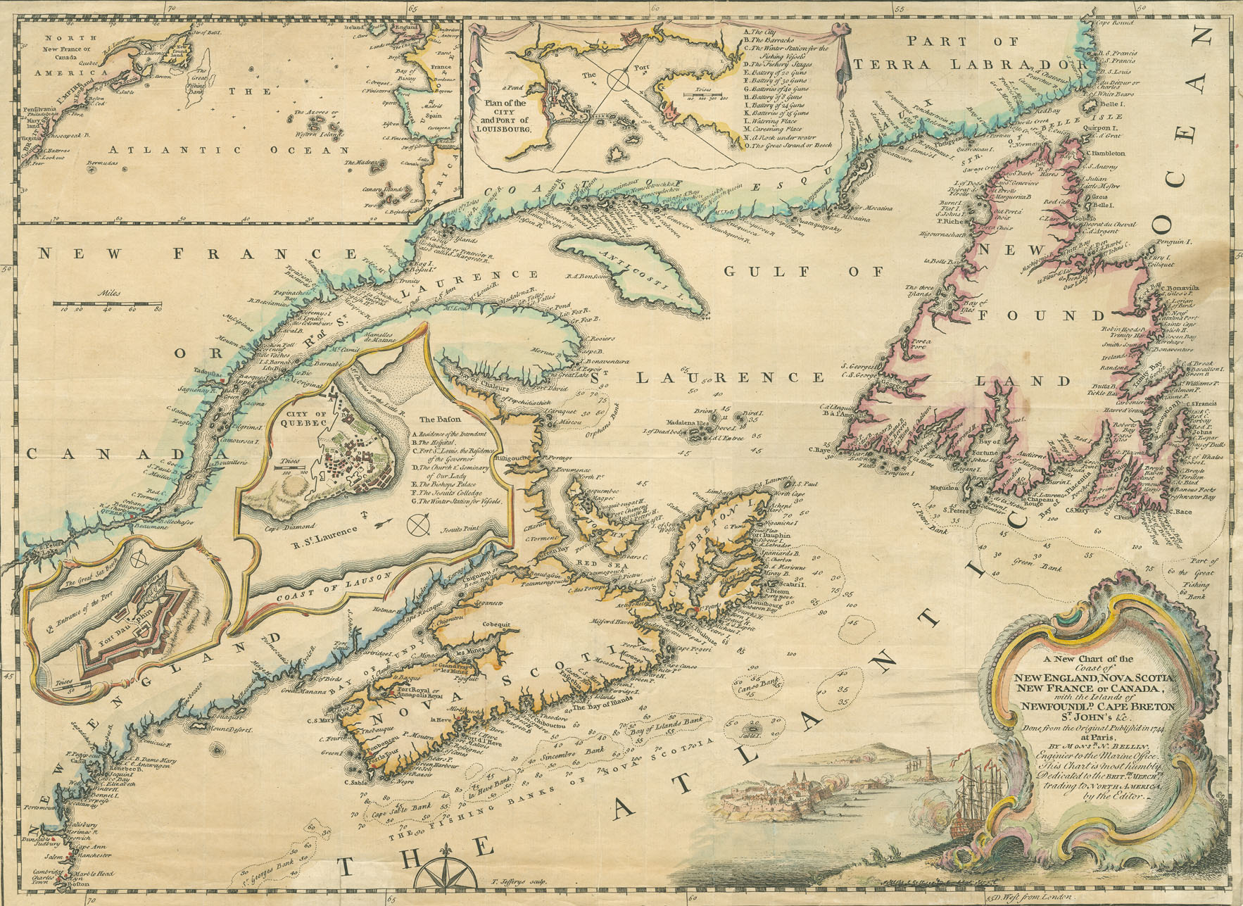
"A New Chart of the Coast of New England, Nova Scotia, New France or Canada"
Date: 1745
Artist: N. Bellin
Reference: Nova Scotia Archives Map Collection: 200-1745: loc.3.5.2
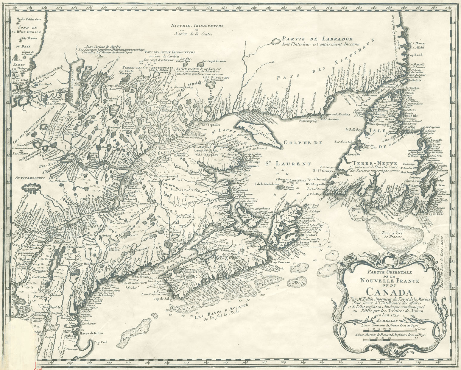
"Partie Orientale de la Nouvelle France ou du Canada"
Date: 1755
Artist: N. Bellin
Reference: Nova Scotia Archives Map Collection: 200-1755: loc.3.5.2
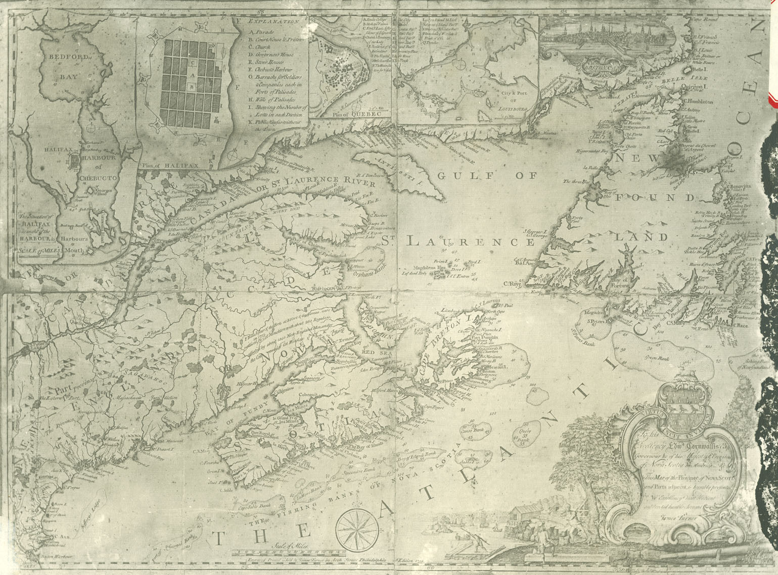
"Map of the Province of Nova Scotia and Parts adjacent"
Date: 1759
Artist: James Turner
Reference: Nova Scotia Archives Map Collection: 200-1759: loc.3.5.6
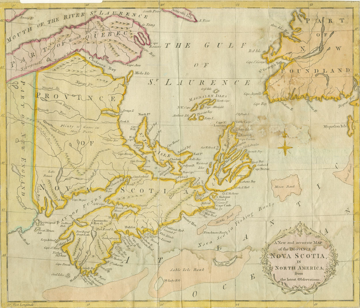
"A New and accurate Map of the Province of Nova Scotia in North America from the latest Observations"
Date: 1783
Reference: Nova Scotia Archives Map Collection: 200-1783: loc.3.5.7
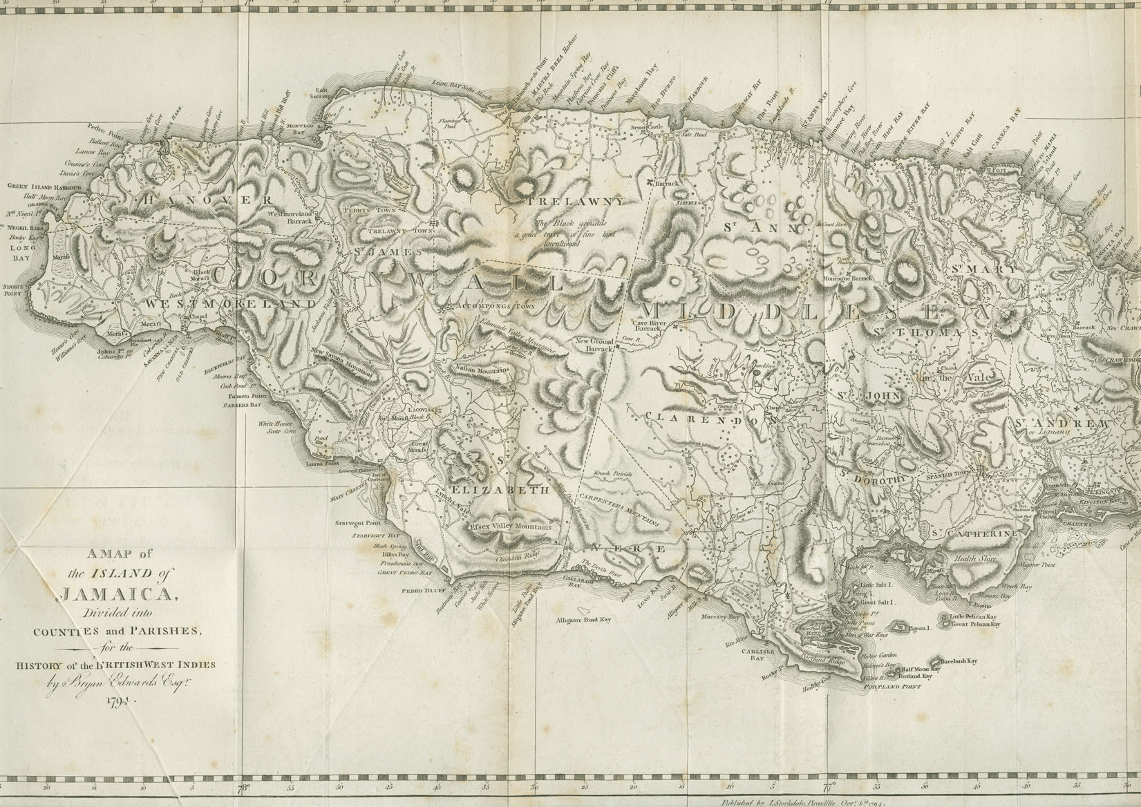
"A Map of the Island of Jamaica"
Date: 1794
Artist: Bryan Edwards
Reference: Nova Scotia Archives Library: AK/ F210/ Ed9 vol. 1