Nova Scotia Archives
Woolford's Surveys: The Roads from Halifax to Windsor and Truro, 1817-18
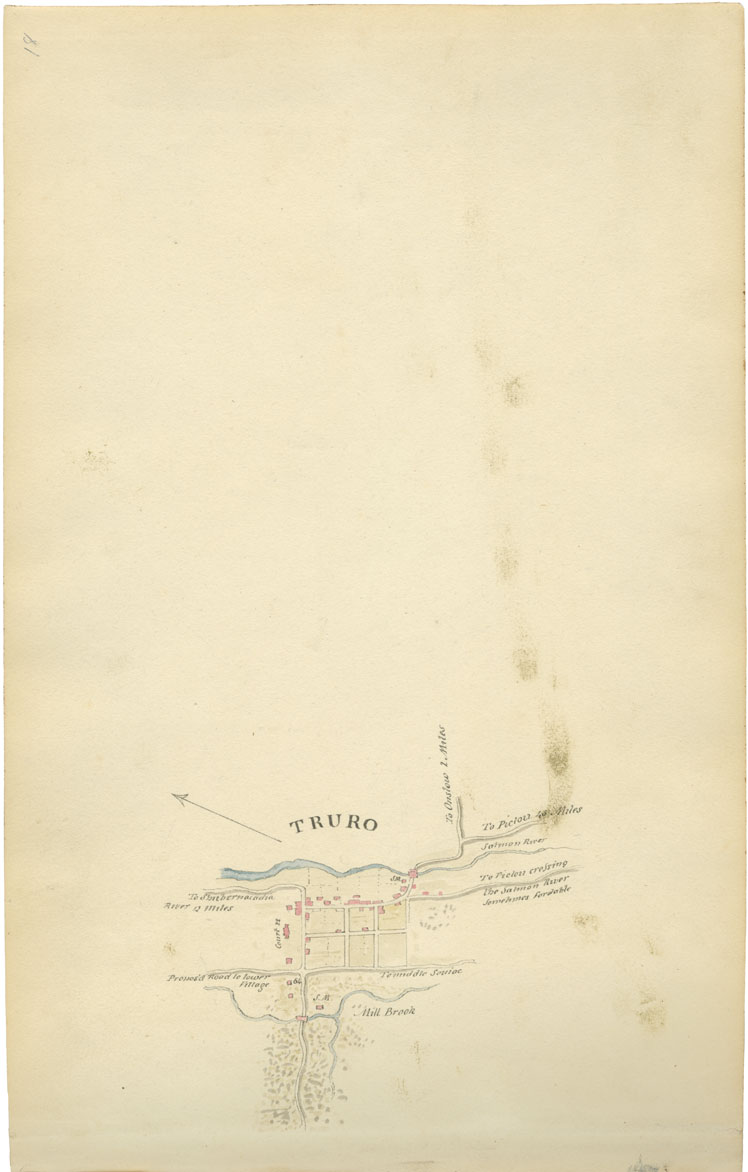
Sheet 18: Mile 64: Truro
Woolford identifies the "Propos'd Road to Lower Village," Mill Brook, "S.M.," "To Middle Souiac" [Stewiacke], to Shubenacadie River (12 miles), the Court House, various unidentified Truro buildings, another "S.M.," "To Pictou crossing the Salmon River sometimes fordable", to Pictou (45 miles), and to Onslow (2 miles). Lord Dalhousie returned from Truro to Halifax in September 1817. His journal notes, "At a mile from the Truro Court House we struck to the left as if into woods. Then we had 8 miles of new, well shaped but soft road, the hanging woods its only beauty - no settler on it - the cause I found was, that the whole township of Truro was in one grant to certain trustees for the general benefit. These trustees are now dead; their individual heirs and successors filling their place, are now all quarrelling, maintaining a right to grant the lands to themselves in lots as original settlers, & thus disputed the country lays a wild but beautiful wilderness."
Date: 1817-18
Draughtsman: John Elliott Woolford
Reference: Nova Scotia Archives Map Collection: 15.1

