Nova Scotia Archives
Search
Results 733 to 780 of 1158 from your search: dartmouth
Note: if what you see below isn't quite what you're looking for, or if you're looking for results from different areas of our website, try our Additional Search Tools or Google
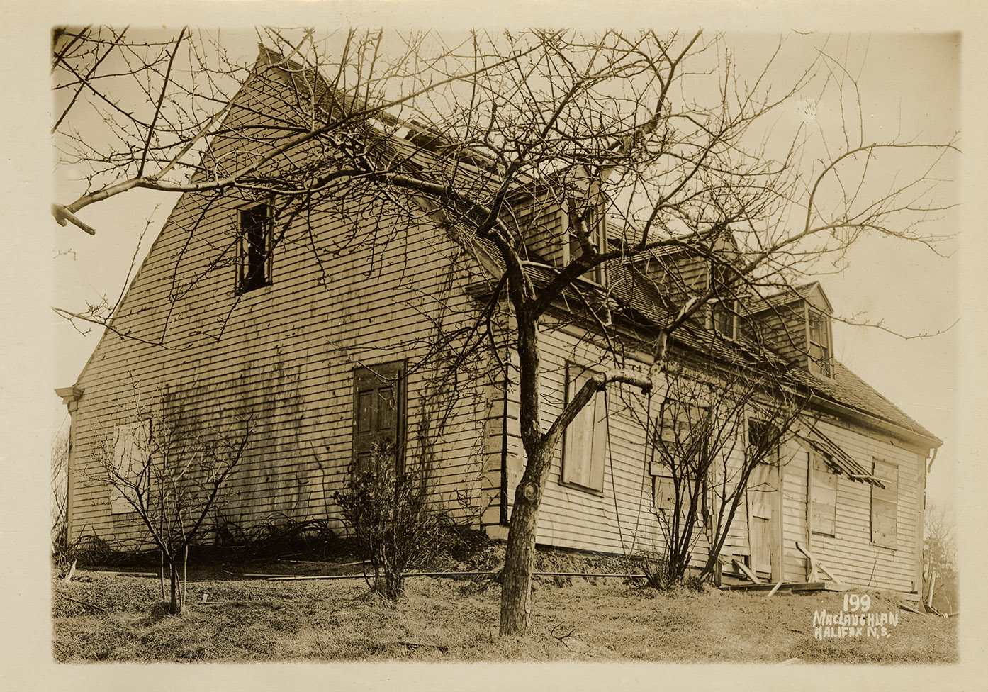
6 Jamieson Street, Dartmouth, MacLaughlan album 2 number 199
maclaughlan : 201726103
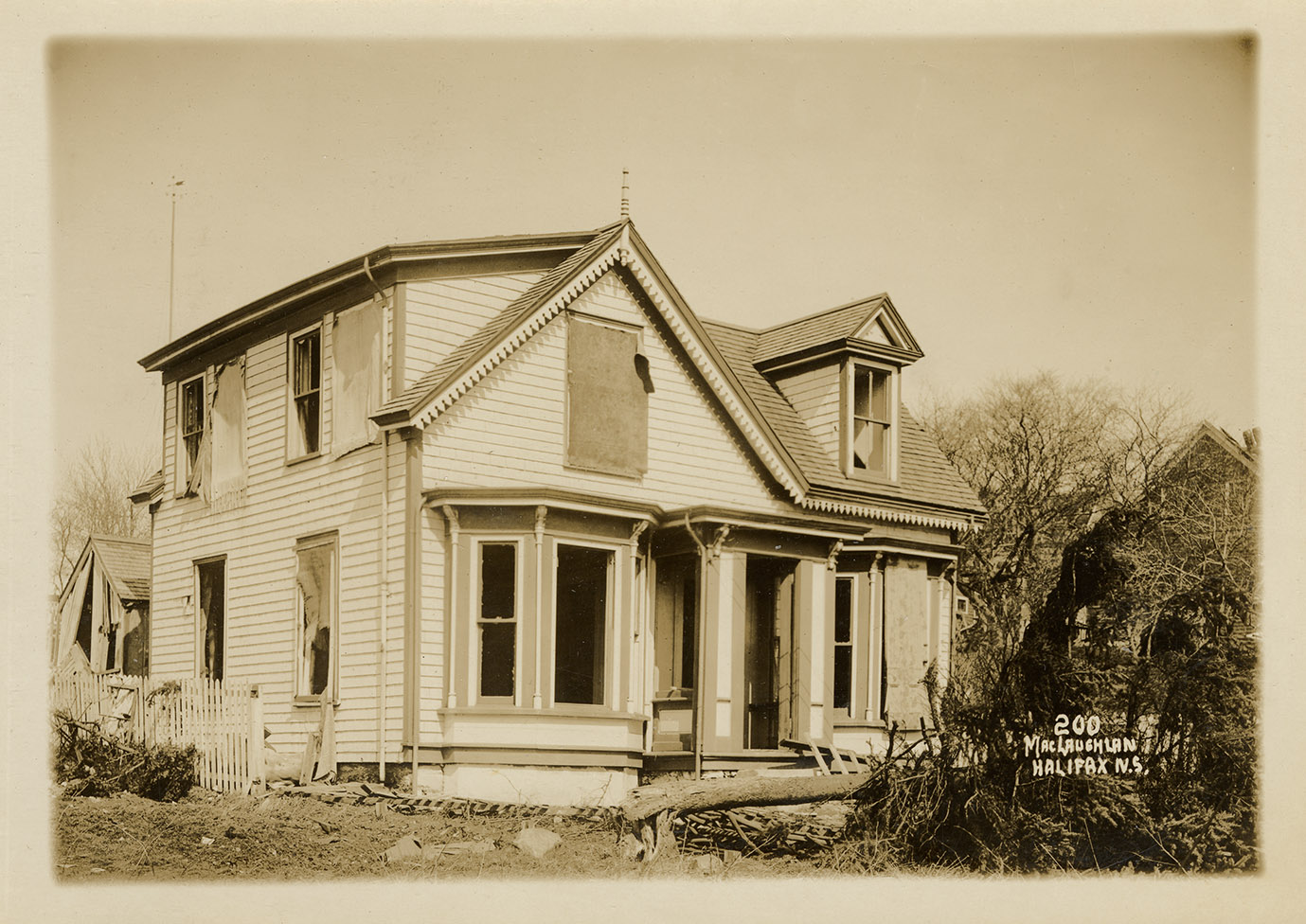
11 Jamieson Street, Dartmouth, MacLaughlan album 2 number 200
maclaughlan : 201726104
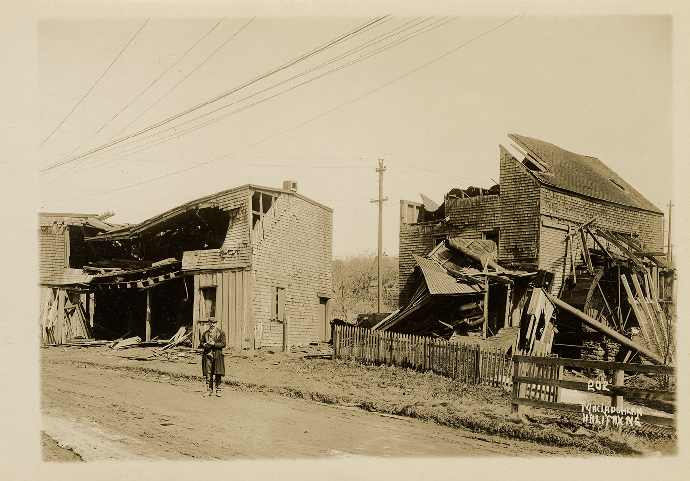
180-182 Windmill Road, Dartmouth, MacLaughlan album 2 number 202
maclaughlan : 201726105
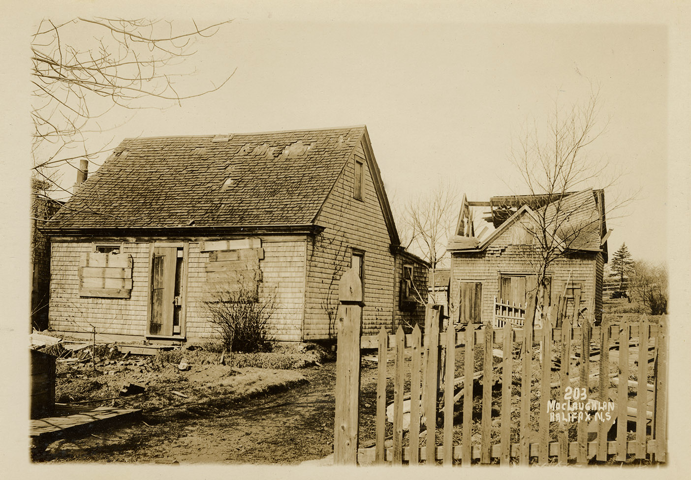
43 Jamieson Street, Dartmouth, MacLaughlan album 2 number 203
maclaughlan : 201726106
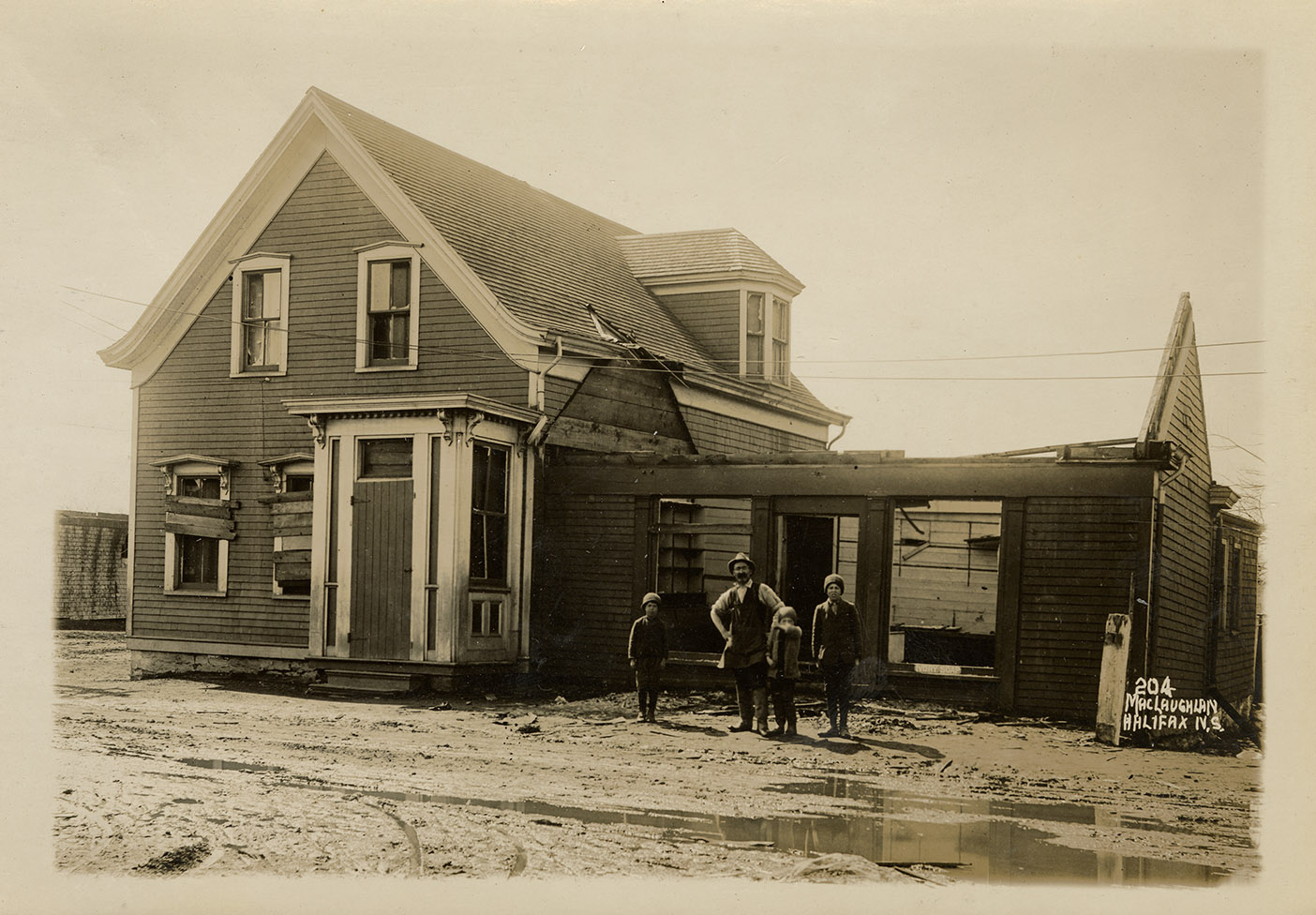
Corner of Wyse Road and Pelzant Street, Dartmouth, MacLaughlan album 2 number 204
maclaughlan : 201726107
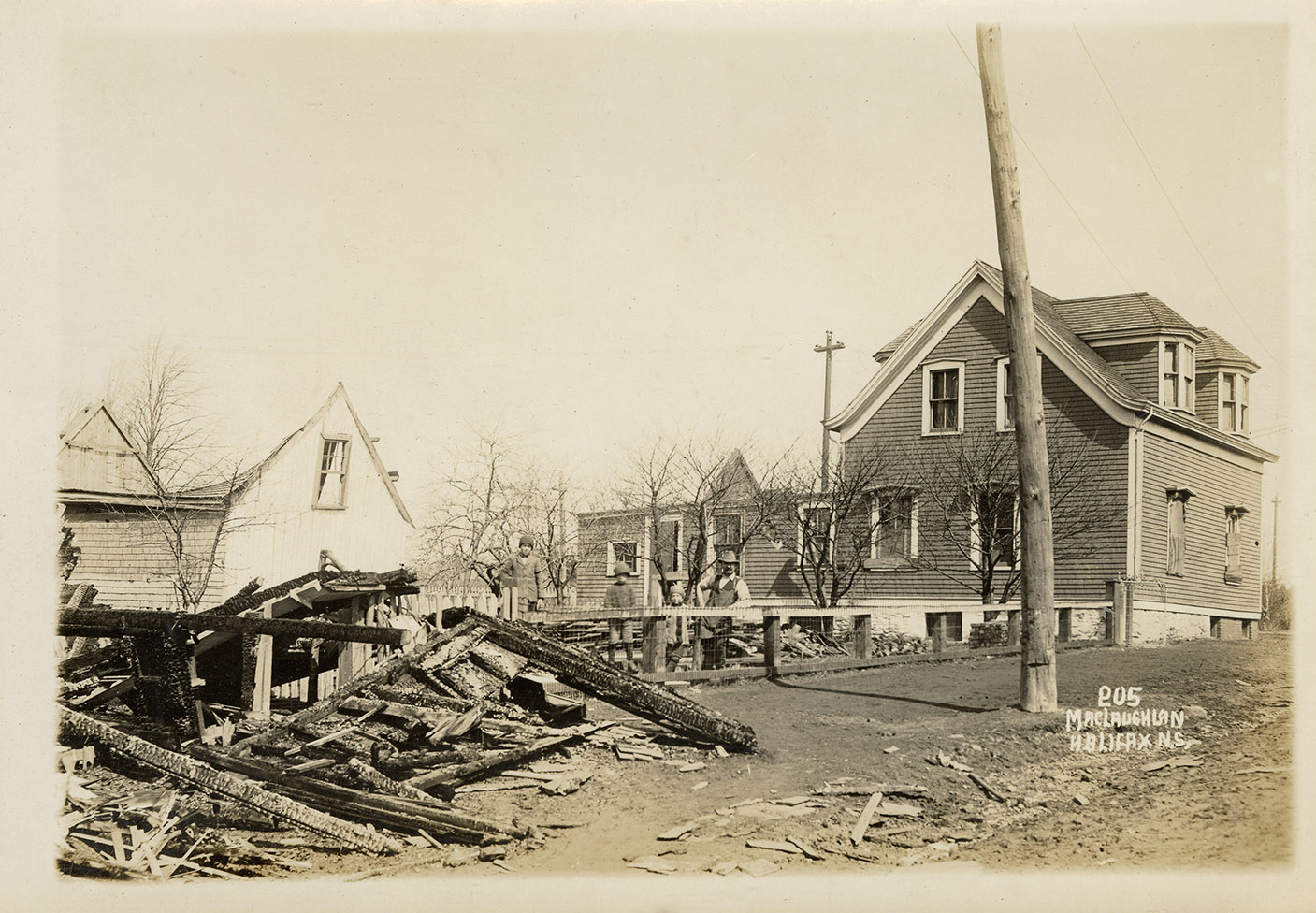
Pelzant Street, Dartmouth, MacLaughlan album 2 number 205
maclaughlan : 201726108
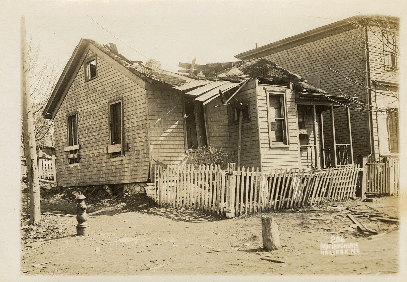
22 John Street, Dartmouth, MacLaughlan album 2 number 206
maclaughlan : 201726109
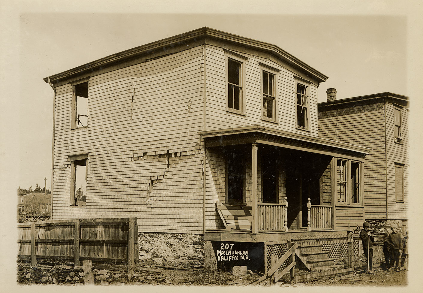
15 Pelzant Street, Dartmouth, MacLaughlan album 2 number 207
maclaughlan : 201726110
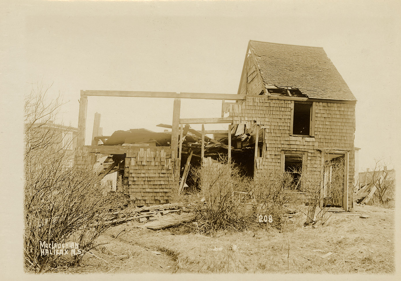
160 Windmill Road, Dartmouth, MacLaughlan album 2 number 208
maclaughlan : 201726111
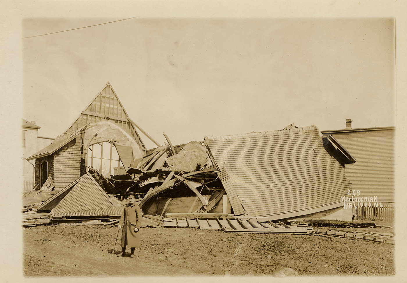
152 Windmill Road, Dartmouth, MacLaughlan album 2 number 209
maclaughlan : 201726112
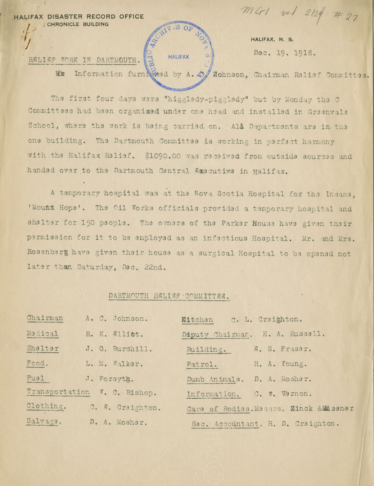
Report: Relief work in Dartmouth
macmechan : 201761226
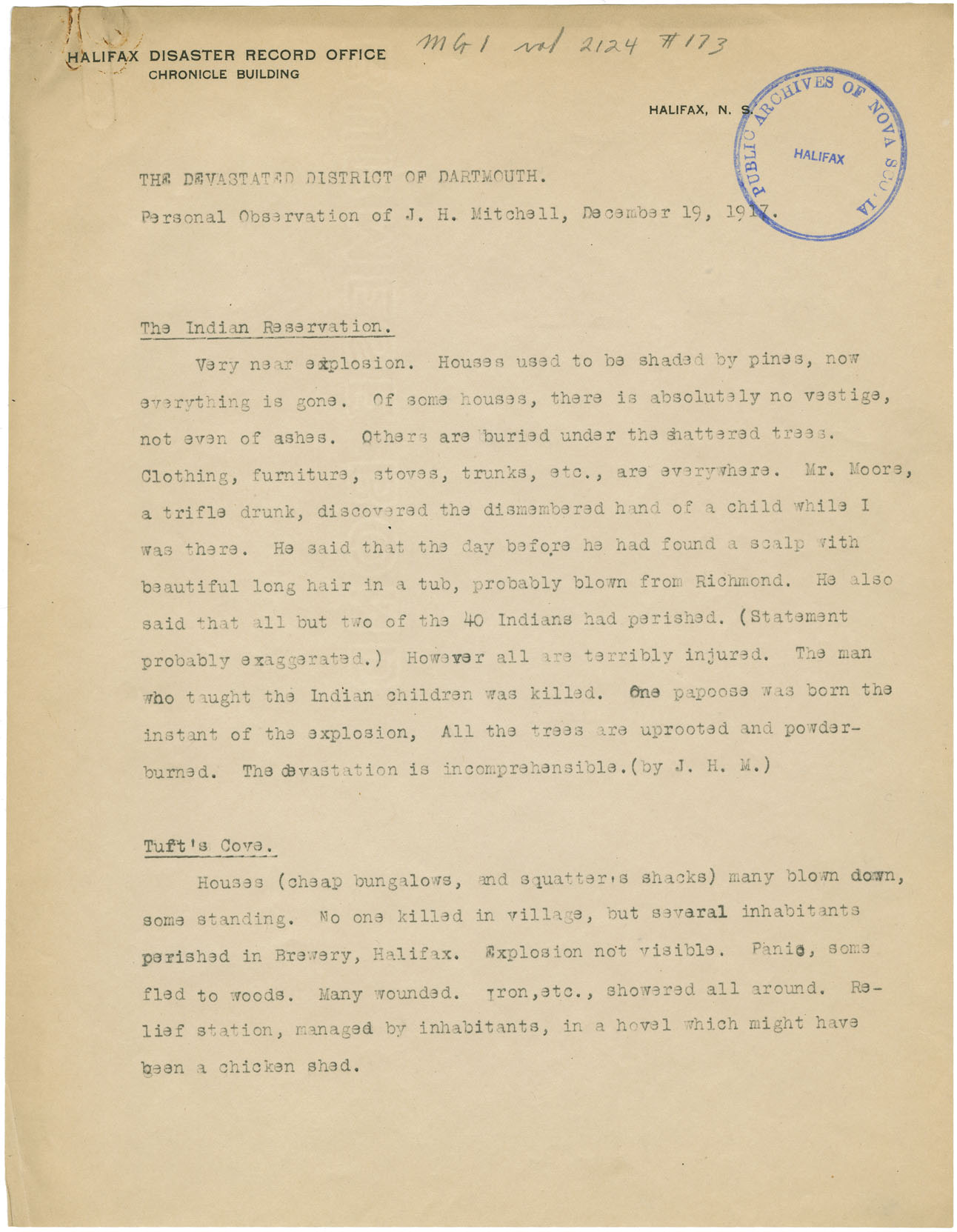
Personal narrative - J.H. Mitchell
macmechan : 201761824
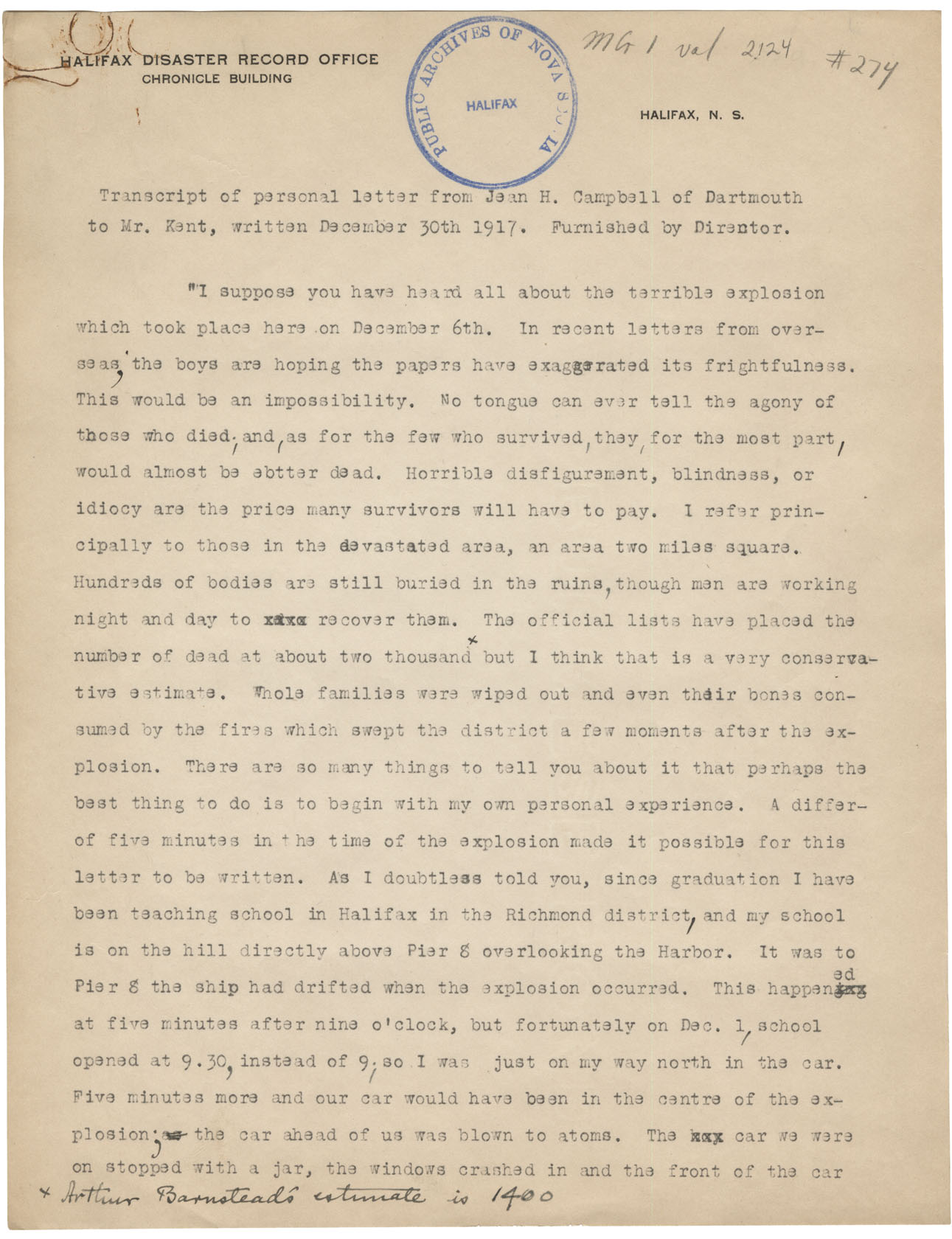
Letter from Jean H. Campbell of Dartmouth to Mr. Kent
macmechan : 201807878
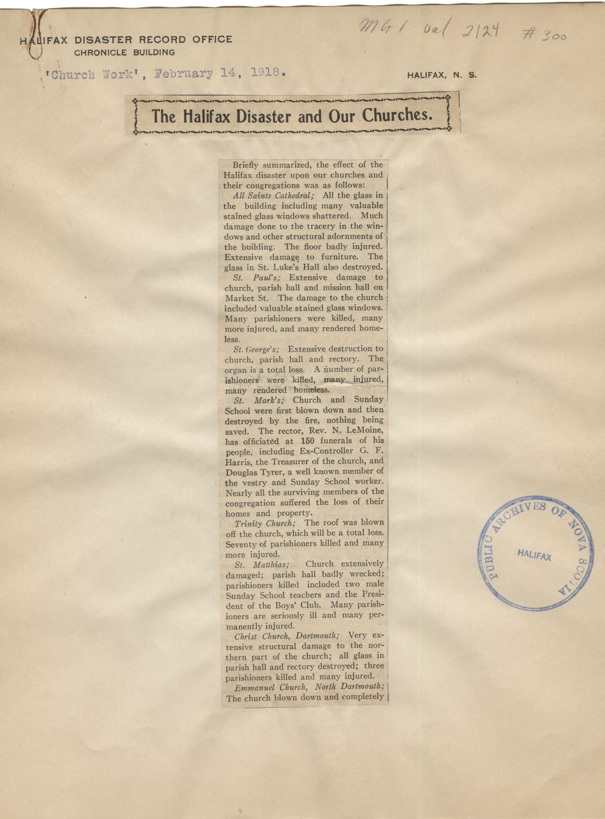
The Halifax Disaster and Our Churches
macmechan : 201807955

Some impression of the Great Disaster which befell Halifax and Dartmouth on December 6
macmechan : 201807990

maps : 201402071

PANS Vert Mss File: Maps: Dartmouth Watering Place c. 1800 (2 maps)
maps : 202012304

Dartmouth: Navy Watering Place c.1800
maps : 202012306


Halifax County Dartmouth Lake & Dartmouth Cove, w.m.1808
maps : 202013013

Dartmouth, Property on Road from Dartmouth to Preston
maps : 202012307
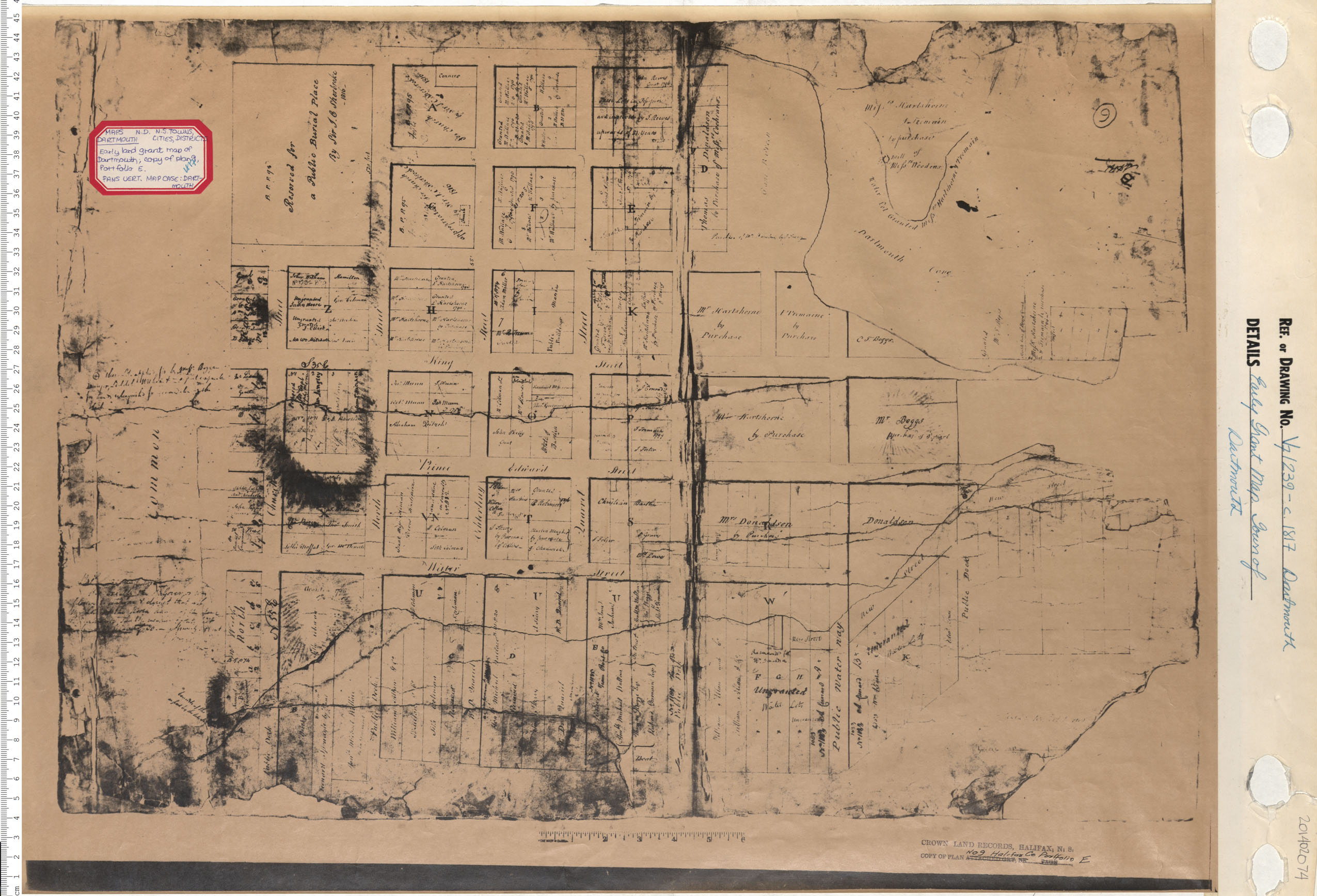
Early Grant Map. Town of Dartmouth
maps : 201402074

maps : 202012310

Plan of the Improvement of Dartmouth Road by Bells Sand Pit
maps : 202012311


Early Grant Map. Town of Dartmouth
maps : 201402075

Plan, Town of Dartmouth Central Core-Land Grants
maps : 202012302

Plan of the Improvement of Dartmouth Road by Bells Sand Pit
maps : 202012316

maps : 201760573


Dartmouth, Property along the 1st Dartmouth Lake
maps : 202012319

Survey of Ferry-House Lot belonging to J.P. Mott Esq.
maps : 201402076


Plan of Part of the Estate the Late Lawrence Hartshorne…
maps : 201402077


Halifax & Dartmouth City & Maritimes map
maps : 202012492


maps : 202012332
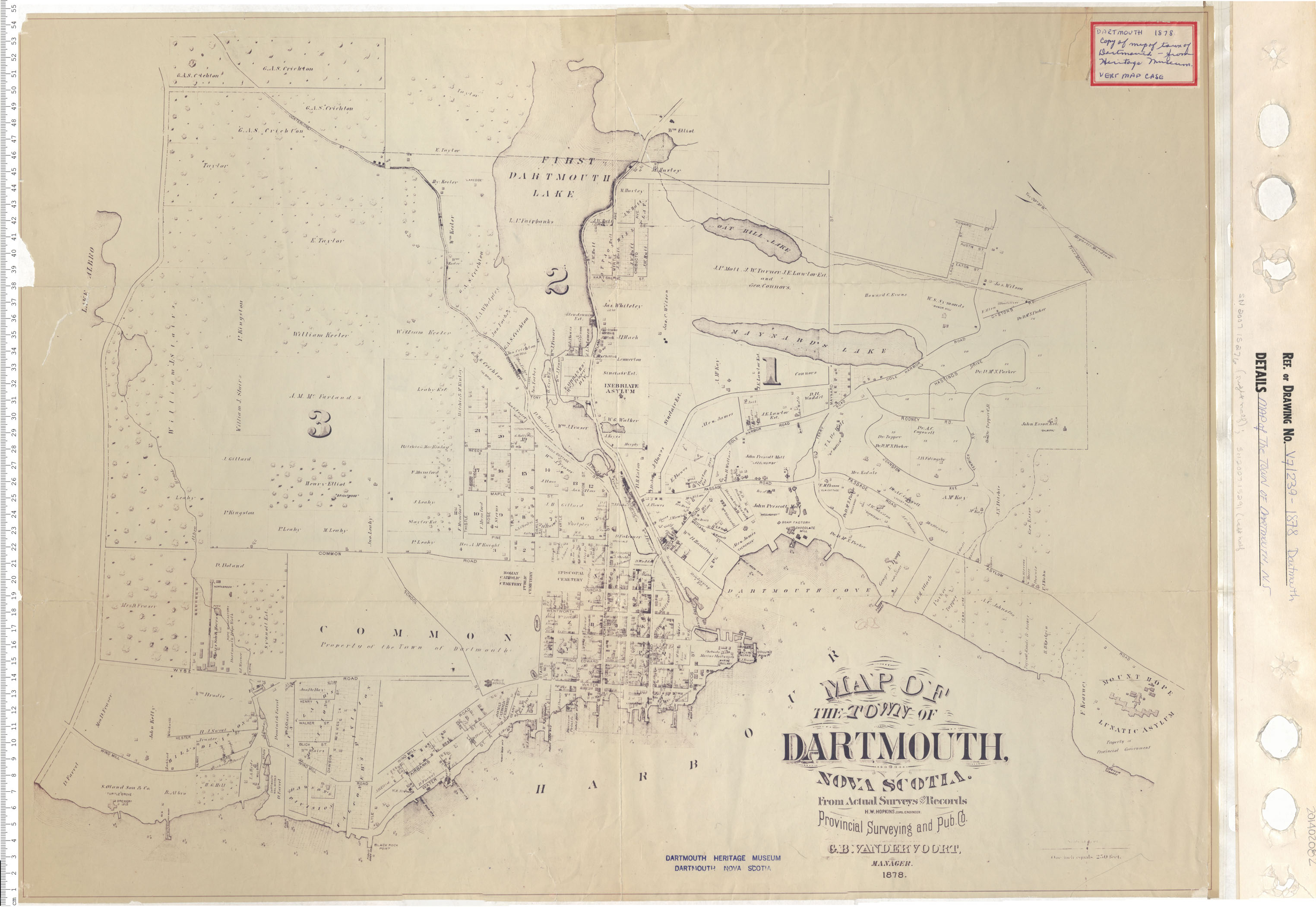
Map of the Town of Dartmouth, Nova Scotia
maps : 201402082

maps : 201402079

Map of the Town of Dartmouth, Nova Scotia
maps : 201402080

PANS Vert Mss File: Maps: Dartmouth: Admiralty Property, c.1880
maps : 202012331

Map of halifax and Dartmouth 1887
maps : 202012412

Plan of Cottage Hill Dartmouth
maps : 202012297

Plan of Cottage Hill Dartmouth
maps : 202012298
Additional Search Tools
Need more results? The Search box in the top right corner looks for digitized content only and does not full-text search our website.
- To search our Nova Scotia Births, Marriages, and Deaths click the Nova Scotia Genealogy button below.
- To search descriptions in the archival holdings catalogue, click the Archival Holdings button below.
- To search items in the library holdings catalogue, click the Library Holdings button below.
- To Google search all our websites click the Google button below
Images Nova Scotia Genealogy Archival Holdings Library Holdings Google Site Search