Nova Scotia Archives
Search
Results 1585 to 1632 of 2049 from your search: map
Note: if what you see below isn't quite what you're looking for, or if you're looking for results from different areas of our website, try our Additional Search Tools or Google
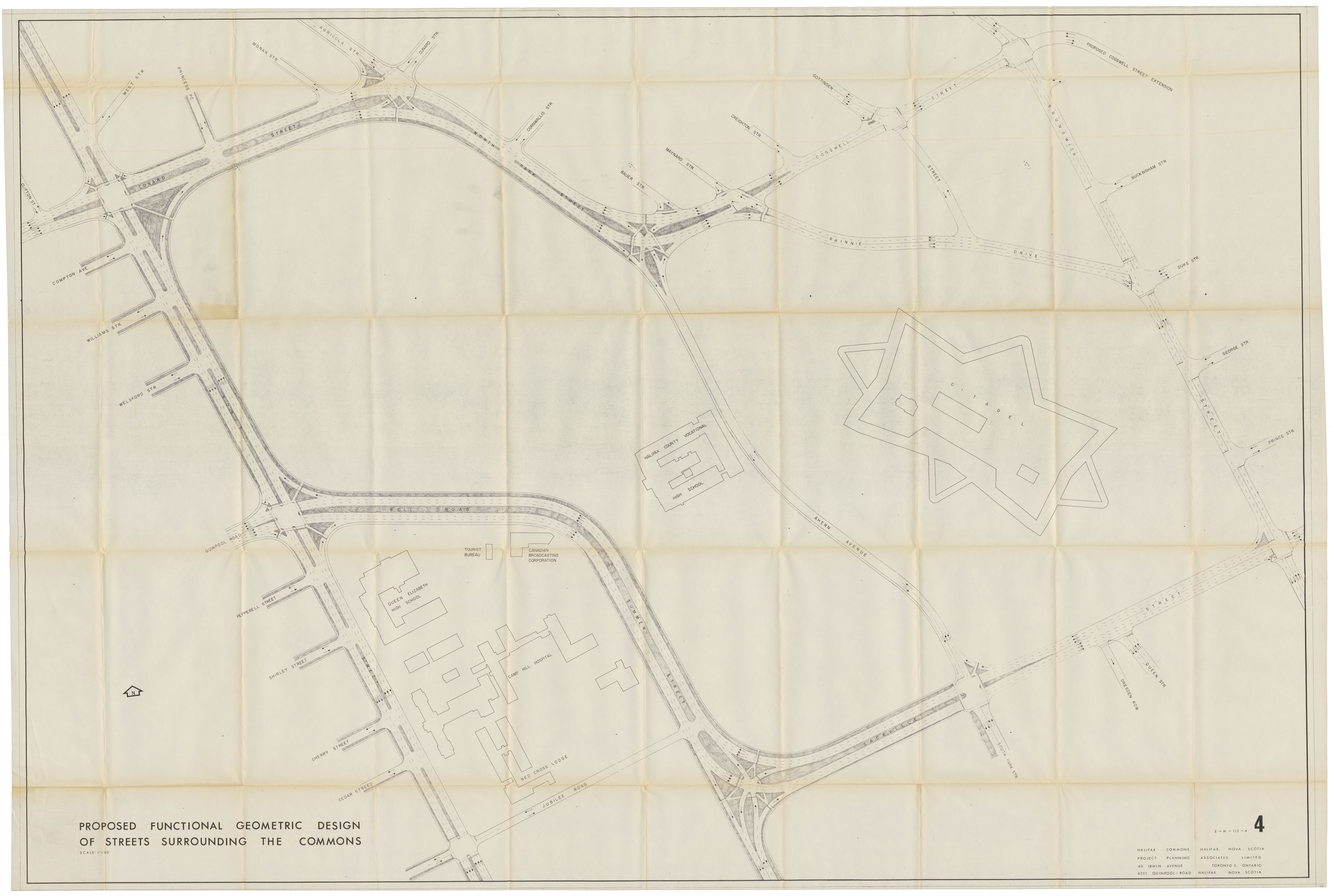
Proposed Functional Geometric Design of Streets Surrounding Commons
maps : 202013825

Sable Island Maps 1767 to 1959
maps : 202015045

maps : 201320576
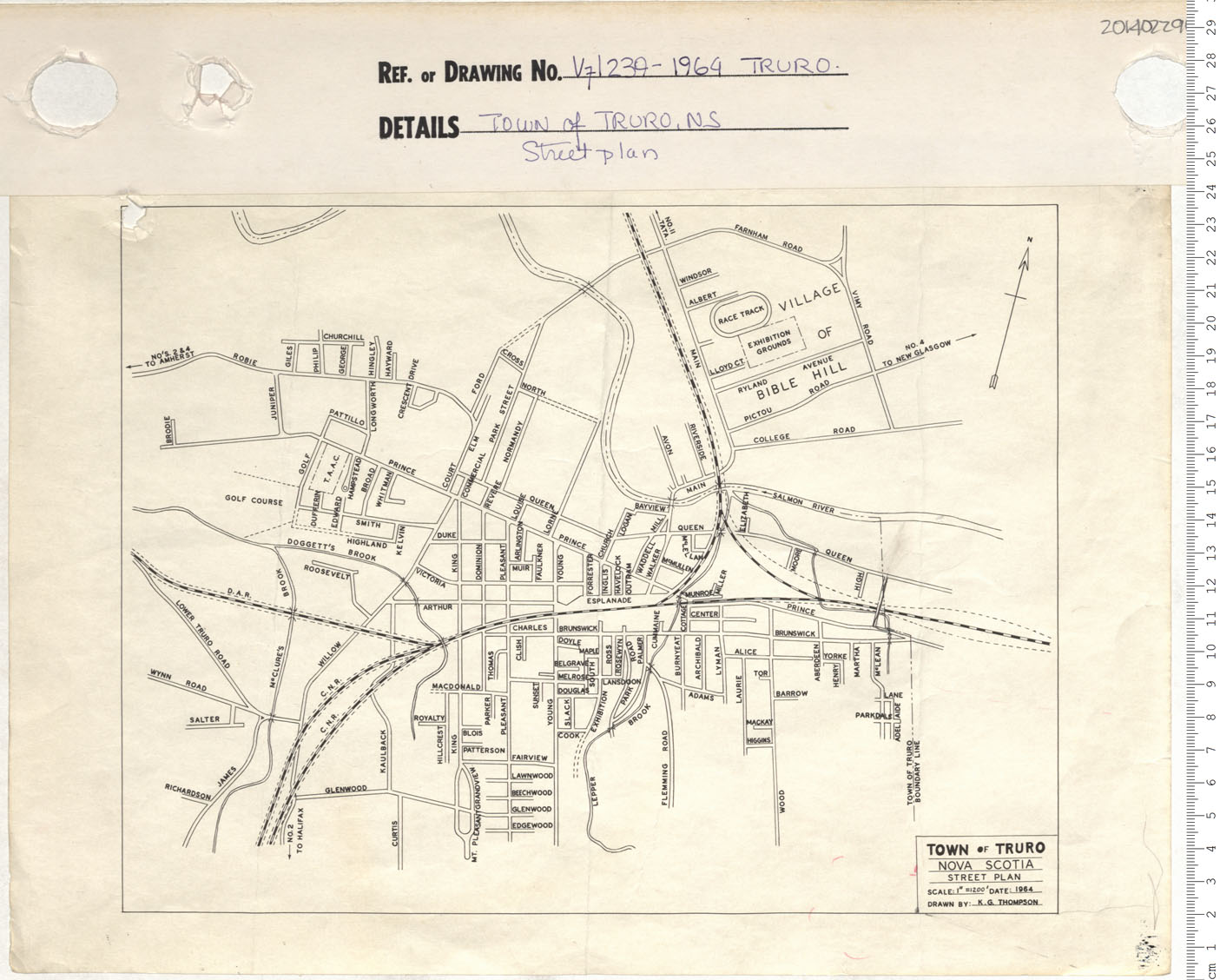
Town of Truro, N.S. Street plan
maps : 201402296


maps : 201520145

maps : 202012346


maps : 202012936

Plan of Town of Wolfville, Lands not Assessed
maps : 202012937

maps : 202013826

Visitors Street map of Halifax
maps : 202013831

Sight-seeing in Halifax, N.S., Canada
maps : 202013833

Belmont Property, North West Arm 28 Sept 1964
maps : 202013835

maps : 201402090


Metropolitan Map and Street Guide Halifax and Dartmouth N.S., Canada
maps : 202012473

Town of Kentville Redden Sub-division Kentville, N.S.
maps : 202012538

Town of Kentville Plot Plan-D.J.Waterbury Property Academy Street
maps : 202012540

Town of Kentville Property Survey: Hiawatha Lodge No 57
maps : 202012541

Town of Kentville Property Survey-MacDonald Ave
maps : 202012545


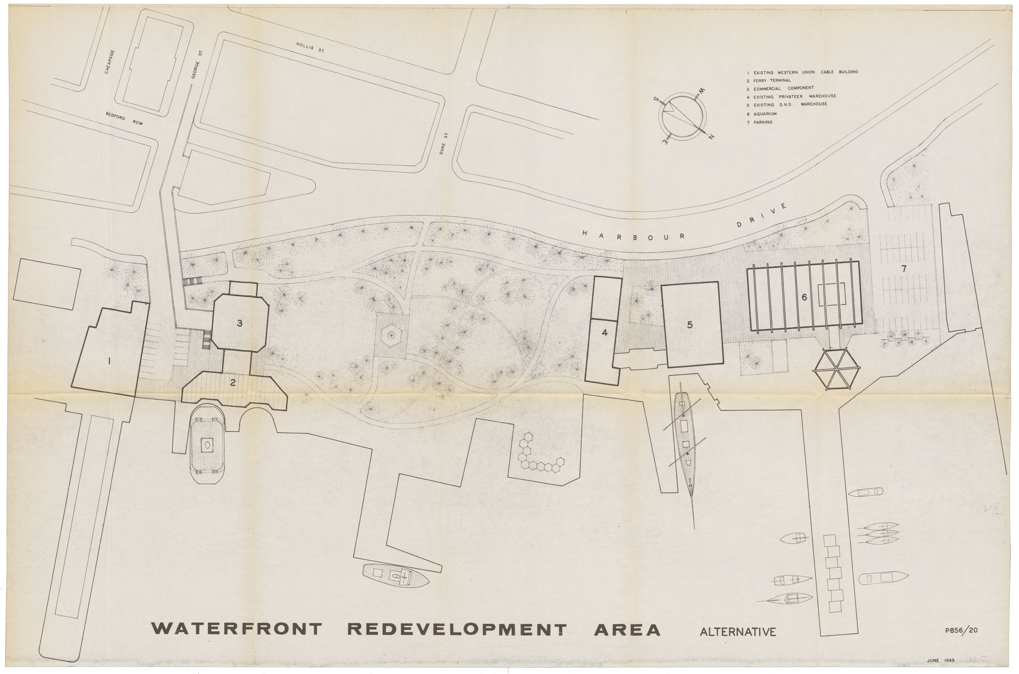
Proposed: Waterfront Redevelopment Aerial View June 1965
maps : 202013836


Proposed Development of Strawberry Hill Area City of Halifax
maps : 202013839

maps : 201520107

Nova Scotia Highway map 1966-67
maps : 201520260

Plan of Lands situated in the Vicinity of Granton, Pictou County
maps : 202012371

Town of Kentville Plot Plan Lot 105 & 106 Parkside
maps : 202012547

Kaye & Isleville St. Highfield
maps : 202013840

Plan showing Land owned by Raymond L. Kaizer Ltd. Halifax, N.S.
maps : 202013841

Resubdivision of Lots B, C & D MacLean St
maps : 202013842


New Brunswick Nova Scotia prince Edward Island also Newfoundland
maps : 201520109

Electoral map of the Province of Nova Scotia
maps : 201520258

Photography Map Off-shore project, NS
maps : 201520264

Nova Scotia Canadas Ocean Playground Highway Map 1967/68
maps : 201520265

Plan of Pictou County Showing position of Mining Rights 2
maps : 202012079

Town of Kentville Plan-Valley Stationers Property
maps : 202012548


Provincial Electoral Boundaries 1967 City of Dartmouth
maps : 202013019

Provincial Electoral Boundaries-1967 City of Halifax
maps : 202013843

maps : 202013844

Temporary Roadway-Trade Mart at Barrington St & Proctor St
maps : 202013847

Additional Search Tools
Need more results? The Search box in the top right corner looks for digitized content only and does not full-text search our website.
- To search our Nova Scotia Births, Marriages, and Deaths click the Nova Scotia Genealogy button below.
- To search descriptions in the archival holdings catalogue, click the Archival Holdings button below.
- To search items in the library holdings catalogue, click the Library Holdings button below.
- To Google search all our websites click the Google button below
Images Nova Scotia Genealogy Archival Holdings Library Holdings Google Site Search