Nova Scotia Archives

''The Great Map'' William Mackay, 1834

Walter Morrison's index map to "The Great Map", 1834, William Mackay. Above is a 1831 map of Nova Scotia (not 'The Great Map') with a simple overlay defining the bounds of earch of the flats of panels from "The Great Map". Zoom in on an area of interest and then locate the corresponding alpha-numeric code below. Click on the Code number to view the panels in detail.
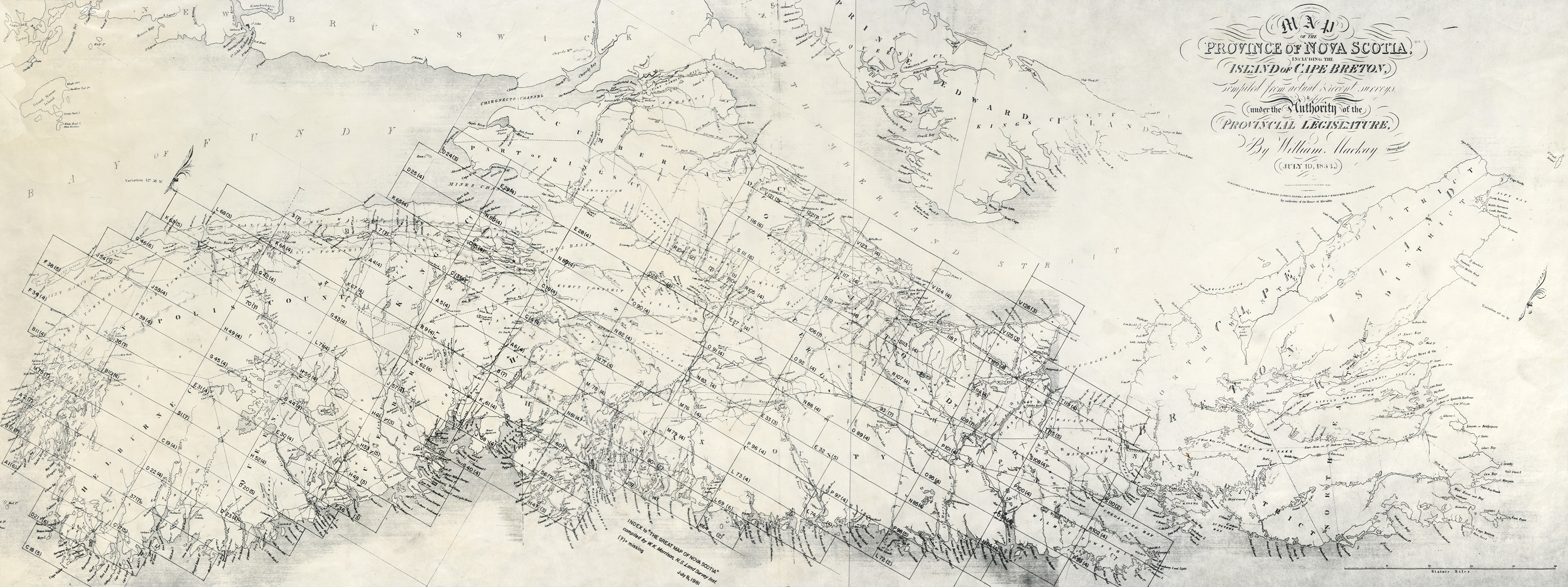
Code County
C 19 (4) Yarmouth, Shelburne, Queens
D 20 (5) Queens
D 23 (4) Shelburne, Queens
E 30 (4) Queens
E 31 (4) Yarmouth, Annapolis, Queens
F 36 (3) Queens
G 44 (4) Queens
G 45 (4) Annapolis, Queens
H 48 (5) Queens, Lunenburg
H 49 (4) Annapolis, Queens
H 50 (4) Queens
H 52 (4) Queens

previous Main Menu Full Index Map and All Counties


Nova Scotia Archives — https://archives.novascotia.ca/maps/greatmap/index/

Crown copyright © 2024, Province of Nova Scotia.