Nova Scotia Archives
African Nova Scotian Diaspora
Description of lands at Preston relinquished by individuals to accommodate Black settlers
note: transcription publicly contributed - please contact us with comments, errors or omisions
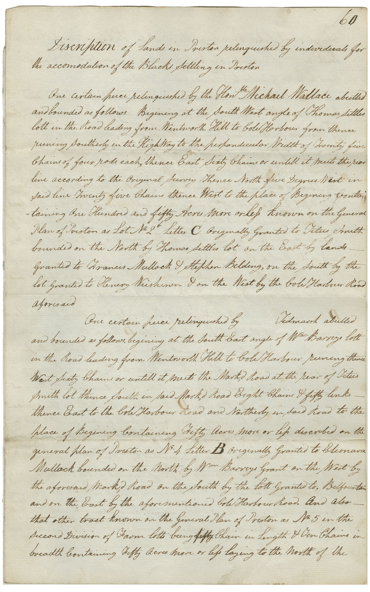
Description of lands in Preston relinquished by individuals for the accomodation of the Blacks settling in Preston
One certain piece relinquished by the Honourable Michael Wallace abetted and bounded as follows. Begining at the South West angle of the Thomas settles both in the Road leading from Wenthworth Hill to Cole Harbour from thence running southerly in the HighWay to the perpandicular width of twenty five chains of four rods each, thence East sixty Chains or untill it meets the rear line according to the original survey thence North five Degrees West in said line Twenty five Chains thence West to the place of Begining containing One Hundred and Fifty Acres more of les known on the General Plan of Preston as lot No. 2 Letter C Originally Granted to Titus Smith bounded on the North by Thomas Settle lot on the East by lands granted to Frances Mullock & Stephen Belding, on the South by the lot granted to Henery [last name] & on the West by the Cole Harbour Road afordsaid
One Certain piece relinquished by Tidmarsh abutted and bounds as follows begining at the South East angle of Wm Barrys lott in the Road leading from Wentworth hill to Cole Harbour running thence West sixty chains or untill it meets the Mark,d Road at the rear of Titus Smith lot thence South in said Mark,d Road eight chains & fifty links thence East to the Cole Harbour Road and Northerly in said Road to the place of begining containing Fifty acres more or less described on the general plan of Preston as No. 4 Letter B originally granted to [first name?] Mullock bounded on the North by Wm. Barry grant on the West by the aforsaid Mark,d Road on the South by the lott granted to, Belfountain and on the East by the aforementioned Cole Harbour Road. And also that other tract known on the General Plan of Preston as No 5 in the second Division of Farm lott being fifty length & ten chains in [illegible] containing Fifty acres more or less laying to the North of the
Reference: Commissioner of Public Records collection Nova Scotia Archives RG 1 volume 422 number 60

