Nova Scotia Archives
African Nova Scotian Diaspora
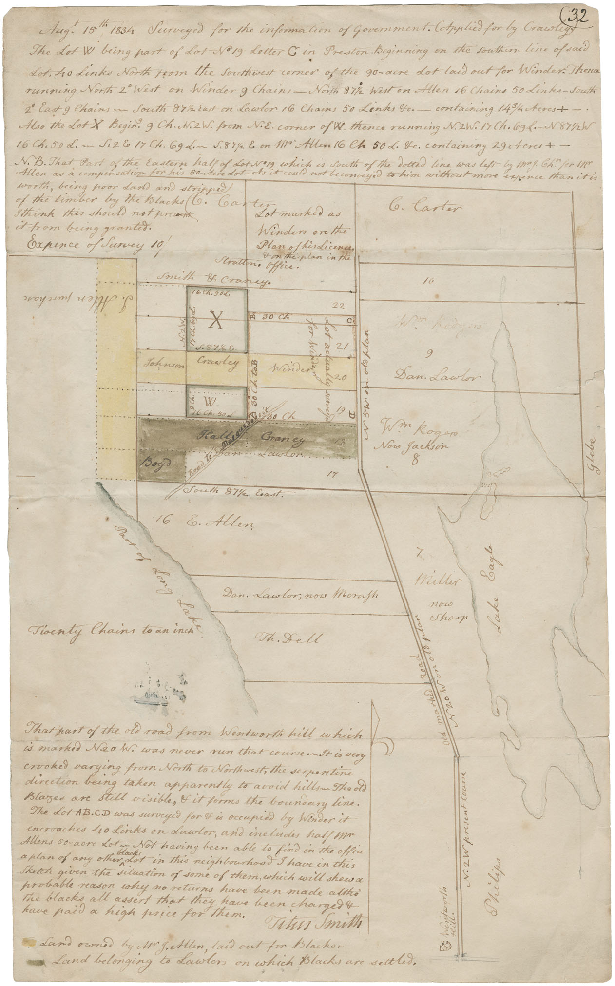
Mr. Titus Smith's plan of lots for Black people near Eagle Lake, Preston. Surveyed 15 August 1834
note: transcription publicly contributed - please contact us with comments, errors or omisions
(32
August 15th 1834 Surveyed for the information of Government. (Applied for by Crawley) The Lot W being part of Lot No. 19 Letter C in Preston. Beginning on the southern line of said Lot. 40 Links North from the Southwest corner of the 90-acre Lot laid out for Winder. Then a running North 2 (degree) West on Winder 9 Chains -- North 87 1/2 West on Allen 16 Chains 50 Links - South 2 (degree) East g Chains - South 871/2 East on Lawlor 16 Chains 50 Links Vc. - containing 14 3/4 Acres+-.
That part of the old road from Wentworth hill which is marker N. 20 W. was never run that course. It is very [crooked?] varying from North to Northwest, the serpentine direction being taken apparently to avoid hills. The old Blazes are still visible, if it forms the boundary line.
The Lot AB,C.D was surveyed for [of?] is occupied by Winder it encroaches 40 Links on [lawlers?], and includes half [mm?] Allens 50-acre lot. Not having been able to find in the office a plan of any other blocks lot in this neighborhood I have in this sketch given the situation of some of them, which will shew a probable reason why no returns have been made altho' the blacks all assert that they have been charged & have paid a high price for them.
- Titus Smith
Land owned by Mr. J, Atlen, laid out for Blacks.
Land belonging to [lawlers?] on which Blacks are settled.
Reference: Commissioner of Public Records collection Nova Scotia Archives RG 1 volume 419 number 32

