Council of Nova Scotia Archives
Halifax Municipal Archives
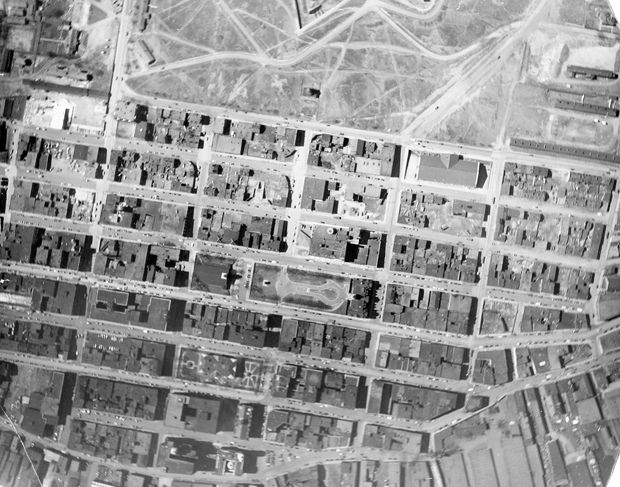
Grand Parade
This is the earliest image in this album and one of the few vertical aerials, meaning it was taken straight down from a camera mounted on the airplane. Centred on the Grand Parade, it shows the area from the Citadel, to Water St., Blowers St., to Jacob St., including the building that housed the Market and Police Station, barracks on the flanks of the Citadel, City Hall, Province House, Royal Artillery Park, and the entire area that was razed to construct Scotia Square. This image mimics the very first aerial photograph in Canada that was taken over the Halifax Citadel in 1883. Captain Henry Elsdale of the Royal Engineers sent up a camera attached to a small balloon. The original aerial photograph is held at Library and Archives Canada (PA 172326).
Topic: Halifax
Date: [ca. 1940]
Reference: City of Halifax Engineering and Works photographs Halifax Municipal Archives 102-39-1-436
For further information, please contact the Halifax Municipal Archives.


