Council of Nova Scotia Archives
Halifax Municipal Archives
Flying to the Past: Selected Historical Aerial Photographs from Halifax Municipal Archives
Examining aerial photos from the past is a fascinating way to see how our land and our cities have changed. Compare these images with the streets you walk today to gain a sense of the often very different path that previous generations walked.
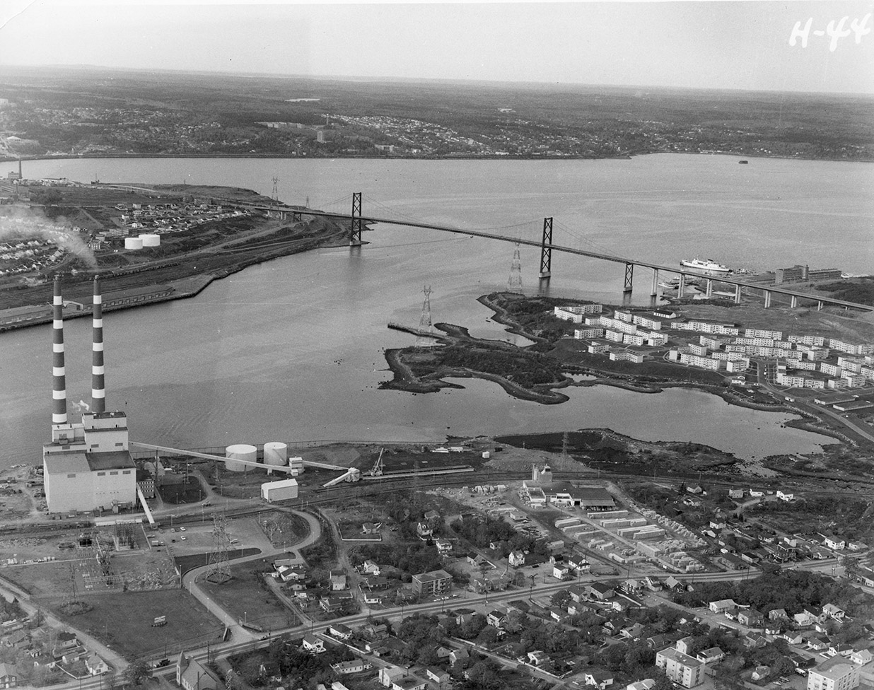
The images in this album are mostly low-level oblique aerial photographs, which mean they were taken on an angle from an aircraft flying below 2,000 feet. This produces a detailed, almost three dimensional record of what our region’s lands, waters, buildings and infrastructure looked like on the date of the flight. They differ from the aerial surveys that are done with mathematical precision to map out specific areas.
The Municipal Archives has many of these views because municipal planners used them to support the decisions they were making about how to develop certain areas, or to document the progress of construction projects. They would hire photographers to fly-over particular sites or regions and the resulting aerial photographs became part of the case-files they were working on (unfortunately not always with the exact date of the image).
These images were selected to offer a representation of the geography and time periods covered by the Archives’ collection and to document significant changes to our landscape such as the urban renewal of the 1960s when the Halifax and Dartmouth downtown changed drastically with the construction of the Cogswell Interchange, Scotia Square, new ferry terminals, Alderney Gate and the “New City Hall”. The creep of urban sprawl is evident in the images from Fairview, Dartmouth East and Bedford. Other images give a sense of the land prior to major developments such as the container terminals, sewage treatment plants, highways and business parks. Natural changes to our topography are seen in the images of Point Pleasant Park prior to Hurricane Juan; the shoreline of the Northwest Arm.
Find your neighbourhood, zoom in on your work-place, discover and reminisce about the changes to our region over the past 50 years. Fly to the past.
About Us:
At the Halifax Municipal Archives you will discover records in many formats (documents, maps, plans, photos, audio-visual recordings), from the 1790s to the present. The Archives is the official repository for the historical municipal records of the Halifax region, and also acquires the archival records of individuals, businesses and organizations active in the region.
Highlights from the Municipal Archives
- Council and Committee minutes and reports from all pre-amalgamation municipalities (Bedford, Dartmouth, Halifax, Halifax County)
- Historical maps, plans and architectural drawings
- Property Assessment records
- Police and Fire Department records
- County Home and Halifax Poor House records
- School Board minutes and reports
- Community groups such as Junior League, Friends of the Public Garden, Halifax Amateur Radio Club, Advisory Committee on Human Rights
Your first step of discovery is our website, where you can search the Archives Database, digitized council minutes, sources on the Halifax Explosion, Africville, Family History, civic addresses, and listings of past mayors and councillors.


