Nova Scotia Archives
Mi'kmaq Holdings Resource Guide
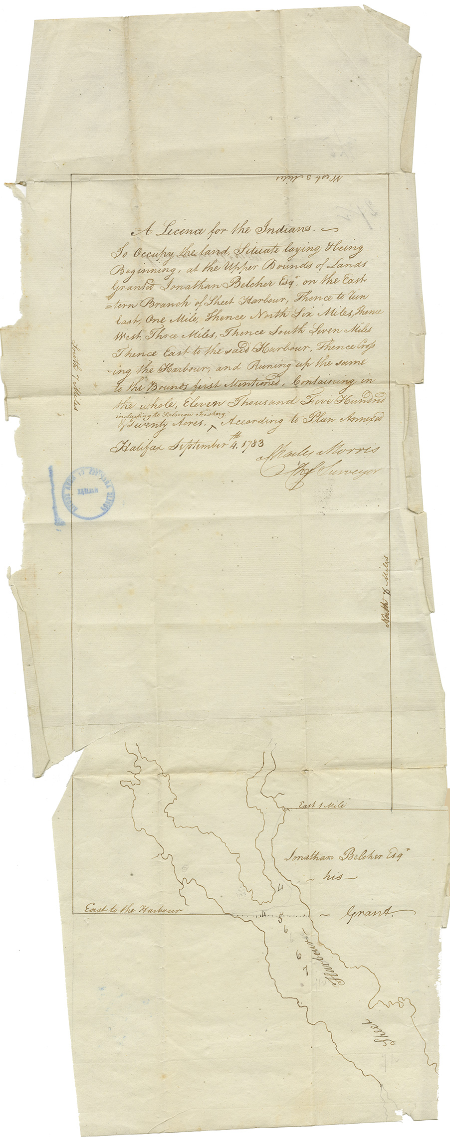
A licence for the Mi'kmaq "to occupy the land" at Sheet Harbour
note: transcription publicly contributed - please contact us with comments, errors or omisions
A license for the Indians ~~
To Occupy the land Situate laying & being
Beginning, at the Upper Bounds of Lands
Granted Jonathan Belcher Esqr, on the Eastern
Branch of Sheet Harbour, Thence to run
East, One Mile, Thence North Six Miles, Thence
West, Three Miles, Thence South Seven Miles
Thence East to the said Harbour, Thence Crossing
the Harbour, and Runing up the same
to the Bounds first Mentioned, Containing in
the whole, Eleven Thousand Five Hundred
& Twenty Acres [including to Salmon Fishery - written above so insert here].
According to Plan Annexed
Halifax September 4th, 1783
Charles Morris
Chief Surveyor
West 3 Miles
South 7 Miles
East to the Harbour
East 1 Mile
North [6?] Miles [written on edge of paper above map]
Jonathan Belcher Esqr.
~ his ~
~ Grant.
Sheet Harbour
Map follows

Includes small map.
Date: 1783
Retrieval no.: Commissioner of Public Records — Mi'kmaq and Government Relations series Nova Scotia Archives RG 1 volume 430 number 27 1/2