Nova Scotia Archives
Nova Scotia's 'Paving Programme'
Highway Reconstruction in the 1930s
Results 1 to 15 of 25 from your search: Broad River
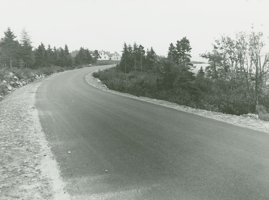
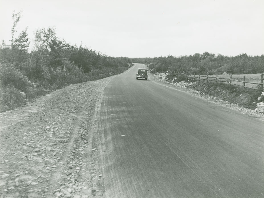
Queens - Lunenburg County Line - Broad River
Date: 1936
Reference: Department of Highways Nova Scotia Archives 2009-023 no. 001 p. 73
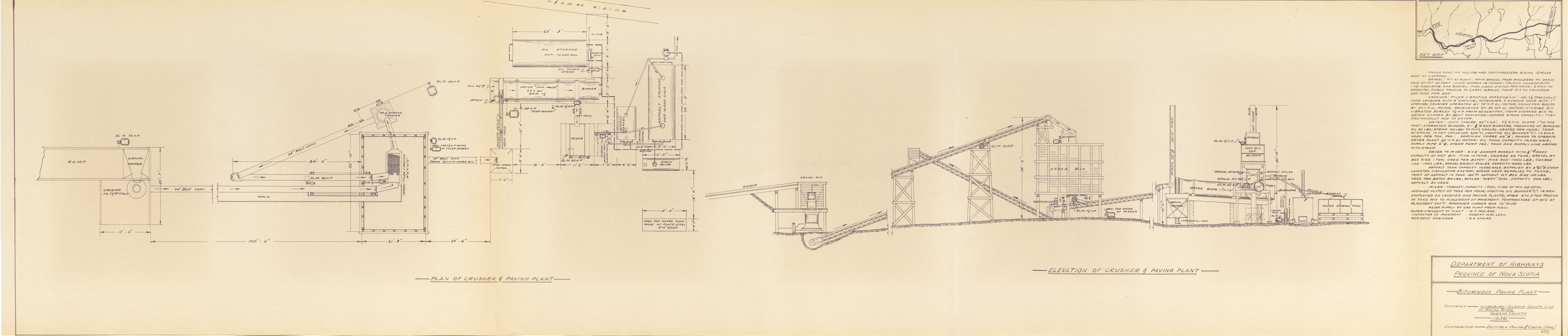
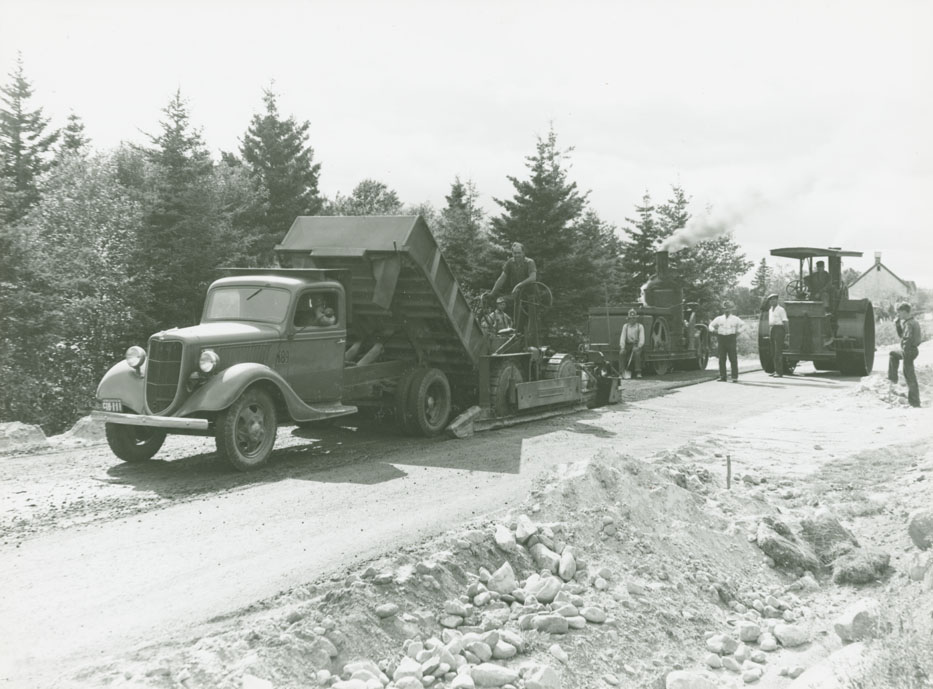
Bituminous Paving Plant - Lunenburg - Queens County Line to Broad River
Date: 1936
Reference: Department of Highways Nova Scotia Archives 2009-023 no. 001 p. 74
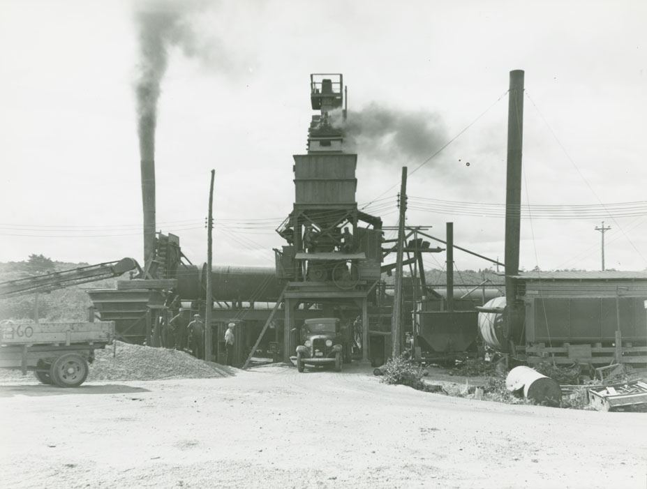
Queens - Lunenburg County Line - Broad River Route No. 3, paving plant at Liverpool from discharge side.
Date: 1936
Reference: Department of Highways Nova Scotia Archives 2009-023 no. 001 p. 75
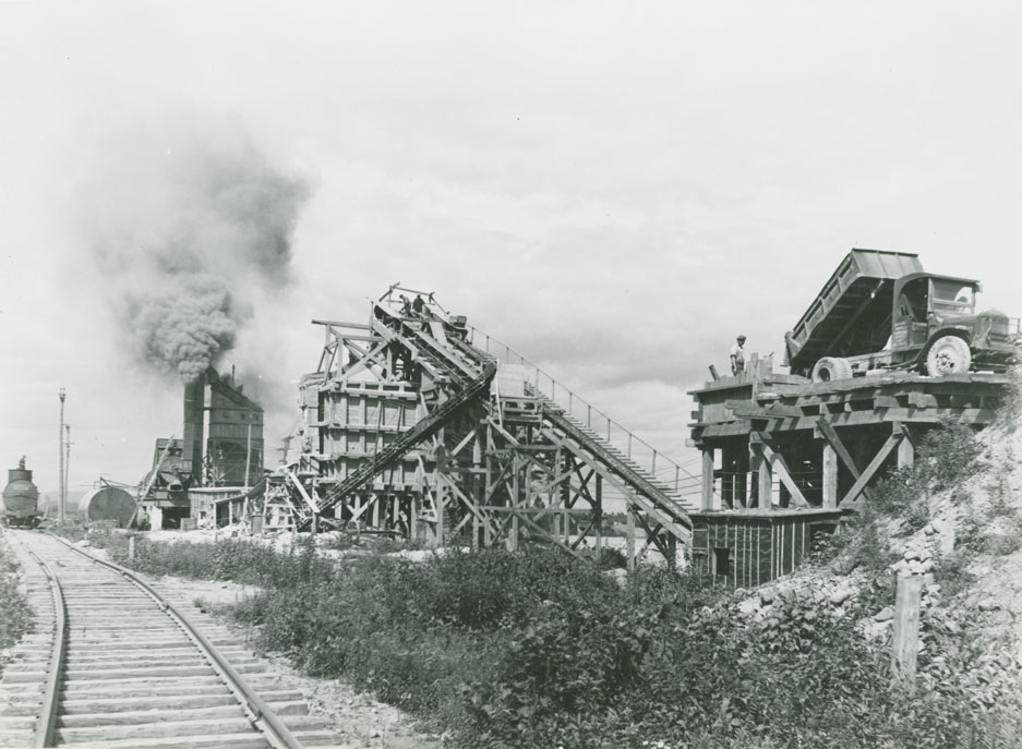
Queens - Lunenburg County Line - Broad River Route No. 3, primary crusher, aggregate bins and paving plant at Liverpool
Date: 1936
Reference: Department of Highways Nova Scotia Archives 2009-023 no. 001 p. 75
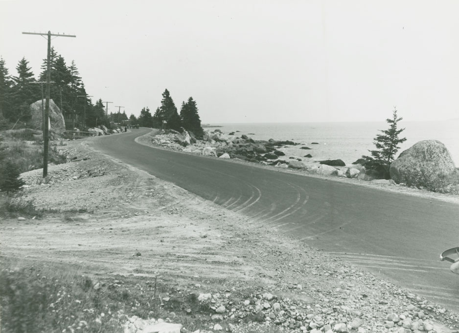
Queens - Lunenburg County Line - Broad River Route No. 3, diversion east of Summerville
Date: 1936
Reference: Department of Highways Nova Scotia Archives 2009-023 no. 001 p. 76
Queens - Lunenburg County Line - Broad River Route No. 3, Jaeger paver and rollers near Broad River
Date: 1936
Reference: Department of Highways Nova Scotia Archives 2009-023 no. 001 p. 76
Queens - Lunenburg County Line - Broad River Route No. 3, east portion of Hunts Diversion, looking east
Date: 1936
Reference: Department of Highways Nova Scotia Archives 2009-023 no. 001 p. 77
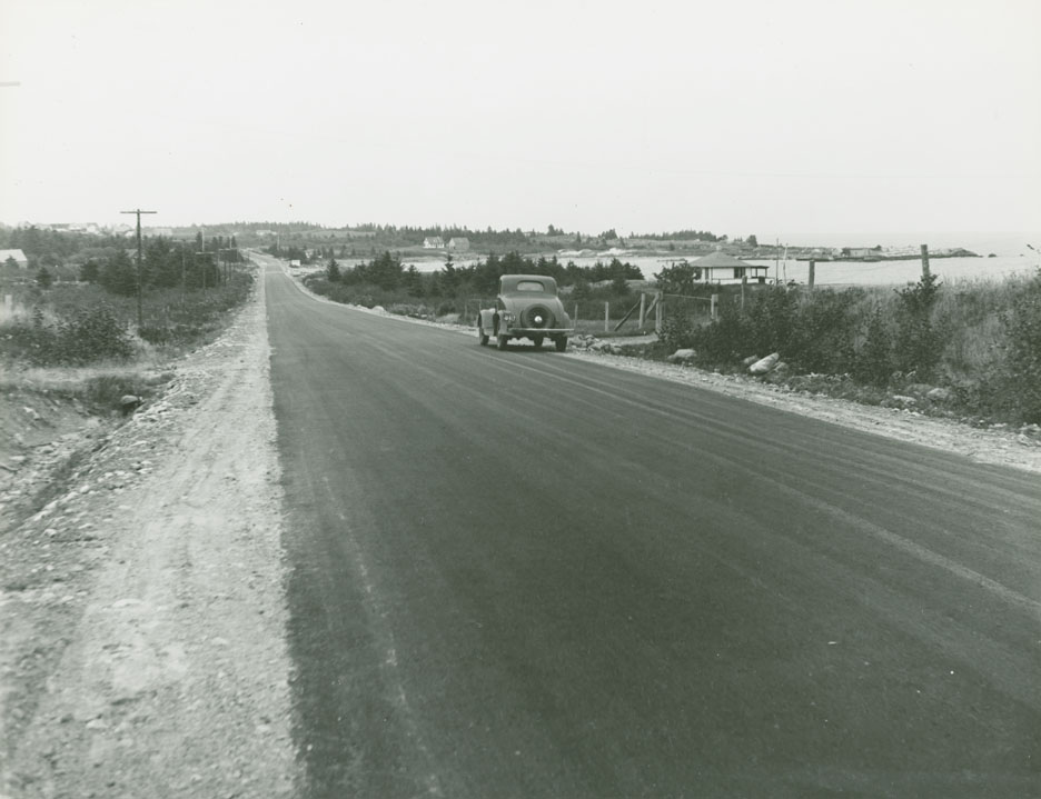
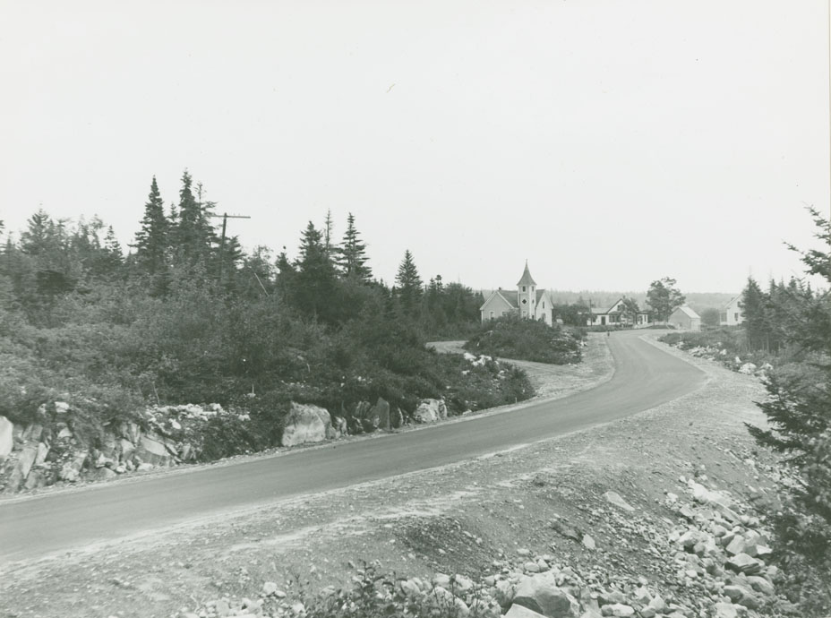
Queens - Lunenburg County Line - Broad River Route No. 3, Summerville looking east
Date: 1936
Reference: Department of Highways Nova Scotia Archives 2009-023 no. 001 p. 77
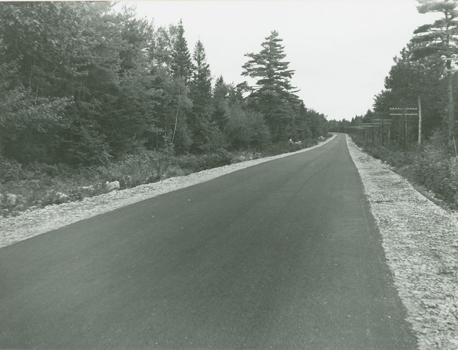
Queens - Lunenburg County Line - Broad River Route No. 3, 1/4 mile east of Broad River, looking east
Date: 1936
Reference: Department of Highways Nova Scotia Archives 2009-023 no. 001 p. 78
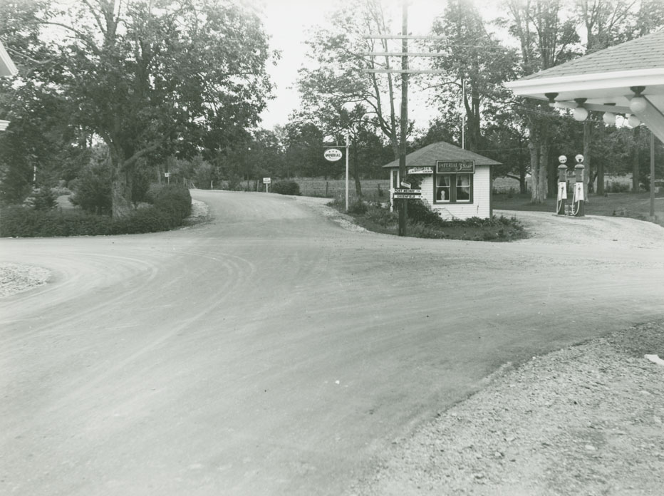
Queens - Lunenburg County Line - Broad River Route No. 3, Port Medway Road intersection Mill Village
Date: 1936
Reference: Department of Highways Nova Scotia Archives 2009-023 no. 001 p. 78
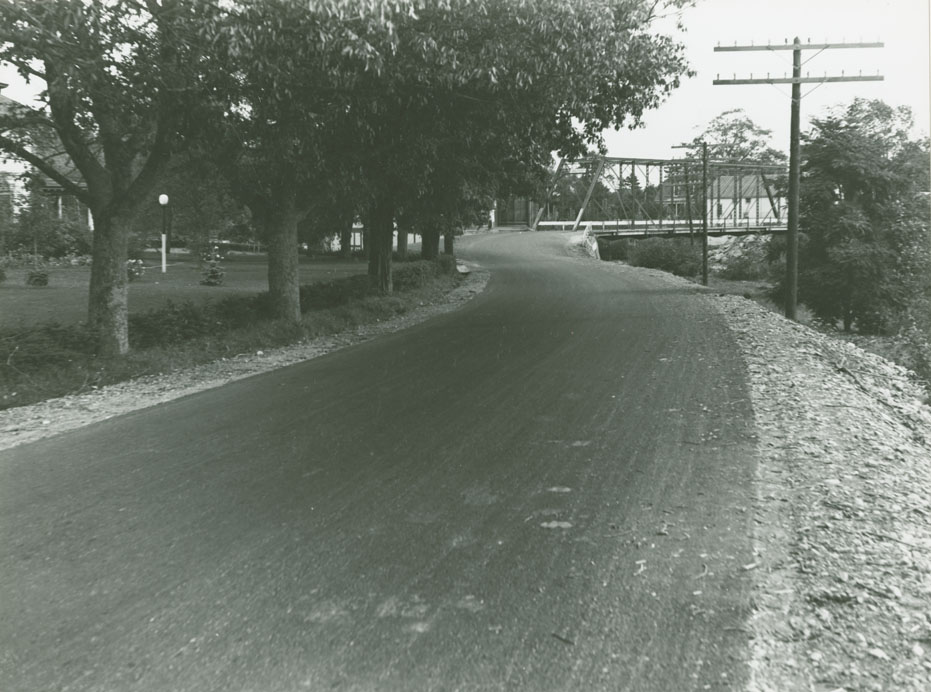
Queens - Lunenburg County Line - Broad River Route No. 3, Medway River bridge Mill Village
Date: 1936
Reference: Department of Highways Nova Scotia Archives 2009-023 no. 001 p. 79
Queens - Lunenburg County Line - Broad River Route No. 3, Mill Village, 1/4 mile west of bridge
Date: 1936
Reference: Department of Highways Nova Scotia Archives 2009-023 no. 001 p. 79
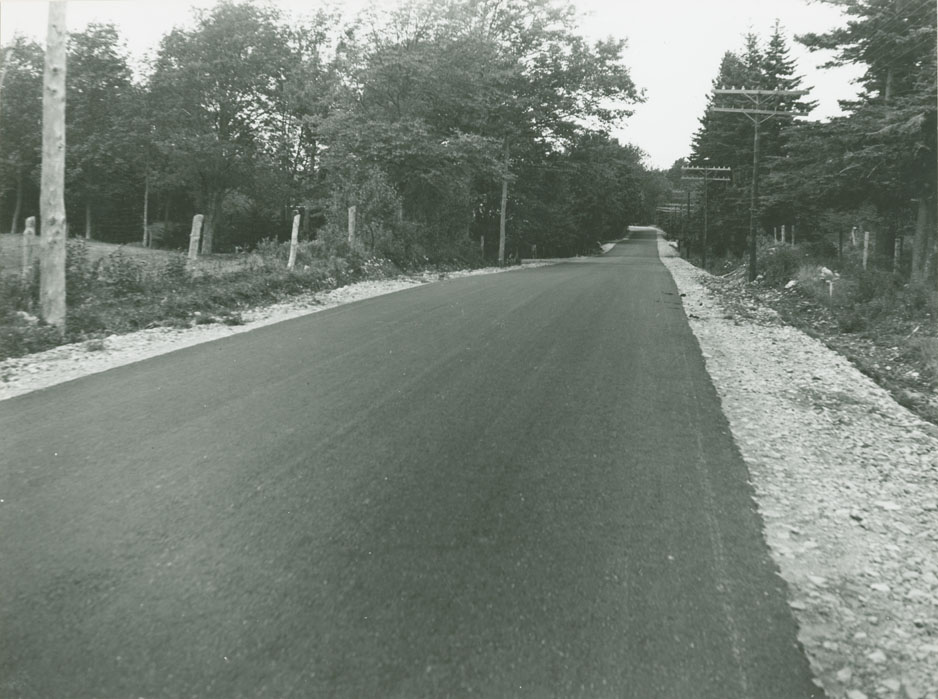
Queens - Lunenburg County Line - Broad River Route No. 3, Danesville, 1 1/2 miles west of Lunenburg line
Date: 1936
Reference: Department of Highways Nova Scotia Archives 2009-023 no. 001 p. 80
Queens - Lunenburg County Line - Broad River Route No. 3, between Brooklyn and Mill Village, looking east
Date: 1936
Reference: Department of Highways Nova Scotia Archives 2009-023 no. 001 p. 80
Broad River - Wall's Corner
Date: 1938
Reference: Department of Highways Nova Scotia Archives 2002-015 no. 002 p. 41